The mountain calls
Leica UAV brings efficiency to volume calculation

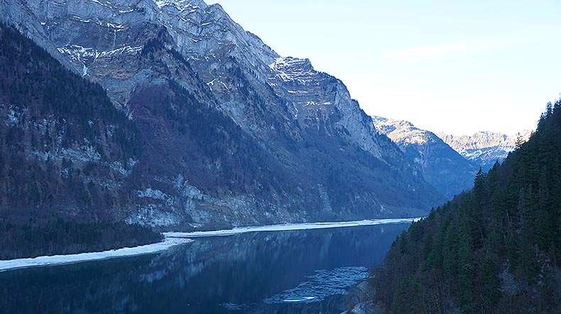
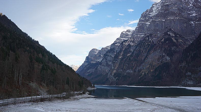
Situated at 848 metres above sea level, the Klöntalersee inspired as early as 1655 the Zurich artist Conrad Meyer to draw the first modern high mountain panorama. Created by a rockslide ages ago and flanked by the 2900-m-high mountain massif Glärnisch, the lake is still a stunning attraction for tourists and artists due its ravishing beauty. But not only poets and painters recognised the potential of the 3.3 square kilometer large mere, which is fed by the surrounding mountain brooks like the Klön. In 1908, the Klöntalersee was impounded on its eastside between Rhodannberg and Sackberg by an earth mound to generate electricity for the surrounding villages and companies.
Due to the new 220-m-long and 21.5-m-high earth bulk dam, the lake can carry about 39.8 million cubic meters of water, which can be used to generate electricity if demand fluctuates and during peak times.
From air to water
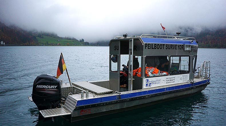
With their groundbreaking approach to combine hydrography and photogrammetry, the IngenieurTeam GEO GmbH planned to survey the area by using their sounding boat, Surveyor, Leica Geosystems industrial Unmanned Aerial Vehicle (UAV) solution as well as state-of-the-art positioning technology from Leica Geosystems in the Swiss canton of Glarus. The goal was to generate a 3D-model for accurate and inch-step precise calculation and simulation of the actual holding capacity.
After all preparatory measures, approval processes and planning had been completed, the experts from Karlsruhe traveled with their sonar equipped vessel to the more than 220 km distant lake into the Swiss Alps to map the lake’s soiling situation at a regular water gauge. All measurements done by the vessel and Leica Geosystems UAV were recorded in the Swiss national coordinate system LV03.
With 172 planned recording lines, the 6-meter-long vessel set sail to create a detailed picture of the lake’s soil using its Reson SeaBat 8101 Multibeam echosounder. The fathometer emits acoustic signals at an angle of 150 degrees and calculates the depth of the water by measuring the elapsed time of the echo. At 101 beams per ping at a frequency of 30 pings per second, the hydrographs receive high-precision data of the bed with a graticule of 3,030 single points per second. With an overlap of one-third of every measuring track, the experts ensure that an accuracy of less than 10 centimeters is achieved during their measurement.
But before data can be gathered, the measuring system must be calibrated precisely in order to avoid disturbance factors and to correctly determine the results. Therefore, the sensor technology must be adjusted before every deployment to subtract both linear movements of the vessel as well as rotation around its axles to impede any falsification. A further step for the hydrographs to get a clear and detailed view of the lakes ground is to factor the waters sound velocity into the calculation, which changes depending on temperature and suspended particles and becomes especially important in lentic water.
After the boat got launched and calibrated, the crew put out to sea on a two-and-a-half hour long first cruise to get a first impression of the lake’s character and began to create the first sonar data of the soil. Following the planned routes and under consideration of the lake’s depth and texture, the highly skilled hydrographs on the Surveyor collected enough information to create a point cloud of 134.837.653 X-Y-Z-coordinates. All in all, the crew of the observation boat made it in five days to record all 2,855,204 square meters of the Klöntalersee.
Beyond limits
Not only rapid changing weather conditions and bone-chilling cold pushed man and machine to its limits, with the glaciated massif Glärnisch building the south embankment, the environment put the technology to the test. With its 2,900 m, the massif literally threw its shadow ahead. Through the massifs steep slopes in close vicinity to the riverside, the experts feared they might lose their GPS-stream due to signal opacity on the south side of the Klöntalersee. In this case, the determination of the boat’s position would have been carried out by tachymeters placed on the northern and eastern shore of the lake. Because of the lake’s long-drawn-out kidney shape, this would have led to serious problems to get accurate details of the boat’s position.
By using the Leica Viva GS 16 GNSS antenna on the Surveyor, the data recorded with the multibeam sonar could be assigned inch-perfect to their coordinates. With its built-in SmartLink-technology, the crew would still have been able to record high-precision data and receive the GNSS correction data even if the signal of the GSM network would have gone missing. Thanks to 550 channels, a state-of-the-art surveying engine and ultramodern RTK algorithms, both the data of the UAV and the vessel could be precisely assigned to the test results.
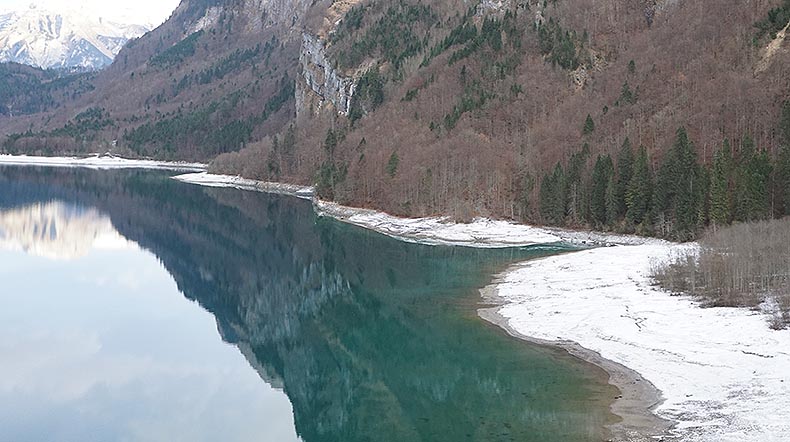
Due their general design, bank situations are hard to capture for multibeam equipped vessels. In addition to that, the risk of damaging the sensitive and expensive sensor rapidly rises in shallow water and in the proximity of the shore. In order to still obtain exact results for the volume calculations and simulations, the engineers relied on their experience with their UAV and decided to capture the shores and embankments airborne via photogrammetry.
Precision from the sky
After the lake was measured at regular water level from the boat, the engineers began to plan the flights for the Leica Geosystems UAV solution. To capture the shore regions overlapping with the measurements taken by the boat, it was crucial to plan the following flights with the UAV at lower water levels. After the level of the Klöntalersee had been lowered seasonally, the survey with Leica Geosystems hexacopter began.
For this purpose, the experts of the Ing.Team GEO planned the flight with the in-house built flight planning software, set the waypoints for the following flights, and determined the parameters suitable for the survey, such as height, ground sampling distance (GSD), flight speed and overlapping of the data. To record the often angled and steep terrain of the bank area as precisely as possible, the experts decided to survey each area several times to increase the validity of their data. After the flight planning on the PC had been completed and the waypoints were loaded onto the UAVs internal storage, the ground control points (GCP) around the lake were measured with the Viva GS16 so first flights could begin.
Once again, the surveying of the alpine reservoirs presented its very own challenges for man and machine. In addition to average temperatures of less than 0 degrees Celsius, rapid weather changes and low clouds, once again the southern bank of the Klöntalersee with its steeply sloping mountain walls was the biggest challenge. The UAV had to be started and landed on a separate boat because the steep walls and the dense vegetation of the shore made it impossible for the pilot to operate from the land. In addition to the sensitive and reliable technology, the skills and the steady hand of the pilot were particularly important.
Despite the adverse conditions, the team from Karlsruhe was able to collect highly precise data in 18 flights, so the dry shore strip with a total length of more than 12 km was covered within two days. With a picture taken every two seconds and the drone moving with 4 m/s, the experts ensured that the data was recorded with the highest accuracy by the camera attached to the flying multisensor platform.
“Due to the fast data availability of the UAV, we were able to evaluate the first results on site,” said Benjamin Busse, IngenieurTeam GEO.
Combining technologies with accuracy
As with the recordings of the surveying boat, it was of immanent importance for the UAV-based results to accurately reference them. For this purpose, the experts of the Ingenieurteam GEO equipped the UAV with an special RTK / GNSS module and used in addition the Viva GS16 GNSS antenna, which was the perfect match to work under these difficult conditions to achieve an accuracy of 1-3 cm in georeferencing the collected data.
After all measurements had taken place, the surveying experts began to process the obtained data. The point clouds created by the multibeam sonar had to be fed into the PDS 2000 bearing software to manually edit and correct them from imprecision. In order integrate the data of the river banks into the volume calculation, all 4,400 high-resolution images created with the UAV had to be imported into flight planning software, where they were merged with the coordinates from the UAV’s log file. After that, the georeferenced data was edited in the post processing software AgiSoft PhotoScan Pro to create a 3D model as well as a point cloud. Subsequently, the two 3D models were combined in the Autodesk application AutoCAD® Civil 3D to generate an exact model of the lake's situation.
Using the data from the 3D model, the engineers generated a precise map with elevation lines for their client. By being able to generate such a precise result and to combine two completely different ways of surveying large and challenging areas, the engineers stood up to the game and used the most modern technology to get the job done. With the data generated by boat and UAV, the experts are able to fulfill their clients’ wishes of a detailed virtual 3D model and a metres long situation plan with contour lines printed out.
“The combination of the measurement results of our modern multibeam system and Leica Geosystems UAV allows us to generate high-precision data very quickly,” said Busse.
Once again choosing the flying multisensory platform by Leica Geosystems to rethink conventional ways of working was the right choice for the professionals to achieve the best results.


