CARRIER Géomètres Experts: Driving Innovation in Surveying Services with Mobile Mapping
Customer Insight

Mobile mapping technology is transforming how surveying service providers collect data, enabling vast and accurate capture faster and safer than ever before. But the transformation does not stop with data collection—it generates new services, competitive bidding, and comprehensive end-to-end solutions for a range of clients, keeping customers happy and helping surveying businesses stay ahead of the competition.

See how CARRIER Géomètres Experts successfully grew their business with mobile mapping
In this customer insight, we learn more about the transformative power of mobile mapping systems through the lens of a 25-year-old surveying company, CARRIER Géomètres Experts, based in Haute-Savoie, France. The company's founder and key player, Philippe Carrier, discusses the role of mobile mapping in driving service innovations and growth in the surveying industry. His insights provide an exciting look into how Leica Geosystems mobile mapping systems have enhanced their workflow and opened new business opportunities.
Key takeaways – Multiple benefits of mobile mapping
Some key insights to look for from Carrier on the multiple benefits of embracing mobile mapping technology:
- More to offer customers: Moving towards cloud deliverables provides clients with more data than other providers.
- Attracting top talent: Investing in modern technologies like mobile mapping appeals to digital natives, enhancing the team and service offerings.
- Direct manufacturer access: Using Leica Geosystems mobile mapping solutions allows for direct support and valuable feedback, improving future products and software.
- Competitive edge: Leica Cyclone office software suite's advanced capabilities provide a competitive advantage in the rapidly evolving surveying industry.
- Securing contracts: Investment in mobile mapping technology can be instrumental in securing and renewing significant contracts.
Company background philosophy on technology
Philippe, could you give us some background on your company, its journey so far, and your role in it?“Our company has been in the surveying business for over 25 years, based in Haute-Savoie, France. Over the years, we've been committed to staying on the cutting edge of new technologies, and I've played a key role in integrating these advancements into our operations. I firmly believe that to remain competitive and deliver top-notch services to our clients, it's critical to have a team that is not only motivated but also well-trained in these innovative technologies.”

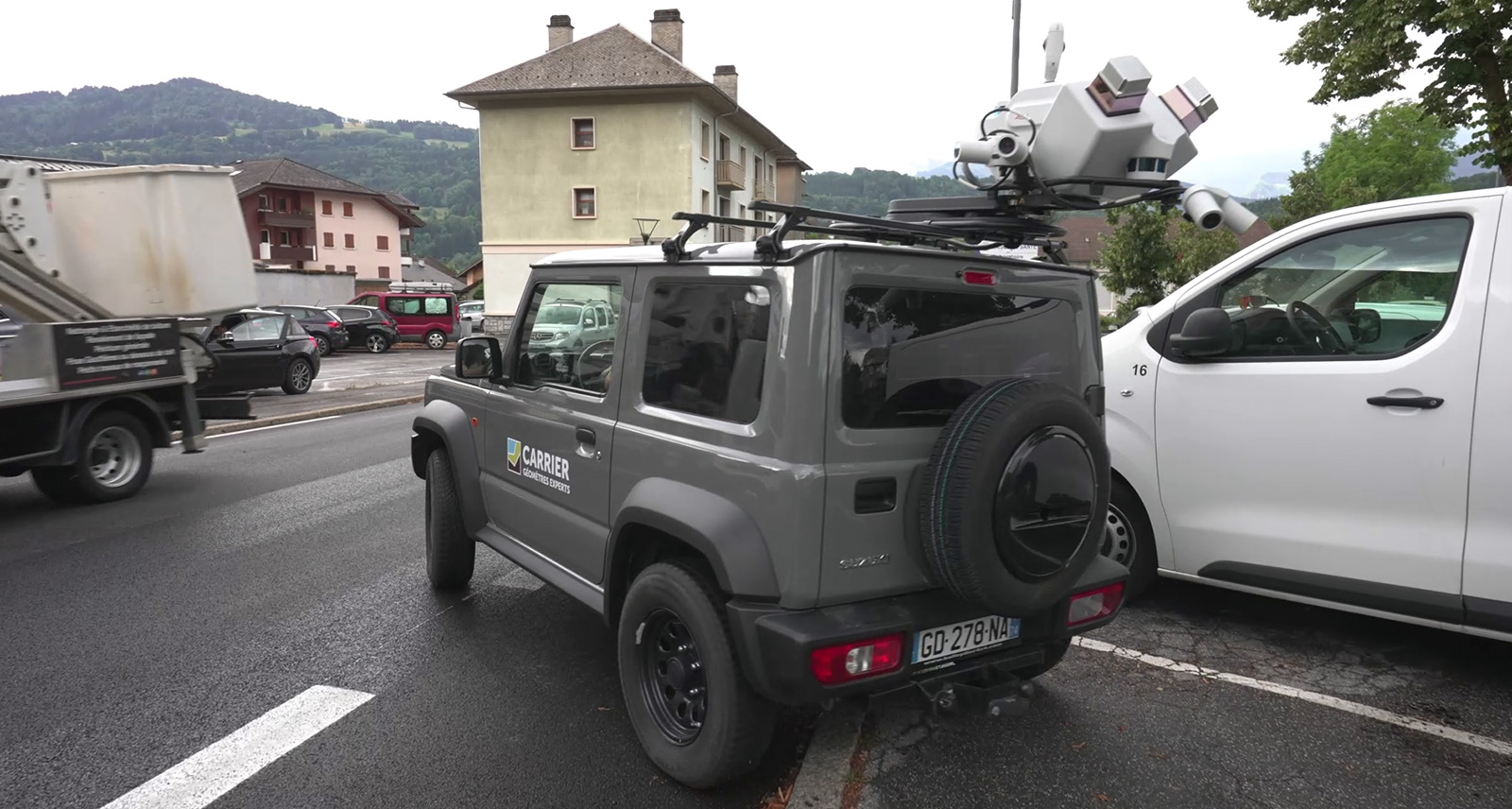
Performing mobile mapping tasks with the Leica Pegasus TRK Mobile Mapping System
Integration of Leica Geosystems' solutions
Could you explain the process of integrating Leica Geosystems solutions into your operations? How has this integration influenced your ways of working?“We've been long-standing users of Leica Geosystems' traditional topographical devices. But as technology advanced, we realised the need to integrate new solutions. This led us to incorporate terrestrial laser scanning into our operations, opening up new markets like interior surveys, 3D modelling, and Building Information Modelling (BIM). One of the advantages of partnering with Leica Geosystems for us has been the comprehensive software suite. The Leica Cyclone software environment has significantly simplified our workflow, whether we're working on static scanning or mobile mapping.”

Embracing reality capture, a Carrier G.E. surveyor collects point and imagery data for a home interior survey with a Leica RTC360 3D laser scanner – data which is automatically aligned in the field with powerful Leica Cyclone FIELD 360 mobile-device software.
Business growth with mobile mapping
How has the adoption of mobile mapping influenced your business scope and market reach?“Mobile mapping has been a game-changer for us. It's opened the doors to new markets that require detailed and comprehensive data, such as 3D mapping and BIM. Without this technology, we risked losing relevance in traditional topography projects. Mobile mapping has made data collection safer for our teams, lowering their potential risks during data collection on busy roads.”

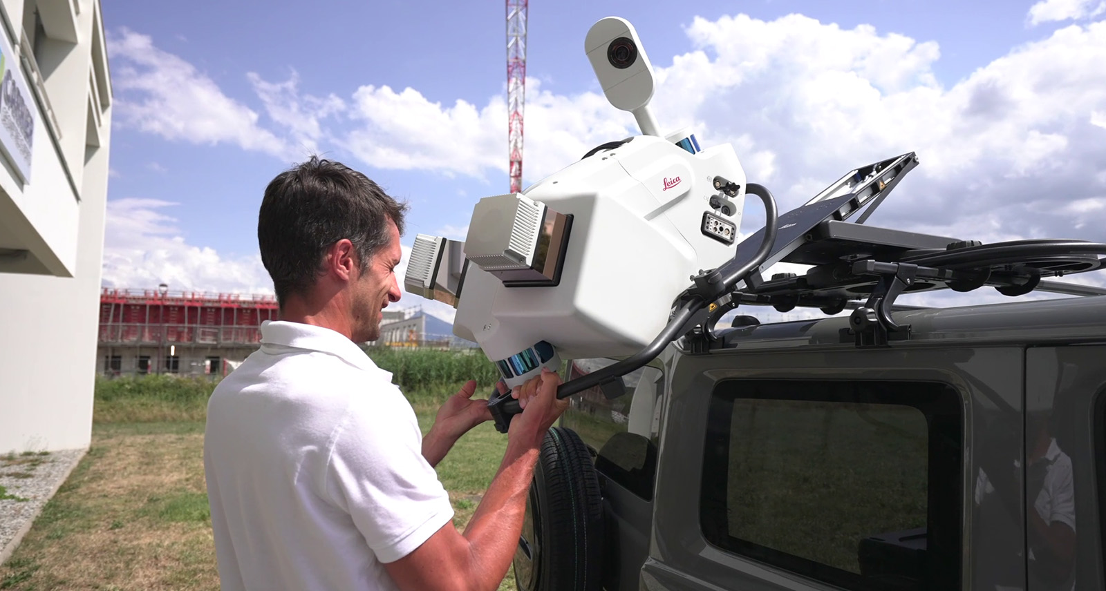
Easy mounting of the Leica Pegasus TRK Mobile Mapping System
Clients benefit from full-scope data
How did your clients react when you introduced mobile mapping to your services?“Mobile mapping has definitely reshaped how our clients perceive and handle the data we provide. They now expect access to the full scope of data we capture, moving beyond the limits of a simple topographic plan. With vast amounts of data captured by our mobile mapping technology, we've had to find efficient ways to present these huge datasets. Platforms like HxDR have been invaluable in this respect, offering streaming solutions for point clouds and enabling easy access to complete data for our clients.”

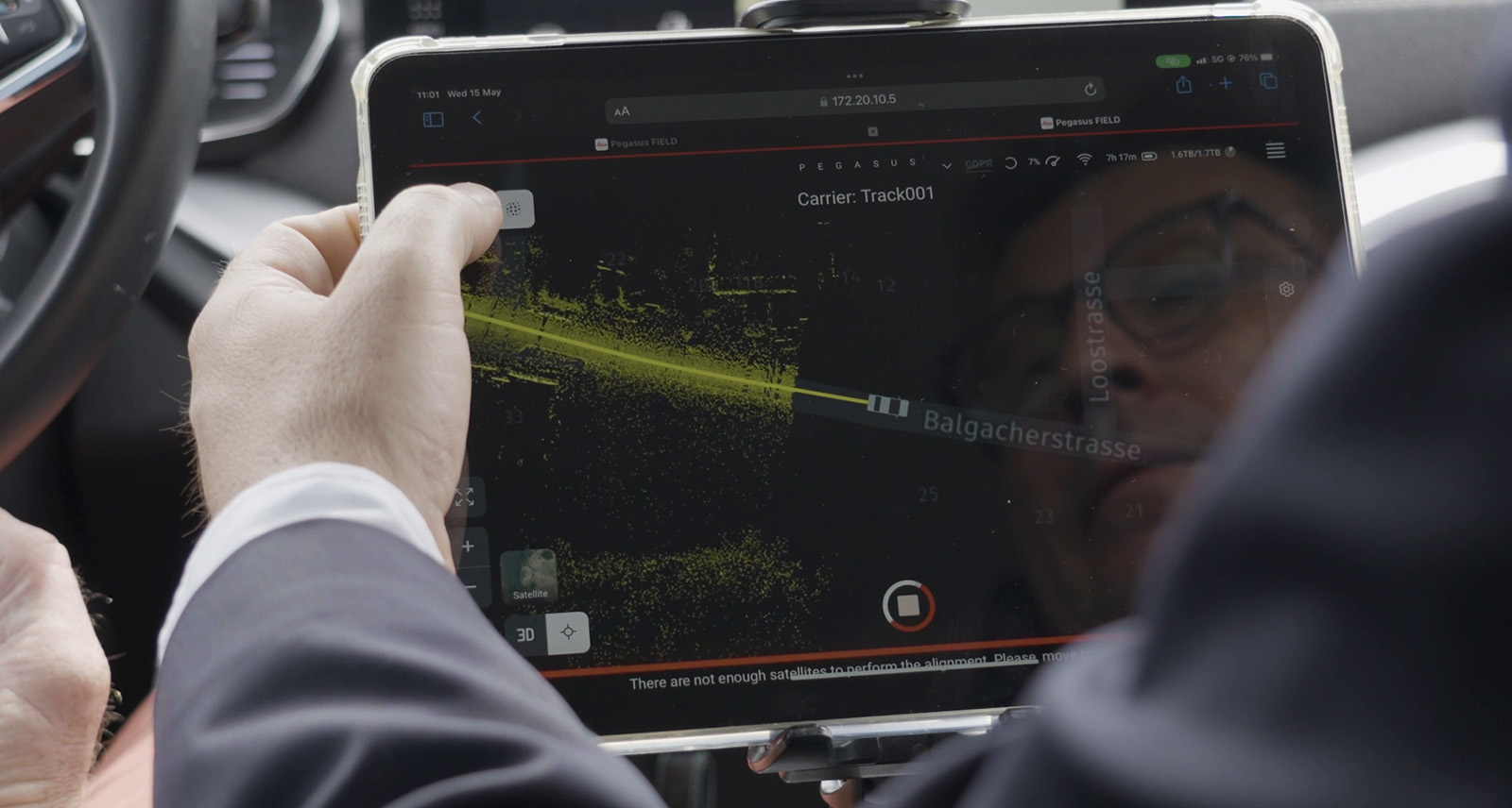
The power of the solution – gathering data with the Leica Pegasus TRK Mobile Mapping System and seeing the data within the Pegasus FIELD software
The future with mobile mapping
Philippe, as we look to the future, how do you envision the role of mobile mapping in your company?“Mobile mapping is more than just a technological addition; it's the cornerstone of our company's future strategy. It's about attracting young talent to the field and keeping up with continuous technological advancements, from the 3D revolution to the possibilities of AI. The future looks bright for our company. We're committed to staying at the forefront of these developments, delivering our clients the best mobile mapping services.”
As Carrier’s experiences show, adopting mobile mapping technology offers vast benefits for both businesses and clients, paving the way for superior services and business growth. To learn more about how successful businesses have used mobile mapping to complete innovative projects across the world, check out our Reality Capture case studies.


