Expert insight: Why road surface measurement remains hard and how DuraBASt confirms mobile mapping as the top-performing approach
Road surface measurement has always faced a fundamental challenge.
Road authorities need data that is accurate, repeatable, and spatially reliable, yet collected under real operating conditions: traffic, speed variation, stop-and-go driving, and GNSS-challenged environments. For decades, different technologies have been optimised for parts of this problem, but rarely all of it at once.
Traditional profilometers offer high accuracy in controlled conditions but are sensitive to speed variation and provide limited spatial context. Connected vehicle and smartphone-based approaches promise scale and frequency but often struggle to match reference-level accuracy and repeatability.
The key question has been whether any technology can consistently deliver reference-grade road condition data without sacrificing operational realism.
The DuraBASt benchmark, executed by VTI at the BASt-certified DuraBASt test facility in Cologne, provides one of the clearest answers to date.
What the DuraBASt study confirms
In 2024 , 23 systems in three different categories were tested side by side: profilometers, mobile mapping systems, and connected vehicle solutions. All systems were assessed against certified ground truth and evaluated both validity and repeatability, not just peak accuracy.
Across a broad set of parameters, a clear pattern emerged.
Mobile mapping systems consistently delivered the strongest overall performance.
As a category, they achieved:
The highest validity and repeatability across key variables.
The best International Roughness Index (IRI) results, including under stop-and-go conditions where other systems degraded.
Strong agreement with reference data for longitudinal profiles.
Centimeter-level accuracy for positioning, height, and lane geometry.
Importantly, these results were achieved under realistic driving scenarios, not idealised laboratory conditions.
The results were presented at the ERPUG (European Road Profiler User Group) Conference in October 2025, with the formal benchmark report published in December 2025. The full report is available in VTI report 1251A.
Why this matters
Several of the most revealing findings were not about absolute accuracy, but about robustness. The study showed that mobile mapping systems maintained stable IRI and profile measurements during braking, stopping, and acceleration. Profilometers and connected vehicle systems, by contrast, were more affected. This distinction is critical, because real road networks are rarely measured at constant speed.
The benchmark also demonstrated that mobile mapping systems can reliably measure:
International Rougness Index (IRI).
Sliding Wire Rut Depth 2.0 m.
Crossfall Regression.
Long-wavelength features such as hilliness.
Absolute position and height with only centimeter-level deviation.
Together, these results indicate a level of maturity where mobile mapping is no longer complementary, but fully capable of serving as a primary road monitoring method.
What the DuraBASt Results Reveal About the Pegasus TRK700 Evo
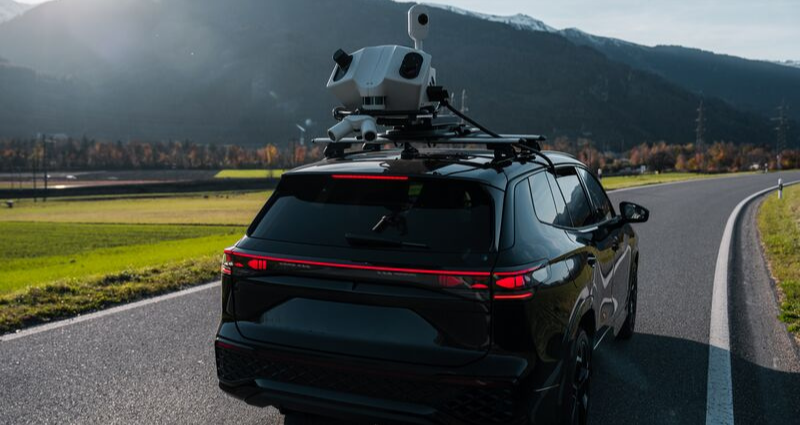
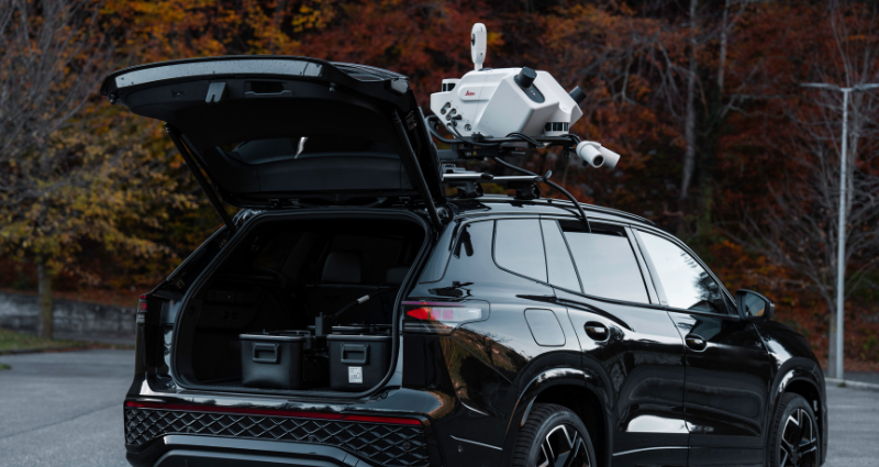
The Leica Pegasus TRK700 Evo in collaboration with Veris (RoadSide) participated in the DuraBASt benchmark as a mobile mapping solution, and its technical architecture closely matches the characteristics associated with the strongest-performing results in the study.
“What we’ve been focused on with RoadSiDe, is automating the extraction of high-quality road condition and asset data at scale using mobile mapping. What matters most in road measurement is the consistency under real operating conditions and it is great to see our approach validated through the DuraBASt benchmark, in terms of quality, consistency and reliability under tough real-world environments. By capturing high-quality spatial data at speed, even in live traffic, we are able to deliver reliable, repeatable results our clients can trust for decision making” said Nathan Quadros, General Manager Digital Solutions at Veris.
Key aspects include:
Dense dual-laser scanning, allowing longitudinal profiles to be derived directly from high-resolution, georeferenced point clouds.
Survey-grade GNSS/INS, integrating multi-sensor fusion and proprietary positioning algorithms, ensuring reliable georeferencing in tunnels, dense urban environments, and other GNSS-challenged conditions.
Pavement-facing and panoramic cameras, capturing detailed surface condition and full spatial context in a single pass.
An end-to-end workflow focused on data integrity, preserving measurement quality from acquisition through post-processing and analysis.
This architecture directly addresses the limitations observed in alternative approaches: sensitivity to speed variation, limited spatial coverage, and reduced robustness under real traffic conditions.
The takeaway
The DuraBASt results confirm a broader shift in the advancements in road measurement.
Mobile mapping has reached a level of technical maturity where it consistently outperforms alternative approaches across accuracy, repeatability, and operational robustness.
Systems like Leica Pegasus TRK exemplify this: delivering reference-grade road surface data while operating safely, efficiently, and reliably in the environments where measurements actually need to be made.
For road authorities and infrastructure owners, this marks an important transition — from choosing between accuracy and practicality, to finally being able to achieve both.


.jpg?sc_lang=en&hash=9400E5E93E33DA1FE643F724574B105C)