How to measure an island
Leica UAV brings efficiency to heritage surveying

In 2003, visionary Ben Kacyra founded CyArk with his idea to create a free and digital archive of cultural heritage sites and architecture to preserve them from natural or human destruction. Driven by the demolition of the Bamiyan Buddhas in 2001 in Afghanistan, Kacyra pursued the idea to save as many cultural heritages as possible at least as a 3D blueprint for following generations. By having Ken Mooyman, Leica Geosystems executive vice president, on CyArk’s Board of Directions, the foundation has another expert and visionary on its side when it comes to mapping and surveying.
With its knowledge and expertise in 3D laser-scanning to create high-resolution point clouds, CyArk took surveying and mapping of cultural heritage sites to another level. Within a short time, the foundation formed a worldwide network to add more than 130 projects to its archive, and launched in October 2013 its ambitious CyArk 500 Challenge to scan and digitally preserve 500 world heritage sites within a period of five years. One of the sites nominated by the 500 Advisory Council was the tidal island St Michaels Mount in Cornwall, England.
The small island lying 366 metres off shore in the south-west of Great Britain, only reachable by boat or, at a low tide, via a causeway, is as well a postcard picture as a historical scene. First populated from circa 4,000 to 2,500 BC, it became a monastery during the 12th century and rose to the now known settlement and pilgrimage site during the 18th century. Endangered due to climate change and erosion, the 500 Advisory Council suggested St Michaels Mount as a cultural heritage site that should be preserved digitally for further generations.
Time savings with an UAV
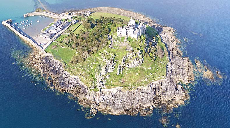
To map this island, Atlantic Geomatics and Leica Geosystems UK paired up to survey the island and the small village within three days using state-of -the-art technology and a trend-setting workflow involving an Unmanned Aerial Vehicle (UAV). With the technology and on-field knowledge of Leica Geosystems UK, the expertise in mapping and surveying from Atlantic Geomatics, and the new approach in creating precise aerial using an UAV, a completely enhanced workflow evolved, changing the game in measuring and mapping large areas.
The choice to use the autonomous hexacopter to survey a cultural heritage site seemed like a long shot, but the versatile UAV had proven before to be the right pick for preserving structures. In 2014, Leica Geosystems UAVs created detailed 3D models of the library and stadium of the National Autonomous University of Mexico (UNAM).
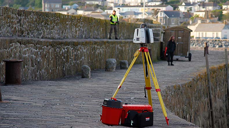
In May 2016, a crew of 10 surveyors and pilots headed to the coast of Cornwall to start preserving the 0.23 sq. km (0.09sq. miles) of St Michaels Mount. The professionals needed high-end equipment to get ahead of this task. Besides the Leica GS16 GNSS to increase the accuracy of their GPS, the Leica MS60 MultiStation fulfilled its promise to create a 3D-grid with more than 1,000 points per second on a distance up to 300 meters during its work on the island. Moreover, the Leica ScanStation P40 worked with a range accuracy of 1.2 mm + 10 ppm and a 3D position accuracy of 3 mm at 50 meters to create fully textured 3D-Models of the cultural heritage site. With this great accuracy and precision both tools were the perfect addition to Leica Geosystems UAV solution, which measured the island aerial to create highly accurate orthofotos.
Streamlining the workflow
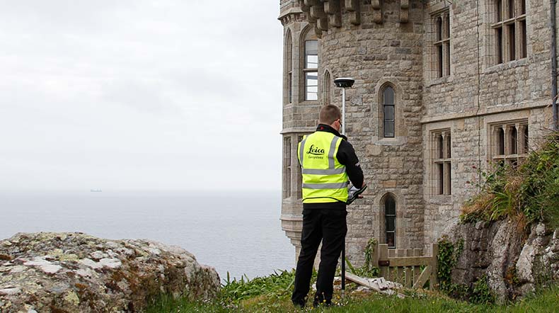
Setting up 65 ground control points around the island to capture as many details as possible, the crew started to prepare the site for measuring with the MS60 MultiStation as well as the GS16 GNSS. But being challenged by rough terrain, bold cliffs and the Atlantic surge, the use of an UAV refined the work of the professionals. Engineers carrying heavy equipment down steep steps is a major safety risk as it is very time consuming. Using the Leica Geosystems hexacopter to get detailed imagery and data of inaccessible ground is a considerably advantage when it comes to safety and efficiency.
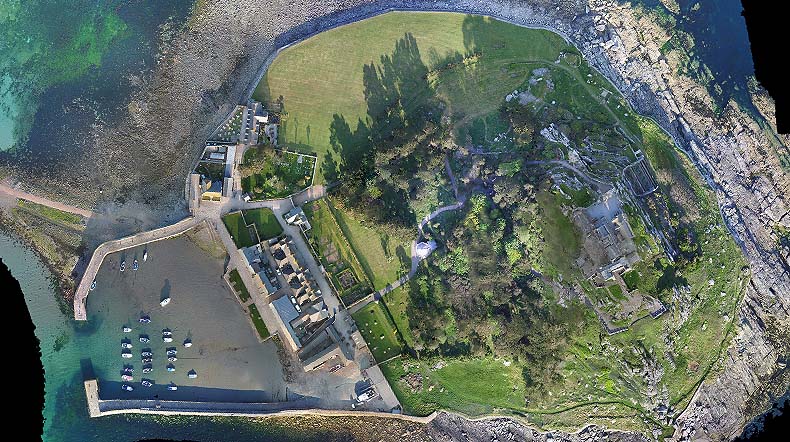
With a flight altitude of 120 m above sea level, the UAV created precise data from the shorelines to the top of St Michaels Mount within 12 automated waypoint flights. By using the RTK/GNSS – module, the UAV flew with an accuracy of 1-3 cm calculating its precise position out of the data stream from 10 satellites. To get as many details as possible during the flight, the crew mounted the fully integrated Sony Alpha 7R to the hexacopters gimbal. A resolution of 7,360x4,192 pixels (36.4 megapixels) assured that every detail was captured and due to its full-frame Exmor CMOS-sensor an even higher quality was possible and less image noise was distributed. Recording the GPS-data per millisecond, every image taken can be precisely located. With the shutter speed set to 1/1000sec and the aperture to 3.2f, the mounted camera took at an ISO of 800 the pictures without any blur or distortion.
Having the most elaborated software built into Leica Geosystems UAV, the copter tags precise to the millisecond when and where a high resolution picture was taken. This gives you the advantage to match every taken image to the most precise GPS-position in the postprocessing.
By using an UAV and latest equipment, the overall time for surveying was reduced by 60 per cent compared with the standard conventional workflow without aerial support.
While the ground-team prepared the site for their measurements, the aerial-crew set the UAV up for its demanding challenge. With the in-house developed flight planning the crew programmed the parameters for the following flights so the hexacopter could gather aerial information in addition to the conventional results.
Capturing more with less
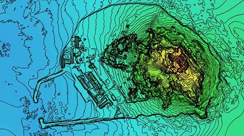
After three days of flying, 12 automated flights to capture every detail of the island, and 4,120 taken georeferenced pictures, the crews came together to merge their data into the post processing software to create a digital high-resolution replica of St Mount Michael. The result was a 3D textured model of the island and its buildings, containing over 2.4 GB of high-res data, showing detailed insights of the cultural heritage. The combination of the captured data from all scanning devices in further data processing is as easy as 1-2-3. With a Ground Sampling Distance (GSD) of 3.2 cm and a relative accuracy in location of 1.2 cm in average, the UAV data was generated to point clouds and a Digital Elevation Model (DEM) with the support of a cloud-based hard- and software solutions. Thanks to software such as CapturingReality, Agisoft PhotoScan Pro, Autodesk ReCap and Pix4D, the combination of ground based scanning data and aerial images took only hours and not days and weeks.
Expanding your ways to work on large-scale projects by integrating the flying tripod from Leica Geosystems gives you the ability to create more data, more precisely in less time. But being more than twice as efficient as before is just a nice treat compared to measuring unreachable areas easily and increasing the safety and accuracy of your staff. Leica Geosystems UAV solution is the real deal when you rethink mapping and surveying.


