


Station totale robotisée Leica TS20
La station totale robotisée Leica TS20 est un gage de productivité pour les levés quotidiens, du cadastre à la construction.


.jpg?sc_lang=fr-fr&hash=9A94E3D63E6A3D8EFA614E65B8130332)
Introduction d’une nouvelle dimension dans la capture de la réalité et redéfinition de la numérisation laser 3D.

As labour shortages and demand increased, ALS invested in survey technology designed to evolve − boosting productivity, workflows and long term readiness

For more than three decades, Associated Land Surveyors and Planners (ALS), PC, has built its reputation in western North Carolina on integrity, personal service, and long term relationships. Founded in 1988 by Terry Baker, the firm has grown steadily into a multi crew operation serving residential, commercial, and construction clients across the region. Today, the next generation is carrying that legacy forward.
But the environment around them has changed.
“The labour shortage is definitely one of the biggest challenges, as well as the demand,” explains Vice President Cameron Baker. “Traditionally, you’d have a three-man crew or a two-man crew. And now, with the labour shortages, you just don’t have the manpower for a lot of those crews anymore.”
With a highly experienced team and long-standing employees who know the work inside and out, ALS also recognises the importance of supporting that talent with the right tools, especially as the demands on the business continue to grow.
“We knew that with the Leica brand, they’re going to stand behind it. We can take on and accomplish more, just because of the technology.”
− Cameron Baker, Vice President, Associated Land Surveyors & Planners, PC, North Carolina
Rather than scaling back or stretching crews thin, ALS made a deliberate choice: invest in technology that would allow the firm to increase productivity without growing headcount. Just as importantly, they wanted systems that wouldn’t box them into today’s workflows but could evolve alongside the profession itself.
For ALS, the move toward a fully standardised Leica Geosystems ecosystem wasn’t a quick or impulsive decision. It followed months of demos, testing, and internal discussion, along with a fair amount of generational debate.
“When he first broached me with this, I almost threw him out the window,” Terry Baker admits with a laugh. “We’re a decent size, but this is a big deal for us.”
What ultimately convinced him wasn’t a single feature or short term gain, but the long term logic behind the investment. As Cameron puts it, the priority was clear: “Being able to maintain the level of production that we’re currently at, but also the ability to increase production without the need to add on more crews or more manpower.”
That future focused thinking became especially important with the introduction of an AI powered total station designed to improve over time. Unlike traditional instruments that remain largely static after purchase, the TS20 is designed to improve over time through firmware and software updates.
To support evolving workflows and long term capacity, ALS standardised its operations on the following Leica Geosystems solutions:
“We’re excited to see the capabilities of what’s to come,” Cameron says. “Just what we’ve seen so far, we’re amazed at the turn speeds and the output we’re already getting fresh out of the box.”
For ALS, that mattered. It meant their investment wouldn’t be locked to today’s requirements; it would help them stay ready for new workflows, tighter timelines, and evolving project demands enabled by survey technology designed to adapt as needs change.
“You hate to put it this way, but time is money,” Cameron says. “And with limited staff, whatever you can do to decrease your time spent on a job or staking a project allows you to get to that next job.”
Notably, ALS didn’t make this transition expecting immediate, dramatic results. In fact, they assumed it would take months for crews to fully adapt.
“We really weren’t expecting to see anything notable until maybe two or three months out,” Cameron notes, acknowledging the reality of change management and learning curves.
“Learning to trust the equipment was quick, but it took me a second or two just because I went from having to hold it plumb and everything be exact to understanding I could be off just a smidge, and it would be okay.”
− Brett Baker, Project Manager, ALS
But improvements were evident even before workflows were fully settled.
“We’re actually surprised at how quickly it has increased productivity,” Cameron says, pointing to both residential staking and heavier construction work.
That readiness mindset − aiming for progress while acknowledging that change requires intentionality − shaped the entire rollout. Crews were involved early, demos were hands on, and leadership made it clear that the goal wasn’t disruption for disruption’s sake.
At the day to day level, that approach paid off in small but meaningful ways. “The import, the export − that is seamless and fast. You just click one button, and it’s there in five seconds,” says Project Manager Brett Baker. “It sounds small, but that’s probably my favourite part of it.” Those gains were supported by field surveying software designed to streamline workflows, making it easier for crews to stay productive without friction.
By standardising hardware and software together, ALS positioned itself to absorb future changes more smoothly, whether those come from firmware updates, new data workflows, or expanding into adjacent markets.
For ALS, readiness is about putting systems, workflows, and people in place so the business can grow with confidence, whether that means shifting crew configurations, responding to unexpected site conditions, or taking on more work with the same team.
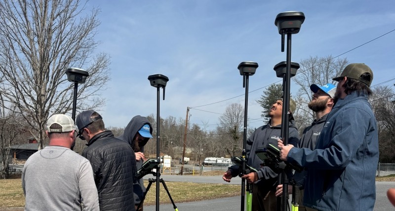
Having flexibility so crews aren’t caught off guard when conditions change.
“We want all of our equipment to communicate with each other and for each piece of equipment to be able to work on the fly.”
− Cameron Baker
Being prepared to move forward even though change isn’t easy.
“We were all a little nervous about how everything was going to go.”
− Cameron Baker
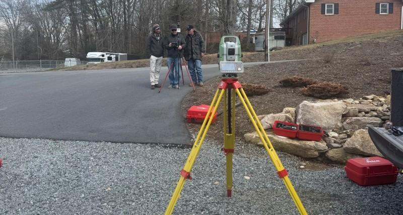
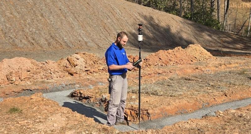
Having operational resilience: fewer return trips, fewer surprises, faster response when plans change.
“Back in the day, lot surveys were always two trips at least. Now you can cut a lot of that out. We have people who can send updates to the field crews, and they can stake it while they’re there.”
− Terry Baker
Being equipped to grow when opportunities arise rather than being constrained by the labour market.
“Technology allows us to be able to grow and to get quicker and to do better.”
− Terry Baker
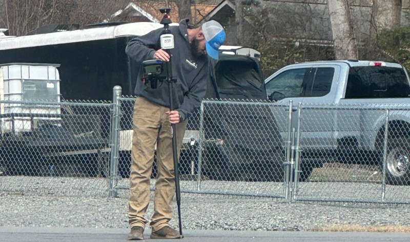
For Terry Baker, who began his career when surveying field work was a manual, labour-intensive endeavour, the pace of change is still remarkable.
“When I started in the early eighties, we were pulling a chain and using a plumb bob,” he recalls. “And now you see this tilt feature, the AI, the turn speeds − you just think, what are they going to come up with next?”
That curiosity has become part of ALS’s culture. The firm doesn’t pretend to know exactly how technology will change next. What they do know is that choosing platforms designed to evolve gives them confidence they won’t be left behind – whether through innovations such as AI-powered robotic total stations and smart pole systems, tilt compensated GNSS for safer, more efficient fieldwork, or new capabilities yet to come.
“Technology allows us to grow, get quicker, and do better,” Terry says. “It lets us take care of our employees, offer benefits, and keep doing right by our clients.”
In a profession facing shrinking labour pools and rising expectations, ALS’s approach reflects a broader shift: investing not just to solve today’s problems, but to be ready for tomorrow’s realities, whatever they may bring.
For Associated Land Surveyors and Planners, ROI shows up in the workday: fewer delays, fewer trips, faster field to office flow, and more jobs completed without stretching crews thin.
ALS evaluates ROI based on whether technology helps the firm:
As Vice President Cameron Baker puts it, ROI is often a “soft measurement” visible in smoother operations, faster turnaround, and the ability to take on more work with the same people. For ALS, the real return is being ready to keep moving forward, whatever the next challenge brings.

La station totale robotisée Leica TS20 est un gage de productivité pour les levés quotidiens, du cadastre à la construction.

Station totale topographique autonome pour toutes les conditions, équipée de la fonction AutoHeight (mesure automatique de la hauteur d'instrument)

Rapide, agile et précis. LA solution de capture 3D pour les professionnels travaillant sur des projets complexes nécessitant des représentations 3D précises et fiables...