(Seoul, 2 October 2024) Leica Geosystems, part of Hexagon, proudly announces that LTMetric, a leading aerial survey company based in Seoul, South Korea, has become the first in the Asia Pacific region to purchase a Leica CountryMapper airborne hybrid sensor.
The new sensor provides LTMetric with the collection performance and flexibility needed for large-area surveys, supporting their expansion into the fast-moving markets of forestry, environmental monitoring and land management.
The CountryMapper leverages Leica Geosystems’ expertise in hybrid airborne mapping systems by integrating a large-format photogrammetric camera with a high-performance LiDAR unit into a single sensor pod. This setup enables simultaneous capture of high-resolution images and point clouds, allowing for the generation of highly accurate 2D and 3D data products in a single flight. The CountryMapper offers a robust and flexible solution for a wide range of applications, such as hydrography, forestry monitoring and infrastructure management.
LTMetric, a pioneer in digital twin technology across South Korea, currently operates a Leica CityMapper hybrid sensor and a Leica DMC III imaging sensor. The company plays a significant role in several mapping projects endorsed by the central government and has supported the creation of the digital twins of Seoul, Chuncheon-si and Jangseong-gun, enhancing decision-making processes for local administrations.
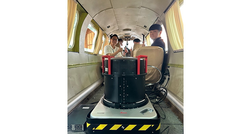
LTMetric team operating the Leica CountryMapper
"The Leica CountryMapper represents a strategic addition to our fleet and will allow us to deliver the most diverse large-scale mapping projects," said Doyeop Kim, Executive Director of the Project Implementation Division at LTMetric. "With the new system, we will further harness Leica Geosystems' hybrid technology to create digital twins not only of cities, but also of large areas."
"We are excited to see LTMetric leveraging the CountryMapper to its full potential," said John Welter, President of the Geospatial Content Solutions division at Hexagon. "This sensor not only represents a leap forward in airborne technologies, but also demonstrates our commitment to supporting our customers in their pursuit of excellence and innovation."
Leica Geosystems, quanto tem que estar certo
Com mais de 200 anos de história, a Leica Geosystems, parte da Hexagon, é a fornecedora confiável de sensores, software e serviços premium. Fornecendo valor todos os dias para profissionais em topografia, construção, infraestrutura, mineração, mapeamento e outros setores dependentes de conteúdo geoespacial, a Leica Geosystems lidera o setor com soluções inovadoras para capacitar nosso futuro autônomo.
A Hexagon (Nasdaq Stockholm: HEXA B) tem aproximadamente 24.500 funcionários em 50 países e vendas líquidas de aproximadamente 5,5 bilhões de euros.. aiba mais na hexagon.com e siga-nos em @HexagonAB.


