


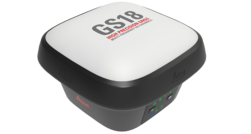
Leica GS18 T – World’s Fastest GNSS RTK Rover
Immune to magnetic disturbances and calibration-free – no need to level

You no longer need to hold the pole vertical to level the bubble with the new Leica GS18 T, the fastest and easiest-to-use GNSS smart antenna and RTK rover. This latest innovation combines GNSS and inertial micro units (IMUs) to be the first true tilt compensation solution immune to magnetic disturbances and is calibration-free.
As you no longer need to watch and level the bubble, you can focus on your task at hand and save time over conventional surveying practices. Uninterrupted, accurate positioning when surrounded by or in close proximity to metallic objects - measure where others simply couldn’t before. The GS18 T works directly out of the box without any calibration procedure.


ENGAGING SOFTWARE
The Leica Captivate field software is the perfect companion for the GS18 T. With easy-to-use apps, all measured and design data can be viewed and used, providing you with a clear understanding of your data in 2D and 3D view. Captivate spans industries and applications with little more than a simple tap, regardless of whether you work with GNSS, total stations or both.
TILT COMPENSATION
Based on sensor fusion of IMU and GNSS, GS18 T’s tilt compensation is immune to magnetic disturbances and it works immediately without calibration. With the GS18 T, surveyors have the flexibility to measure points with a levelled pole and still save the tilt values of each measurement. That way you have the trust that what was measured, is correct.
INTERNAL MEMORY
Users with any GS18 model have the flexibility to log raw data into an SD card or the internal memory.
4G LTE & EXCELLENT MEASUREMENT QUALITY
Tracking multi-frequency signals comes as standard with all Leica Geosystems GS sensors. Combined with an excellent GNSS antenna element and a position update rate of 20 Hz, GS18 T ensures reliable measurement quality.
IMPROVED PERFORMANCE
Multipath reduction and interference mitigation options in Captivate boost GNSS signal tracking quality under harsh environments, which improves RTK availability and accuracy. Also, an interference toolkit will enable filtering to remove in- and out-of-band distortions for even more robust GNSS signal tracking.
ACTIVE CUSTOMER CARE
Through Active Customer Care (ACC), a global network of experienced professionals is only a click away to guide you through any challenge. Control your costs with a Customer Care Package (CCP) which gives you peace of mind you are covered anywhere, anytime.
Brochure
Leica GS18 T brochure
Data sheet
Leica GS18 T data sheet
Compare GNSS solutions
GNSS comparison chart
Articles
Improved high-precision RTK positioning through multipath reduction and interference mitigation (as published in Proceedings FIG Congress 2022)
How Galileo benefits high-precision RTK (as published in GPS World magazine, August 2017 issue)
High-precision RTK positioning with calibration-free tilt compensation (as published in Proceedings FIG Congress 2018)
Assessing the benefits of Galileo to high-precision GNSS positioning – RTK, PPP and post-processing (as published in Advances in Space Research, 2020)
White papers
Leica GS18 T – World’s Fastest GNSS RTK Rover
Leica Viva series white paper BeiDou integration
Leica Viva series white paper RTK positioning

Contact us about GNSS systems
Get in contact with us about Leica Geosystems GNSS sensors.
Get in contact with us about Leica Geosystems GNSS sensors.


How To Use The GS18 T
Learn how easy it is to use the GS18 T. Training videos show you how to set up, work and get the information needed to complete the job.

New Pure Surveying industry page
Learn about our new surveying solutions to grow your business, training to upskill yourself or your team or just see what's new. Visit our brand new industry site.
Learn about our new surveying solutions to grow your business, training to upskill yourself or your team or just see what's new. Visit our brand new industry site.

HxGN SmartNet
HxGN SmartNet provides trusted GNSS data over more than 5,300 reference stations worldwide.
HxGN SmartNet provides trusted GNSS data over more than 5,300 reference stations worldwide.

Leica Infinity
Leica Infinity is the user-friendly geospatial office software for the measurement professionals. The surveying software is designed to manage, process, analyse and quality check all field survey measure data, including total stations, digital levels, GNSS and UAVs.
Leica Infinity is the user-friendly geospatial office software for the measurement professionals. The surveying software is designed to manage, process, analyse and quality...