By John Fraser
Camborne School of Mines (CSM), part of the University of Exeter, has spent more than a century preparing engineers and surveyors for some of the world’s most demanding underground environments. Today, however, institutions like CSM are facing a challenge that extends far beyond education: helping the mining and tunnelling industries address a rapidly growing shortage of highly specialised surveying professionals.
Meanwhile, global investment in underground infrastructure, transportation tunnelling and mining projects is increasing demand for surveyors capable of working in complex underground environments.
For Professor Andy Wetherelt, the issue is impossible to ignore.
“I have seven mining engineers in year one at the moment,” he says. “I could do with thirty-seven. The demand is there; these students will probably get three job offers each just for second-year vacation work alone. The real challenge isn't finding employment for our graduates; it's getting enough students through the door in the first place.”
That disconnect, rising global demand for skilled surveyors combined with declining enrolment in specialist mining and surveying programmes, has become a major concern across the industry. As experienced professionals retire and infrastructure projects become increasingly complex, companies are searching for graduates who understand not only modern geospatial technologies, but also the fundamental surveying principles required in high-risk underground environments.
At CSM, that combination of traditional expertise and modern technology remains central to how students are trained.
Why underground surveying still demands specialist expertise
While drones, GNSS and laser scanning technologies have transformed surface surveying workflows, underground environments continue to present challenges that cannot be solved through automation alone.
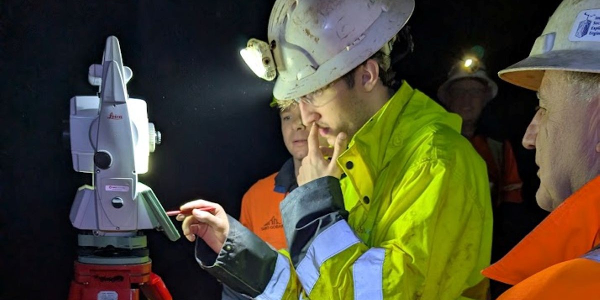
“Data capture has become significantly easier,” Andy explains. “The question is: how do you know that data is good? That's what I focus on teaching, not just how to press buttons, but how to validate measurements, understand error propagation and ensure accuracy.”
That distinction becomes critical underground, where GNSS signals cannot penetrate and surveyors must maintain precise control over measurements across long tunnel networks, shafts and complex underground infrastructure.
In mining and tunnelling projects, even minor alignment or measurement errors can create major safety, scheduling and cost consequences, making accurate underground surveying critical to successful project delivery.
“The real challenge isn't finding employment for our graduates; it's getting enough students through the door in the first place.”
− Andy Wetherelt, Professor, Camborne School of Mines
“In the 21st century, we're still lowering wires down shafts,” Andy says. “There's no other way to transfer coordinates accurately down a 60-metre shaft. Then you've got two wires moving, so your azimuth is constantly changing. How do you carry on an underground traverse and come out 5 kilometres later within 30 millimetres? You need traditional surveying methodologies with modern technology to check and correct your work.”
Students at CSM begin by learning the fundamentals: mechanical theodolites, levelling, calibration procedures, statistical analysis and rejection theory. From there, they progress to robotic total stations, laser scanning and advanced underground alignment techniques.
Andy’s own experience reinforces the importance of that rigorous foundation. After graduating from CSM in the early 1980s, he worked in Cornish tin mines, South African gold mines and on the Channel Tunnel project before returning to CSM as a lecturer in 1991. Over the years, his expertise in gyrotheodolite tunnel alignment has led to consultancy work on major infrastructure projects including HS2, Crossrail and the Thames Tideway Tunnel.
“Senior surveyors won't normally hole a tunnel through without getting me to check the alignment,” he says. “When you're boring through 5 kilometres of earth and need to meet within 30 millimetres, there's no room for error. That real-world pressure informs everything I teach.”
Preparing surveyors for modern mining and tunnelling workflows
For CSM, one of the biggest priorities is ensuring students graduate with experience using the same technologies and workflows deployed on active mining and tunnelling projects worldwide.
That alignment between education and industry has been strengthened through CSM’s long-standing relationship with Leica Geosystems, part of Hexagon.
Students train using the same Leica Geosystems total stations, GNSS receivers and laser scanning technologies deployed across real-world project environments. The partnership also creates regular engagement opportunities between students and industry professionals through demonstrations, technical events and career-focused sessions hosted at the university.
For Andy, access to current technologies is about more than familiarity with equipment. It is about helping students understand how modern instrumentation integrates with fundamental surveying principles in challenging field conditions.
“Anyone can operate a drone or a scanner now,” he says. “The data quality, the ability to validate measurements, to work in challenging environments underground, that's what makes our graduates valuable. That's what the industry needs.”
Addressing the underground surveying skills gap
Like many specialist technical programmes worldwide, CSM has faced significant enrolment challenges in recent years despite strong demand for graduates.
The undergraduate mining engineering degree was temporarily closed due to low student numbers before restarting in September 2025 with a common first-year engineering programme shared across disciplines. The MSc in Surveying has also been temporarily paused, though efforts are underway to restart it with support from industry partners.
Despite the challenges, graduate demand remains exceptionally strong.
“We've never had problems finding vacation work for students; it's mandatory,” Andy explains. “I've had 50 mining engineers in previous years and we have found vacation work for all of them.”
Many former students now work on major mining and tunnelling projects worldwide and continue turning to Andy for advice on complex underground surveying challenges.
Preserving critical underground surveying skills
As underground infrastructure, mining operations and tunnelling projects continue expanding globally, the industry’s challenge is no longer simply access to technology. It is also ensuring there are enough skilled professionals capable of validating, interpreting and applying precise geospatial data in environments where errors carry significant operational and financial consequences.
At CSM, that means continuing to teach students how to combine advanced geospatial technologies with the surveying principles that remain essential underground.
“I tell them: put it on your CV that you can do Weisbach triangles, underground resections and gyro observations,” Andy says. “Many surveyors don't know these techniques because surface surveying has become more common. But underground? That's where you prove your worth.”
For institutions like Camborne School of Mines, supported through collaboration with industry partners such as Leica Geosystems, the goal is not simply producing graduates. It is helping preserve the specialist underground surveying expertise required to support the future of mining, tunnelling and underground infrastructure worldwide.
About the author:
John Fraser brings deep industry experience and long‑standing expertise in surveying and measurement technologies to his work at Leica Geosystems, part of Hexagon. Having collaborated closely with product specialists, engineers, and surveying professionals worldwide, he plays a key role in preserving the principles of precision, reliability and technical excellence that underpin the Leica Geosystems’ legacy.


.jpg?sc_lang=en-in&hash=A252ABBC554D328B602D678CFD1734AF)


