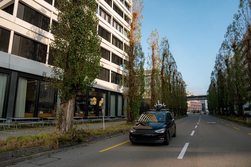
Today, asset managers and infrastructure teams increasingly need accurate, up-to-date geospatial data on roads, bridges, tunnels, utilities, and other critical assets. As they shift from reactive maintenance to proactive asset management, this data helps reduce costs and closures by identifying emerging issues earlier, like cracks before they become potholes.
Meeting this surging demand for geospatial data requires data capture that is accurate, efficient, safe, and scalable. However, traditional tools, such as terrestrial laser scanners (TLS), struggle to keep pace, particularly across large, complex sites with live traffic, GNSS obstructions, and limited access windows.
Traditional surveying and mapping of roads and highways places crews close to live traffic and may require road closures to capture the necessary data. This increases project costs and disruption to normal highway operations. It’s also slow, requiring significant time moving between individual setups in the field to capture the necessary data.
On the other hand, mobile mapping systems (MMS), such as the Leica Pegasus TRK, are designed to overcome these challenges. They enable rapid, autonomous data capture of roads, highways, and tunnels, while helping teams work more safely.
“The Pegasus TRK can accomplish in 2 hours what would take a terrestrial scanner 20 days to scan on a highway corridor of the same density. The larger the project, the greater the efficiency gains.”
David Jaynes, Sales Representative for Mobile Mapping Solutions, Leica Geosystems
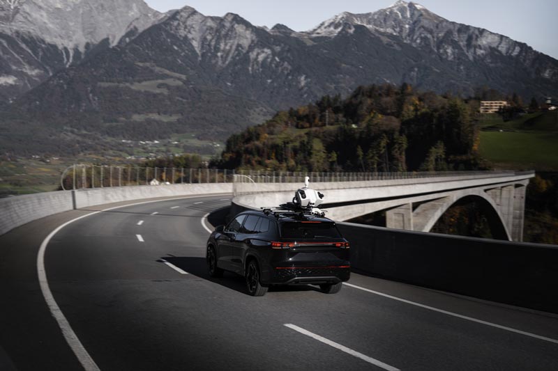
MMS enables efficient and safe data capture of road and highway networks.
Mapping roads and highways with Pegasus TRK
Historically, mobile mapping required highly specialised technicians. The Pegasus TRK removes that barrier with an intuitive, autonomous field workflow. Operators can be trained to collect survey-grade data within an hour, allowing field teams to focus on safe driving while the system manages the capture.
Road and highway surveys with Pegasus TRK follow a simple Capture, Prepare, Deliver workflow. Before the survey, it’s important to plan the route, set control points, and assess GNSS visibility. One tip, especially when mapping long road networks, is to plan safe opportunities to stop in open-sky areas. Good GNSS visibility allows the IMU to correct for any accumulated drift.
Once the route is planned and the system is mounted to the vehicle, data capture can begin after a short initialisation and alignment.
Leica Pegasus FIELD software on the tablet guides users through this simple procedure.
While driving, the software provides live feedback so operators can confirm coverage while still out in the field, avoiding the need for multiple re-drives to capture the necessary data.
In the office,
Leica Pegasus OFFICE combines trajectory, LiDAR, and imagery into a georeferenced point cloud dataset, using automated registration and control where required. The final data can then be exported as LGSx, our proprietary, all-in-one data format, which is supported by third-party software like
Mach9 for enhanced AI extraction of curbs, gutters, signs, and pavement markings.
Alternatively, Pegasus OFFICE supports export to standard formats, like e57 or LAS, for extraction, analysis, and client-ready deliverables in common software tools like
TopoDOT.
The Ohio Department of Transportation deployed a Pegasus TRK700 during a major urban interstate upgrade, where three sections were ranked among the state’s top-10 crash locations. The team paired the mobile mapping system with aerial LiDAR, using mobile mapping for the mainline where accuracy was critical for tie-ins and crown extractions, while aerial LiDAR covered local roads where the project area got too large.
Despite challenging conditions, including signal interference from surrounding buildings, partial construction zones and harsh winter weather, the combined approach delivered accurate data across the corridor, while also avoiding the need to put a crew in live traffic in one of the state’s most dangerous stretches of road.
Multiple deliverables from one capture
One of the core benefits of mobile mapping roads and highways is that the colourised and georeferenced point cloud can be used for a range of deliverables that support inspection, planning, design, maintenance, and asset management.
Mobile mapping produces accurate, reusable data for inspection, planning and asset management. With Pegasus TRK, organisations can support safety reviews, corridor and road-design planning, bridge-clearance assessments, rockface modelling, volume surveys, utility and powerline extraction, and as-built documentation for roads, tunnels and bridges.
What’s more, additional deliverables can be realised at a later date using the same data captured from a previous day.
As-built documentation
As roads, tunnels, bridges, and utilities are built or updated, transport agencies and asset managers need an accurate record of changes for compliance and future reference.
Pegasus TRK collects LiDAR, high-resolution imagery, and road condition data simultaneously, so full-colour imagery and the road surface are all part of the same survey. While users are running an IRI (International Roughness index) assessment of road surfaces, they’re also collecting what they need for a telephone pole inventory or guardrail check, so there’s no need to return for additional drives.
The result is a detailed record supporting future inspections, upgrades and long-term asset management.
Pegasus TRK captures the full roadside context in a single drive. including vegetation, buildings, and street furniture.
Road and pavement condition assessments
Pavement-condition assessments help road authorities monitor deterioration such as rutting and cracking. The resulting data support hazard identification, maintenance planning, and long-term road improvement.
Dedicated road-surface testing (RST) laser equipment can capture roughness data accurately. But Pegasus TRK goes beyond this capability by collecting a high-density point cloud and imagery of the wider road corridor, including kerbs, drainage features and roadside assets.
Pegasus TRK delivers precise positioning and high-density point clouds, enabling teams to assess pavement condition alongside the surrounding road environment in a single survey. Engineers can use this data to identify surface defects and other features relevant to safety assessments.
One study testedurement tools. Systems spanning traditional profilometers, MMS, and connected vehicle solutions were tested against certified ground truth across real-world driving scenarios, including braking, acceleration, and stop-and-go traffic.
Mobile mapping systems consistently demonstrated the strongest overall performance. They maintained stable IRI and profile measurements during braking, stopping, and acceleration, where traditional profilometers and connected vehicle systems struggled.
Find out more about the DuraBASt benchmark.
Powerline mapping and corridor asset inventories
Utility operators need visibility over assets spanning long corridors, from overhead power lines to roadside equipment. Dense vegetation around pylons often blocks the clear, static sightlines a TLS might depend on, forcing surveyors into multiple scan positions to fill in gaps.
Long-range performance and multi-return LiDAR mean the Pegasus TRK is purpose-built for mapping wide open areas while also capturing small details, like overhead cables, with precision. Teams then walk away with everything needed for powerline extraction, asset inventories, and corridor planning, forming a complete digital record for ongoing inspection and maintenance.
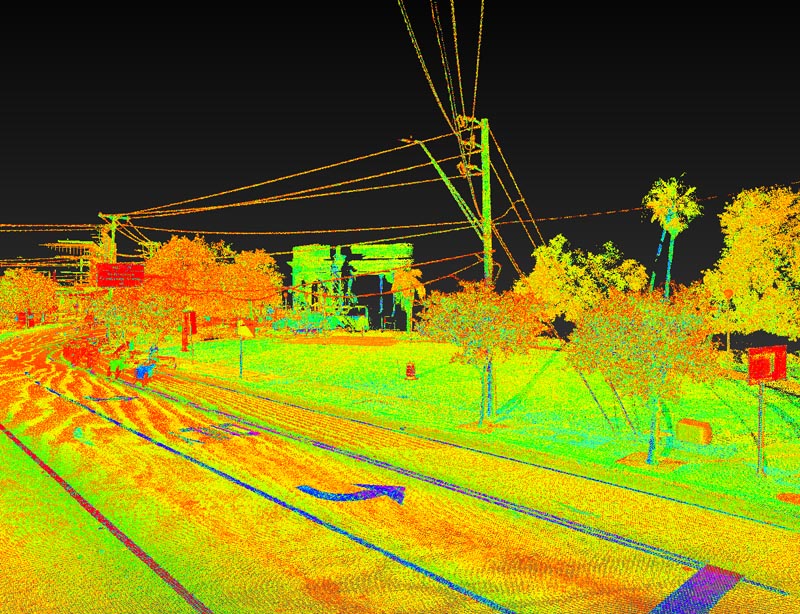
The Pegasus TRK accurately captures the full road width and overhead utility lines at the same time.
Mapping tunnels, bridges, and other GNSS-denied environments
The Pegasus TRK can handle brief GNSS disruptions without issue, such as those caused by short tunnels, bridges, tall buildings, or dense tree cover. However, some road networks include extended GNSS-denied sections, like long tunnels and underpasses. These environments require a more considered approach to planning and data capture.
Plan ahead for GNSS obstructions
Mapping tunnels and bridges requires careful planning around access restrictions and satellite availability. This is especially important when it comes to mapping tunnels, bridges, and underpasses, because teams are often only given limited windows for data capture, such as nighttime closures or scheduled access periods.
Unlike road surveys, tunnel mapping requires greater reliance on control because GNSS signals are blocked underground. That’s why, before entering a tunnel, the vehicle should sit still in an area with open sky to accurately lock in a strong GNSS and IMU reading before starting data capture. It’s recommended to repeat the same process after exiting a tunnel.
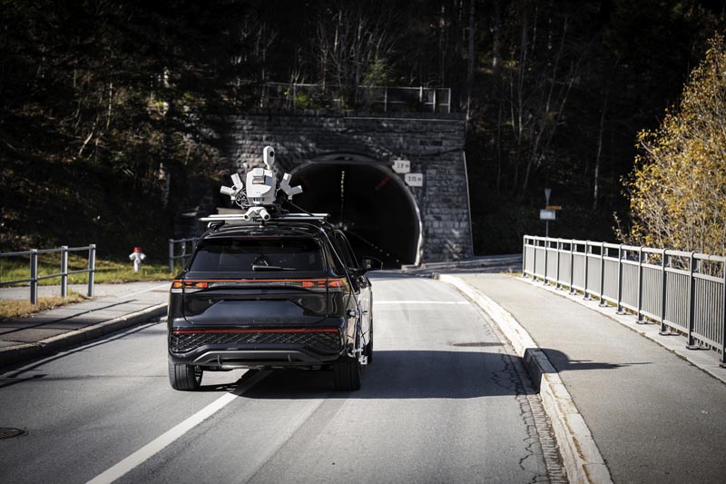
Mobile mapping in GNSS-denied environments, like tunnels, requires more planning and a slightly adjusted data capture workflow.
Maintaining an accurate position and trajectory
To help ensure an accurate trajectory in GNSS-denied environments, teams can add a distance measurement instrument (DMI) to the vehicle. The Pegasus TRK supports both mechanical and optical DMIs, which are either mounted to the wheel or the rear of the vehicle, respectively.
By providing reliable distance and speed measurements during GNSS outages, the DMI helps maintain accurate georeferencing throughout the tunnel survey.
The Pegasus TRK continues to rely primarily on the IMU for positioning and trajectory when the GNSS signal drops out. The DMI simply helps to adjust for any drift. The SLAM sensors in the Pegasus TRK also help adjust for horizontal constraints by matching features like tunnel walls against the surrounding environment. Together, the DMI and SLAM sensors act as a check and balance, keeping the IMU on track.
More insights and greater impact
Pegasus TRK enables teams to collect detailed road infrastructure data faster, safer, and with fewer resources, all while supporting multiple applications from a single drive. The bigger the project, the greater the payoff, as efficiency gains scale with project size.
As road and highway networks grow and age, planning and maintenance requirements become more demanding. Mobile mapping is a sustainable way to keep pace with the scale of these modern projects.
For more information about the Pegasus TRK portfolio,
contact us today or read more
here.


.jpg?sc_lang=en-in&hash=A252ABBC554D328B602D678CFD1734AF)