


Leica Captivate Apps Overview
Discover all Leica Captivate apps, developed to fit your surveying requirements

Leica Captivate surveying field software comes with diverse apps, all developed to meet your needs on site and support an easy-to-manage flow between the field and the office. Defined by a user-friendly interface, the apps help you perform tasks intuitively, while also offering a high level of customisation options to fit your specific needs. This overview is meant to bring you clarity, save your time and help you focus on projects.
1) Core Functionality and Data Collection related apps
Our first set of available apps/settings touches all the steps you need to take to start with your surveying tasks. Leica Captivate was developed to enable you to adapt it to your needs and the way you are used to performing your tasks.

3D Viewer
The 3D Viewer is the part of the software where you can visually inspect and interact with your data. You can see the data of the job you are working on either in 2D or 3D. Depending on the app, you might even be able to switch to an additional view like arrows view for stakeout or a cross-sectional view. With controls like zooming, panning (dragging) and rotating, you always get to view data in a way, best suitable for your project. You can centre selected objects - even around your current position or fit the measured elements into the window. You can configure the display of points, lines, scans, DTMs and alignments - and much more.

Setup
The Setup app includes all the methods that are needed to set up a total station. There are diverse methods to choose from: Set orientation, Known backsight, Multiple backsights, Transfer height, Resection, Orientate to line and Orientate to object.
GS Base Setup

Measure
The Measure app is where you will probably spend most of your time. Asides to storing points, you get to measure distances, define codes and more.
Imaging GS Imaging
GS Imaging
The GS Imaging app is where you will be using the incorporated camera to camera to capture images of an object of interest.

Scanning
The Scanning app is available for Leica MS60 includes all the methods that are needed to set up a total station. There are diverse methods to choose from: Set orientation, Known backsight, Multiple backsights, Transfer height, Resection, Orientate to line and Orientate to object.
2) Staking, Checking, and Computing related apps
Leica Captivate offers diverse apps to help with the stakeout process: Stake points, Stake a line, Stake DTM and Stake pts & DTM. Staking a point is a straigthforward process of transferring dimensions from the layout plan to the ground. Within Leica Captivate, this involves three simple steps: selecting the data to stake out, following on-screen navigation and storing the result.
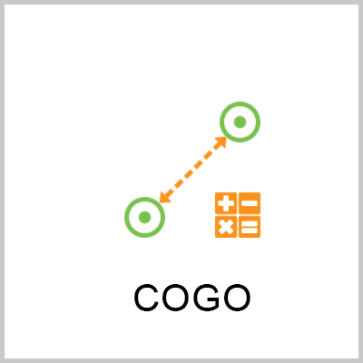
COGO
Cogo is an app ti perform coordinate geometry calculations such as coordinates of points, bearing between points and distances between points.

Stake points
Staking out reference points is a common surveying task with a huge importance when it comes to guiding/setting the base of any construction processes. The Stake points app enables the user to import, manually enter, calculate or measure points with Leica Captivate.

Stake DTM (Digital Terrain Model)
Staking a DTM (Digital Terrain Model) is possible when using design data where a surface has been triangulated. The DTM is converted from either a XML or DXF file to a DTM job. Most of the stake apps within Leica Captivate allow using a DTM to define the heights, so it can be used in conjunction with staking points, lines or alignments. A specific Stake DTM app also allows to only stake a DTM surface, in which case only height stake information is given.

Stake to line
This app allows staking out a line, a segment of a line or a grid. Whether it is a single straight line or arc segment, or a multi-segment polyline, the Stake to line task treats the line as continuous, and allows staking at any location along the line. This task is perfect for staking pipelines for example, when needing to reference from the beginning of the line. Using the Stake Segment task, a particular segment of a polyline line can be isolated. This is useful for staking building footprints for example, when it is needed to reference only one side or one face of the building.
Stake DTM (Digital Terrain Model)
Staking a DTM (Digital Terrain Model) is possible when using design data where a surface has been triangulated. The DTM is converted from either a XML or DXF file to a DTM job. Most of the stake apps within Leica Captivate allow using a DTM to define the heights, so it can be used in conjunction with staking points, lines or alignments. A specific Stake DTM app also allows to only stake a DTM surface, in which case only height stake information is given.

Stake pts & DTM (Digital Terrain Model)
This app is designed to help you stake out points and DTM heights.

Stake DTM (Digital Terrain Model)
Staking a DTM (Digital Terrain Model) is possible when using design data where a surface has been triangulated. The DTM is converted from either a XML or DXF file to a DTM job. Most of the stake apps within Leica Captivate allow using a DTM to define the heights, so it can be used in conjunction with staking points, lines or alignments. A specific Stake DTM app also allows to only stake a DTM surface, in which case only height stake information is given.
Contacto Leica Geosystems
Encuentre su contacto de Leica Geosystems para ventas, soporte y servicio técnico.
Encuentre su contacto de Leica Geosystems para ventas, soporte y servicio técnico.