


.jpg?sc_lang=ko-kr&hash=5A380D418D403D88683EA1039550C56F)




고객의 측량 파트너
라이카 지오시스템즈는 유일하게 200년 동안 측량 업계에서 역사와 전통을 보유, 측량 프리미엄 품질의 측정 및 포지셔닝 솔루션과 서비스로 고객을 지원.
라이카 지오시스템즈는 유일하게 200년 동안 측량 업계에서 역사와 전통을 보유, 측량 프리미엄 품질의 측정 및 포지셔닝 솔루션과 서비스로 고객을 지원.


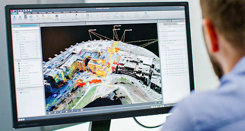
Leica Infinity is a user-friendly office software for surveyors and measurement professionals who require a comprehensive solution for their geospatial data needs. An investment in Infinity, ensures management, processing, analysis and quality assurance of survey data from total stations, digital levels, GNSS and Unmanned Aerial Vehicles (UAV’s). With Infinity office and Leica Captivate field software being perfectly synchronised in design and operation, seamless connectivity between the field and office is guaranteed. Supporting survey, mapping and construction applications, Infinity is the ultimate geospatial office software hub.
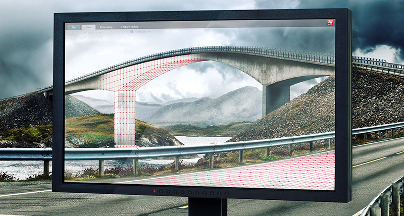
Leica Infinity is the geospatial office software of choice for infinite applications. From survey to construction, it supports BIM, CAD, GIS and more to accompany the growth of your business into new applications. Infinity software is ready to consume data from traditional sensors like a total station, GNSS and digital levels, and is equally comfortable with point clouds from the MS60 MultiStation and UAV’s.
Explore facts you need to consider when selecting surveying office software and how Infinity is empowering surveyors in every step – be it visualising, preparing, collecting, processing, confirming, reporting and/or sharing data.
Leica Infinity is the ultimate surveying software hub. Designed to support countless workflows, data from BIM, CAD, GIS and more, come together with measurement data in one easy-to-use survey office package. Images and point clouds from total stations, MultiStations, UAVs and GNSS are seamlessly integrated with traditional measurements to create valuable deliverables that can be shared digitally via the cloud or analogue printed plans. With data services by Hexagon and third parties integrated, access to data is seamless and effective. With full traceability and quality reporting, always be confident in your deliverables.
Explore tips and benefits on how industry surveying office software can simplify your workflow throughout the four pillars of a surveying job.
Leica Infinity was designed to seamlessly connect to the field, and at any time reproduce results that were measured in the field. Coordinates can be simply and automatically re-computed if a pole’s or instrument’s height was changed, avoiding time-consuming manual processing. With cloud connectivity between the field and office, surveyors in the field always have the latest data, and office processing can immediately begin, even before the field crews leave the job site.
Explore our collection of online training to get the most out of Infinity.
라이카 지오시스템즈는 유일하게 200년 동안 측량 업계에서 역사와 전통을 보유, 측량 프리미엄 품질의 측정 및 포지셔닝 솔루션과 서비스로 고객을 지원.
라이카 지오시스템즈는 유일하게 200년 동안 측량 업계에서 역사와 전통을 보유, 측량 프리미엄 품질의 측정 및 포지셔닝 솔루션과 서비스로 고객을 지원.


