Key takeaways
- PT Tolan Tiga Indonesia captures geospatial data through a standardised GIS workflow with Leica Zeno Mobile One, creating fully traceable and auditable records.
- Accurate, defensible measurements improve confidence in contractor verification, asset inventories and operational planning.
- Real-time field-to-office data sharing accelerates reporting, validation, and decision-making across more than 72,000 hectares of operations.
By Alexander Macdonald
On the eastern edges of Sumatra, where oil palm terraces ripple towards the horizon, the field teams at PT Tolan Tiga Indonesia begin their work before the heat of the day settles in. The plantations are vast − more than 72,000 hectares of palm and rubber, with tea estates extending into the highlands of West Java. This is a company shaped by more than a century of agricultural heritage, yet today its momentum comes from something decidedly modern: the pursuit of accurate, transparent and defensible geospatial data.
Across these estates, a quiet transformation has been under way. For the surveyors responsible for mapping roads, drains, planting blocks and legal boundaries − the data that governs payments, planning and compliance − the way land is measured has fundamentally changed.
At the centre of that change is the Leica Zeno Mobile One workflow with the Leica FLX100 plus GNSS smart antenna, representing a new generation of GIS workflows that emphasise not just accuracy, but accountability.
A legacy of responsibility meets the demand for audit-ready data
Founded in 1919 and now part of the Belgium-based SIPEF Group, PT Tolan Tiga Indonesia has long positioned itself as a responsible steward of land. Its operations comply with RSPO, ISPO, ISCC and Rainforest Alliance standards and employ more than 15,000 people. Sustainability, biodiversity protection and community development are embedded in how the company operates.
As plantation operations expanded, however, the challenge of maintaining consistent, auditable geospatial data grew more complex.
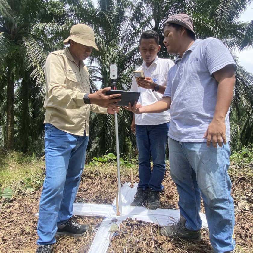
“For years, measurements relied on tools that produced inconsistent and non-traceable results,” explains Putra Aditama, Office Head Assistant GIS. “Tape metres, legacy maps, and earlier GNSS systems made it difficult to fully verify contractor work or eliminate discrepancies.”
In an environment where road lengths, drainage volumes, and planting areas directly affect contractor payments and long-term planning, unclear data introduced real financial and operational risk. PT Tolan Tiga Indonesia needed more than incremental improvement; it needed a system that could deliver accuracy at scale, while producing data that was fully defensible.
Re-thinking GNSS: From tools to trusted infrastructure
The decision to deploy Zeno Mobile One with the FLX100 plus marked a fundamental shift in how PT Tolan Tiga Indonesia approached geospatial data − not as a collection of tools, but as operational infrastructure.
At the centre of that shift is Zeno Mobile One, a mobile GIS app designed to make high accuracy data collection both consistent and accessible. Running on everyday iOS and Android smartphones and tablets, the app provides a clear, map centric interface for capturing points, lines, and polygons while editing attributes directly in the field.
That software foundation is paired with the FLX100 plus GNSS smart antenna, which brings the accuracy and resilience required for plantation environments. Combining real-time kinematic (RTK) and post-processed kinematic (PPK) capabilities with a modular design that separates the receiver from the mobile controller, the system is well suited to conditions defined by heat, rain, dense vegetation and physical wear. If a component is damaged, it can be replaced independently, reducing downtime and significantly lowering long-term replacement costs.
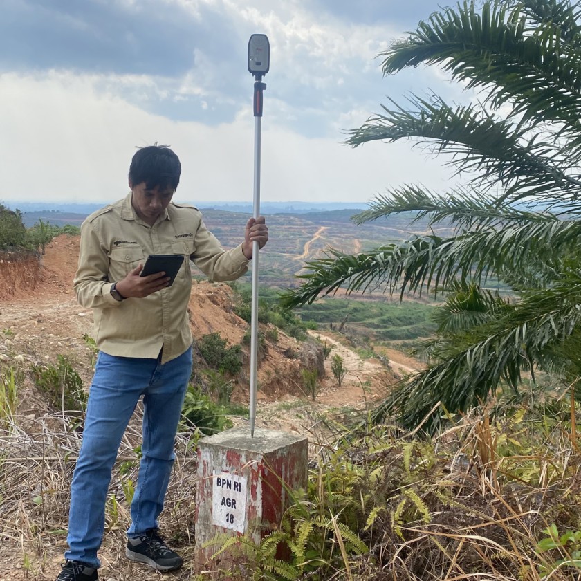
According to Arya Wardhana, Senior Manager GIS, it was the balance of performance and practicality that made the difference. “High accuracy, stable signal acquisition, simple operation and real cost efficiency,”he says. “If one component is damaged, we replace only that part, not the entire system.”
The transition was swift. Within two to three days, surveyors were fully operational. More importantly, the workflow fit naturally into daily operations, allowing teams to spend less time managing equipment and more time capturing data they could trust.
Real-time mapping across a living landscape
The scope of PT Tolan Tiga Indonesia’s GIS work is extensive. On any given week, survey teams measure:
- Plantation roads and drainage networks for contractor billing
- Replanting plots covering roughly 10% of estates per cycle
- Nurseries, housing complexes, and operational infrastructure
- Conservation zones and high-value areas
- Bridges, culverts, and harvest collection points
With Zeno Mobile One, points, lines, and polygons are captured faster and with greater consistency. Just as importantly, data moves immediately.
Every dataset is traceable. … Contract payments are now accurate, verifiable and transparent.
- Putra Aditama, Office Head Assistant GIS-
Survey results can be exported and shared via WhatsApp directly from Zeno Mobile One in the field, allowing supervisors and managers to review measurements the same day. What once required end-of-day uploads and multi-day processing cycles is now a continuous, collaborative workflow.
The impact goes beyond efficiency. Faster verification reduces errors earlier, aligns teams more closely and accelerates decision-making across departments.
Building an auditable workflow from field to invoice
Nowhere is the value of the Zeno Mobile One workflow clearer than in contractor verification.
A typical project begins with a survey request from the estate. Regional management assigns the task, and surveyors collect measurements using the FLX100 plus and Zeno Mobile One. Raw data and notes are uploaded immediately, then processed, corrected, and validated by GIS teams.
From there:
- Billing maps and summary records are produced
- Estate field assistants perform quality control
- Outputs are compiled into the Work Completion Report (BAP)
- Contractor invoices are issued, backed by transparent, traceable data
Every step is auditable. Every measurement is defensible.
“Past measurements were often unclear between point A and point B,” Putra explains. “Now, every dataset is traceable. That reduces disputes, eliminates remeasurement and protects the company from financial leakage.”
Reducing risk today and enabling digital growth tomorrow
The operational benefits are measurable: fewer reworks, faster surveys, lower equipment replacement costs and reduced labour overhead. But the strategic impact is broader.
The Zeno Mobile One workflow has become a cornerstone of PT Tolan Tiga Indonesia’s expanding UAV programme, where accurate ground control points are essential. What began as annual UAV mapping has grown into twice-yearly campaigns across five plantation regions, providing higher-frequency insights into land use, crop development and accessibility.
“The reliability of the system in daily operations has been officially validated by our Continuous Improvement Department,” says Putra. “That gives our teams confidence to rely on it every day.”
By anchoring GNSS, GIS and UAV workflows in a single, audit-ready platform, the company is steadily advancing towards a fully digital plantation model, one where decisions are guided by high-fidelity, high-confidence data.
A practical vision of the future
From the outside, plantation management may appear rooted in tradition. Inside PT Tolan Tiga Indonesia, however, a different story is unfolding, one where modular GNSS technology, mobile GIS workflows and UAV mapping converge to redefine how land is managed.
“The impact has been transformative,” Putra says. “Contract payments are now accurate, verifiable and transparent; the risks of financial discrepancies and fraud have been drastically reduced; and plantation management gains dependable data for replanting strategies, conservation planning and long-term production estimates.”
It is a transformation built not on abstract promises, but on accurate daily measurements − captured reliably, shared instantly and trusted across the organisation.
And in the early morning hours, as surveyors walk the roads and terraces with the FLX100 plus and Zeno Mobile One app in hand, the future of plantation management does not feel theoretical. It feels operational, precise and already well under way − one defensible point at a time.


.jpg?sc_lang=nl-be&hash=3E8603D3743EEF0A68A45FC62CA7887B)