Writer: Mary Jo Wagner in collaboration with Yannick Stenger
Part two of a two-part AI Classification series with Yannick Stenger, Cyclone 3DR Product Manager. In the first part of this series, Stenger discusses the development of AI Classification within our reality capture software portfolio, its functionalities, and how it benefits users. In this article, he discusses AI Classification application examples, workflow enhancements and how AI Classification will continue to shape reality capture.
Across many industries, professionals embrace AI in their daily work and replace time-consuming tasks and challenging processes with innovative tools. In the geospatial world, AI plays an essential role in point cloud classification, streamlining pre-processing steps and helping ensure success in downstream processing and analysis.
At Leica Geosystems, part of Hexagon, we are continuously identifying and developing our AI portfolio and working in collaboration with NVIDIA, to enhance point cloud classification and create efficiencies for our customers in automated point cloud processing. As part of this focus, we’ve recently improved our AI Classification for Leica Cyclone 3DR, our powerful software solution powered by NVIDIA CUDA that combines AI with the accuracy and efficiency of reality capture technology to help users deliver 3D results for many applications.
AI Classification use cases across all industries
Our latest Cyclone 3DR version powered by NVIDIA RTX GPUs not only has a 20-percent faster point cloud engine than it’s predecessor, but the combination of AI Classification with 3D-algorithm-driven features unlocks endless possibilities for Leica Geosystems’ reality capture software, offers significant flexibility and optimises accuracy. In particular, combining AI Classification with Cyclone 3DR mature SDK functions can generate accurate deliverables and provide outcomes once only dreamed about.
Although we’re often surprised by the ingenuity of our customers in creating new ways to use our software, we’ve identified some notable use cases for several markets.
AEC | Progress Monitoring

Classification in the Progress Monitoring features categories and colour-coded construction elements in three main groups; installed, in progress, not installed.
Within the AEC Edition of Cyclone 3DR, Progress Monitoring, released in 2024, is the first feature of the software application that can directly digest the scan’s class information to optimise the results of the analysis.
Progress Monitoring in Cyclone 3DR is a disruptive feature in the construction market that offers a desktop user-friendly solution to compare an as-built condition of a construction site and a design IFC model, delivering a straightforward report that categorises the construction elements in three main groups––Installed; In progress; Not Installed––and colour codes them. Combined with efficient scanners from the Leica BLK series, Progress Monitoring is a very efficient way to deliver reports regularly, help site managers manage invoicing, monitor sub-contractors, verify completion of the worksite, and report to the facility owner. Although this feature predominantly targets construction, it is also great for utilities and plants to identify where there are missing assets or to instantly acquire the status of any object by clicking on a point in the design model.
Whether it’s AEC, a utility or a plant, a significant strength of Cyclone 3DR and Progress Monitoring is its flexibility in visualising and reporting. Users can ask to see all assets currently in progress or those not yet built, and with reporting, those results can be visualised and delivered any way the customer needs. It can be a simple list or an information-rich Excel spreadsheet with all the notifiers for each component’s status. It's also possible to create a heat map that you can visualise in Cyclone 3DR or other third-party applications in 3D or as a mesh in a viewer. Users can create customised reports showing or listing just the columns or walls built that week or provide a progress summary table only for columns, walls or pipes.
In addition to its flexibility, Progress Monitoring offers a new option that optimises 3D analysis based on the point cloud classes from the “Indoor Construction Site” classification model. Adding the intelligence of colour-coded objects improves the analysis algorithm in the back end and optimises calculations. The immediate benefit of this option is a drastic decrease (> 75%) in the number of false positive values in the Installed and In Progress groups. That means that the manual step of wizard workflow, which is focused on checking the analysis results, is significantly reduced, offering vast time-saving for the end-users.
Plant | Scan-to-Pipe
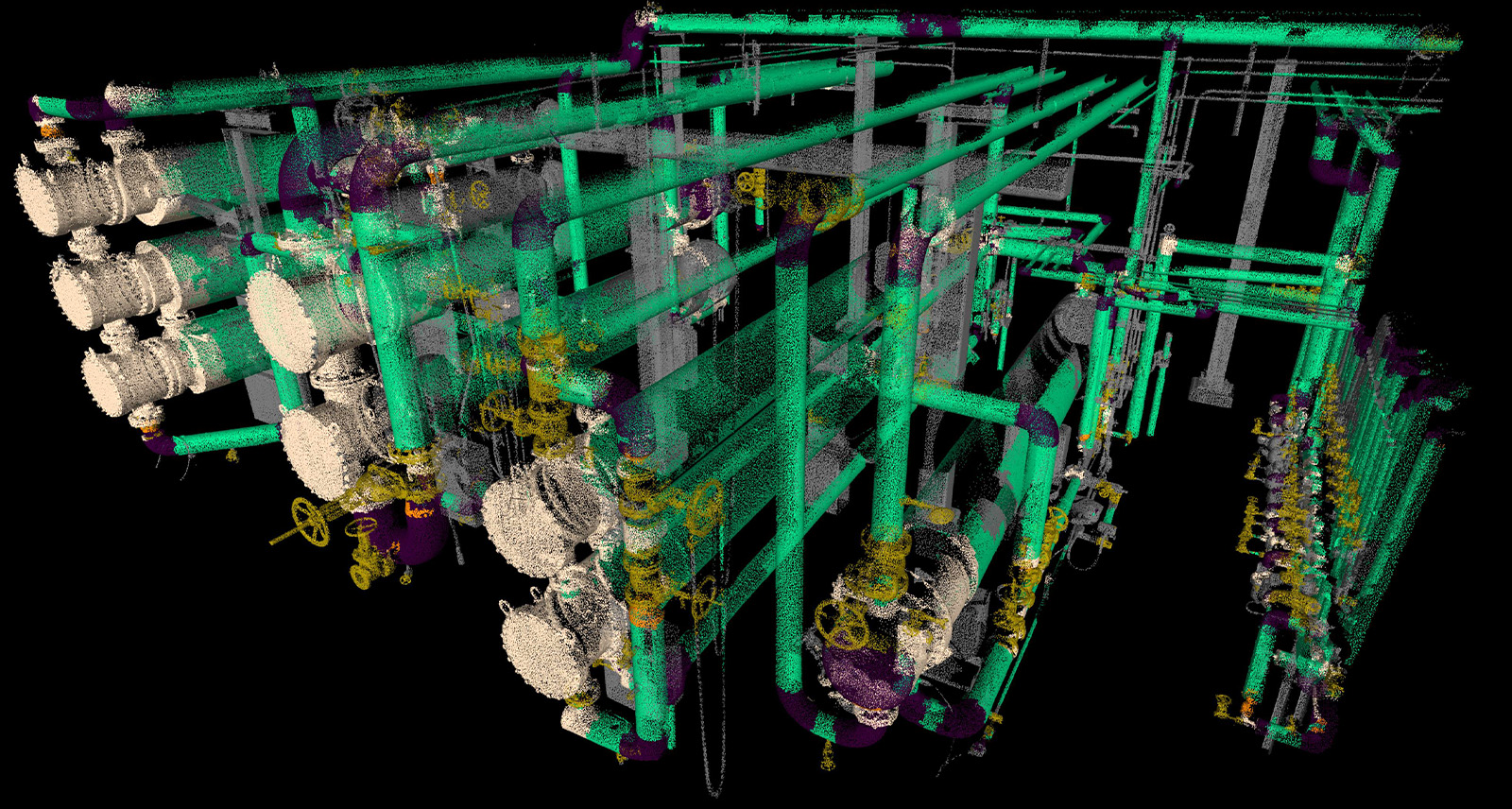
Easily remove unclassified points from the 3D environment with the 'Segment by Atributes' feature.
An immediate benefit of Cyclone 3DR’s Plant model is the facilitation of all Scan-to-Pipe workflows.
Cyclone 3DR Scan-to-Pipe feature is designed to offer a user-friendly tool for creating 3D models of piping systems, producing intelligent digital twins of plant facilities, controlling MEP equipment, anticipating plant site refurbishments, and performing flow calculations of pipe systems.
Working with a classified point cloud is an incredibly helpful facilitator. Given the intricate and layered pipe infrastructure, it’s very helpful to quickly clean, isolate and visualise only the pipe sections a user needs. Cyclone 3DR does this very well. By simply offering a class-color representation of the point cloud, the 3D digital environment becomes much easier to understand, and the clicks to enable the semi-automatic modelling tools of Scan-to-Pipe become even more natural.
Another way to optimise the Scan-to-Pipe process is to use Cyclone 3DR’s Segment by Attributes feature to remove the unclassified points from the 3D environment. With this feature, users can model pipe systems only from the points flagged with “Pipe” information (cylinders, bends, reducers, …). The extraction becomes more accurate and so much easier because the 3D environment is cleaned from unwanted points.
Survey | Advanced DTM
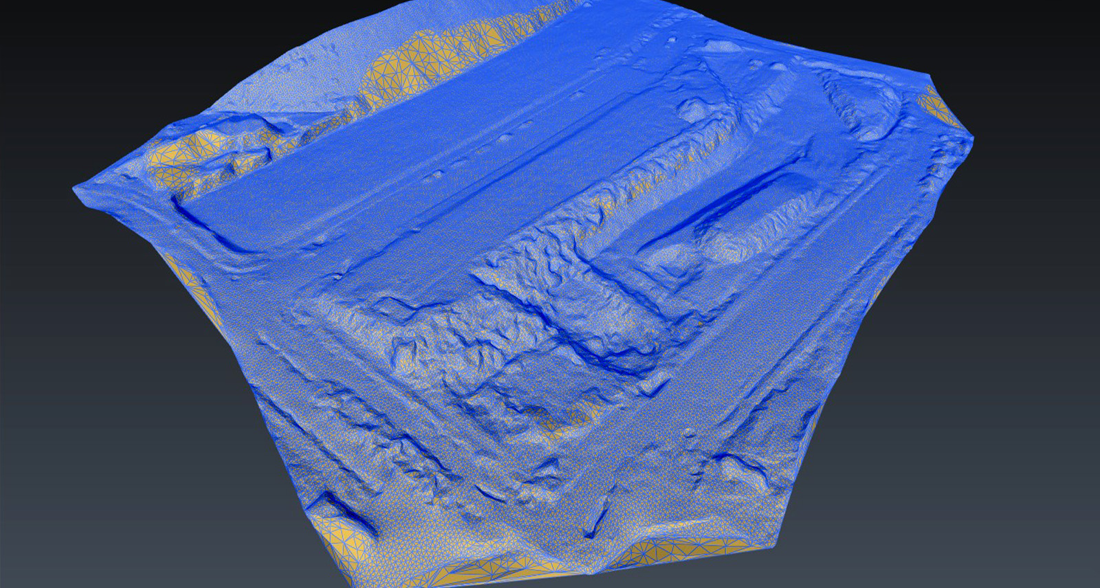
With the Outdoor Heavy Construction model, categorise outdoor artefacts to quickly remove unwanted areas from the point cloud before utilising the DTM feature to create a mesh terrain model.
A typical survey application based on AI Classification is creating Digital Terrain Models (DTM) for outdoor construction sites. The purpose of creating a DTM for heavy construction sites is to calculate volumes or compare the as-built ground with a design model. The DTM offers a precise way to monitor ground volume changes, allowing users to control the cost risks for all the construction stakeholders.
Thanks to the Outdoor Heavy Construction model, Cyclone 3DR users can benefit from an industry-specific model to categorise outdoor artefacts with a high level of accuracy before creating a DTM. Using AI Classification, users can first remove unwanted areas like vegetation, buildings, vehicles, or worksite equipment from the original point cloud.
Then, based on highly refined parameters such as slope angle, steepness, and the removal of certain objects, the Cyclone 3DR DTM feature can efficiently create a mesh terrain model to execute an extremely accurate DTM in a single step.
Survey | Virtual Surveyor
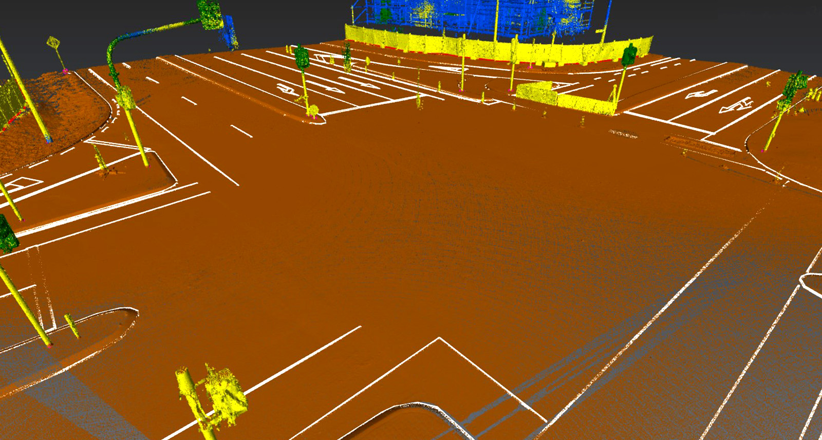
Isolate various assets from street signs to paved roads or sidewalls with the Road Classification model.
The Road classification model with Virtual Surveyor in Cyclone 3DR offers a top-notch experience for helping users create 2D topographic plans, the main CAD deliverable from the Virtual Surveyor feature.
If a user has scanned an outdoor environment like a street, road intersection or parking lot with a Leica RTC360 3D laser scanner, they can apply the Road model on the point cloud, and in one click, they can isolate assets like ground, paved roads, sidewalks, road edges, buildings, fences, road signs, and poles.
The user-friendly approach of Cyclone 3DR’s Virtual Surveyor allows users the possibility to extract points and polylines of interest with customised feature code values, and it provides full flexibility to represent the 3D environment scene depending on the workflow or application. For example, road assets, such as road signs or turning arrows painted on the road, are better visualised with intensity values rather than the classification. The classification will classify this as a road sign, but the user might need the image to see that it’s a stop sign. So, switching from one type of visualisation to another or jumping from the point cloud to images significantly improves their analysis for downstream workflows. They can also display only some relevant classes like poles. With the Virtual Surveyor, they can choose the “Pole Center” tool to position the coordinates onto the final 2D topo deliverable correctly.
Digital Reality | Scan-to-Mesh

Scan-to-Mesh is beneficial to all industries. A point cloud cleaned with AI Classification produces a realistic digital twin.
For the creation of realistic digital models, Cyclone 3DR’s one-click Scan-to-Mesh is a game changer in the reality capture market. When combined with a point cloud that has been cleaned with AI classification, the outcome mesh model from the workflow is an amazing, realistic digital twin.
Thanks to the diversity of the embedded models in Cyclone 3DR for various outdoor or indoor environments, Scan-to-Mesh is beneficial to all industries and is optimised for each application. The input point cloud can be subdivided into different subgroups with the class information. Then, Cyclone 3DR’s meshing flexibility for each subgroup can propose a different meshing strategy to deliver the most realistic model. For example, other parameters are used for trees, concrete floors, furniture or heritage facades. As a consequence, Cyclone 3DR offers a simple workflow that allows users to create optimised mesh models for their own needs.
The Scan-to-Mesh feature is adapted to automatic script routines for repetitive tasks.
The AI-classification-boosted Scan-to-Mesh workflow is an excellent candidate for Cyclone 3DR users who are willing to get onboarded into scripting. The script code for this workflow remains very accessible and relies on a couple of core script functions (Classification and Scan-to-Mesh) that can be executed fully automated through the export of textured models.
Asset Management |Object localisation with scripting

Asset detection and localisation has many applications, including for road and railway projects.
Cyclone 3DR has easy tools that enable users to easily understand the class information of a point cloud, split the scan data by class group, and create clusters representing the assets/objects to detect specific classes thanks to its robust algorithm. In addition to these benefits, users can geo-localise assets with labels and produce deliverables with visuals, PDFs or CSV reports.
The applications of these tools include asset detection and localisation for roadway or railway projects (poles, signs, vegetation, road furniture, rail tracks, overhead lines, etc.), asset detection in a plant facility environment (valves, pumps, pipes), and estimating quantities in a building for renovation purposes (slabs, walls, windows, columns, doors).
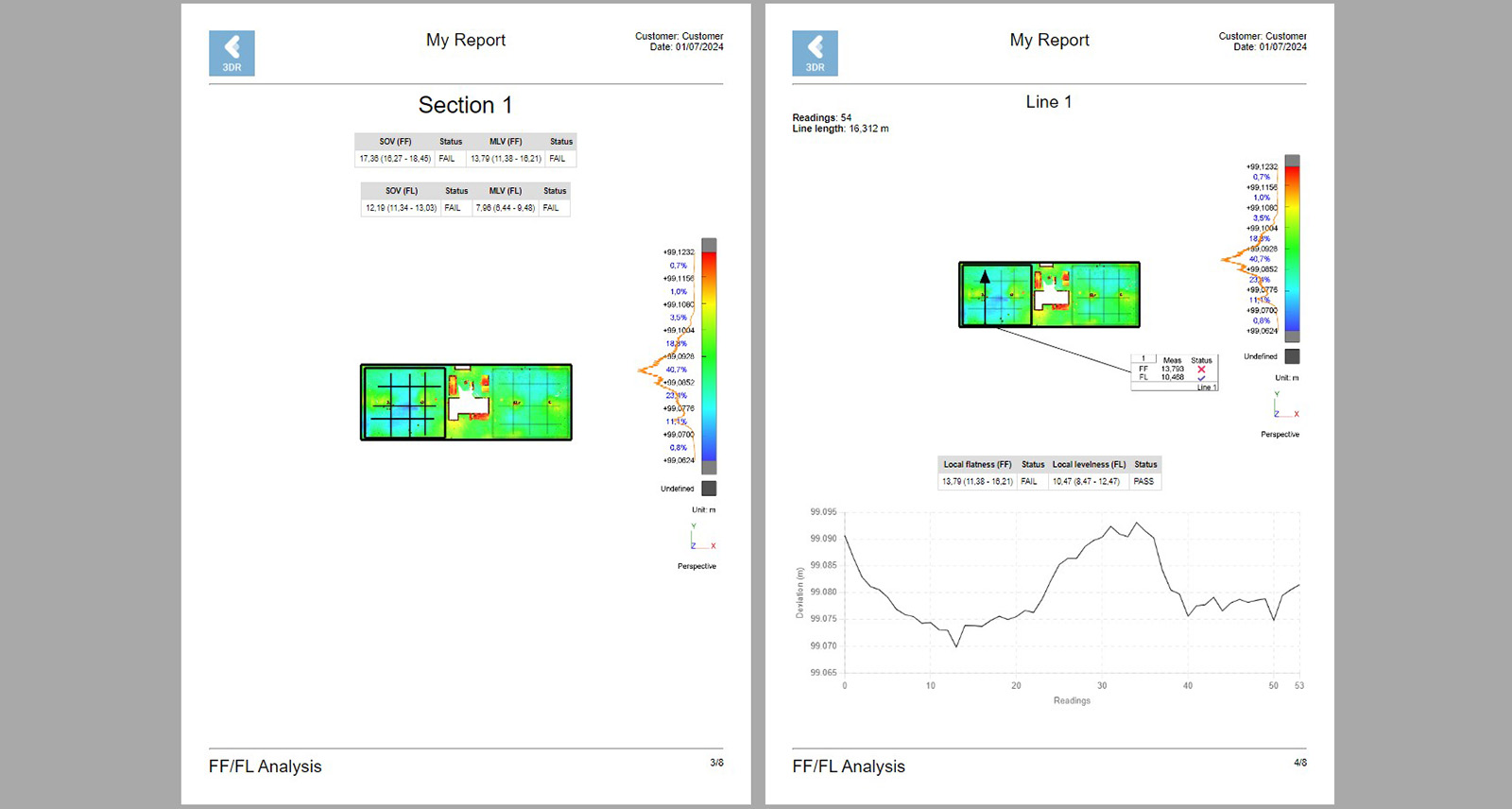
AI Classification combined with the automation of Cyclone 3DR's Progress Monitoring tool allows for quick and efficient reporting.
In the end, it's all about efficiency
The main benefit of AI Classification to end users is efficiency. Before the era of AI, reality capture users have often been challenged to balance meeting project deliverable deadlines with pursuing new business opportunities. The time-consuming nature of delivering weekly reports, analyses or models limited their available time for other pursuits. For example, say I am a surveyor tasked with providing a weekly progress report on a construction project. Prior to AI Classification in Cyclone 3DR, that surveyor might have spent half a day manually cleaning and checking the reality capture data, and then preparing and exporting the report. And if they had more than one project with similar deliverable requests, that time was quickly consumed by just reporting. The automation of Cyclone 3DR’s Progress Monitoring tool reduces that half day to minutes, freeing them up to meet weekly reporting requirements and respond to new tenders.

Looking toward the future
The future is bright for AI development in reality capture. End users can expect:
More accurate and more robust models for various applications.
The Hexagon AI Classification technology is maturing significantly and is proving to be an efficient path to success for the reality capture community. Hexagon will consolidate its positioning to deliver models optimised for the market’s most requested applications and driven by industry needs.
With innovation at our core, Hexagon’s AI Hub is leading multiple research initiatives that will lead to new technologies and new facilitating tools that will speed up the current AI Classification engine.
Given that focus, we can expect regular improvements for the existing classification models with more accuracy and consistency. Performance improvements will be delivered to allow users to classify larger and larger datasets and reduce computation time. And, because our classification models have been trained previously with AI, users can process, analyse and store their data locally, which provides a nice layer of security for users.
Deliver every AI-classified data from everywhere
Leica Geosystems’ reality capture division embraces a clear strategy to deploy the core Hexagon technologies to every platform to encourage collaboration and accelerate exchanges, easing our customers’ work lives.
Consequently, the AI Classification technology won’t remain static in our desktop solutions. It will be deployed in our field applications, and in particular, there will be a strong connection between our cloud technology, the office and our field solutions. The disruptive Reality Cloud Studio, powered by HxDR, will be the ideal online component of workflows to process very large datasets for the benefit of laser scanner partners.
User-centric customised workflows
Since we aim to offer automated solutions to customers to help them achieve sustainable success, we will continue to be guided by end users to create innovative solutions that are increasingly flexible and serve their needs.
By combining AI Classification with other AI backend technologies, our reality capture portfolio will continue to improve and reach a new era when users will be the architects of the features they need.
As more end users explore Cyclone 3DR and become familiar with its impressive functionality and flexibility, we expect to see more amazing innovation and application development by the reality capture community. We predict an exciting journey ahead for reality capture fans and are excited to be a part of it.
Interested in learning more about AI Classification and other features and workflows in Cyclone 3DR? Browse our Cyclone 3DR YouTube Channel for tutorials, tips and tricks.

Yannick Stenger
Product Manager, Leica Cyclone 3DR


