Combining geotechnical and geodetic data for monitoring
Case study

Author: Renata Barradas Gutiérrez
Cities are evolving entities that need to adapt to accommodate the needs of the people, sustain economic functions and provide well-being and life quality. Adapting and building new infrastructure in cities with rich cultural heritage and city Old Towns pose a greater challenge as any construction works must maintain the integrity of historic structures.
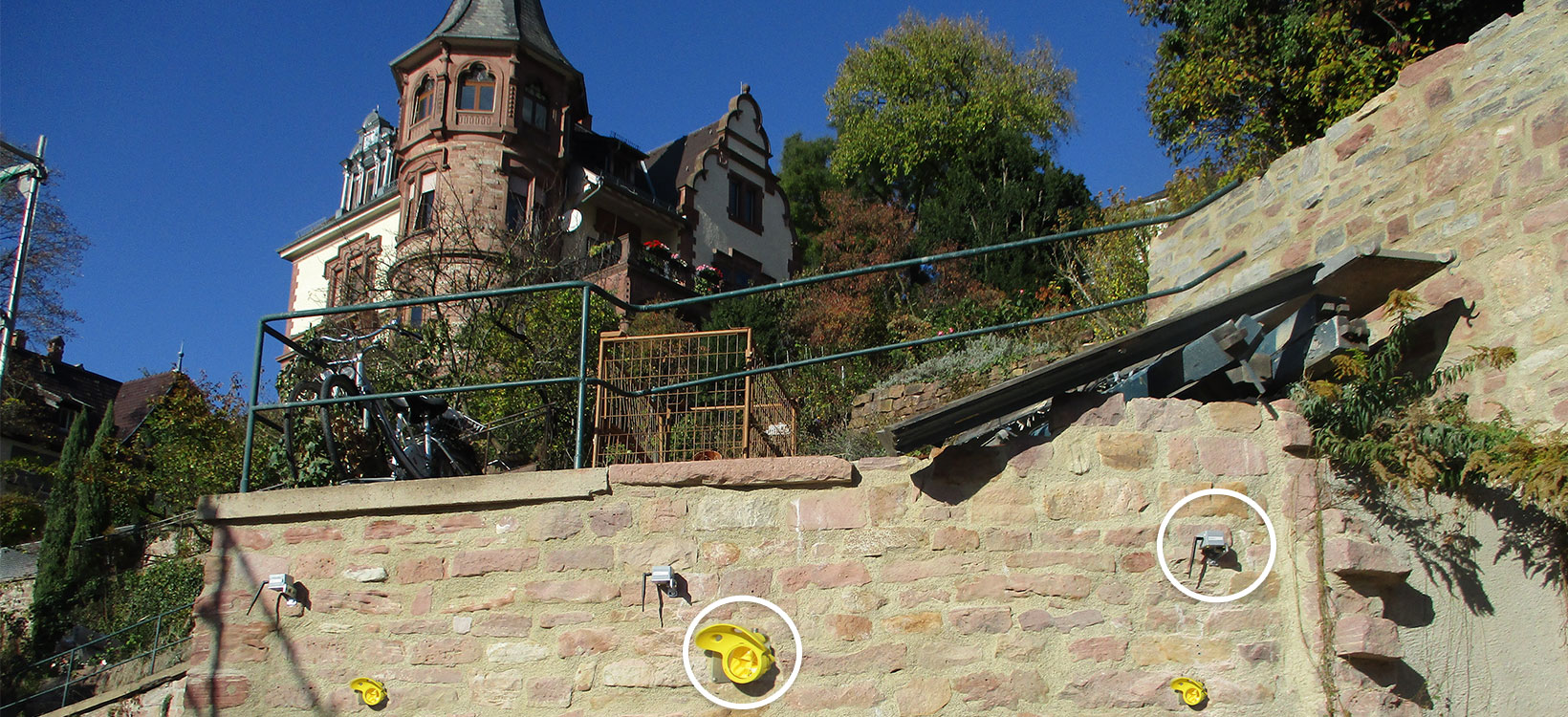
Crucial monitoring, including historic structures, is happening around the world without most of us noticing. Such is the case in Heidelberg, where at the heart of its Old Town a historic retaining wall built around 1871 is being monitored. To cope with the need to accommodate cars, an underground car park is being constructed right next to the historic retaining wall and foundation. The construction required to dig a 10-metre-deep pit reinforced with bored piles in front of the historic retaining wall reinforced with anchors.
For this German city situated on the Neckar river, this retaining wall is important beyond its historic value – the structure restrains soil to stabilise a slope. To ensure its reinforcement works are stable, securing measures are adequate and the historic wall is preserved, monitoring is required.
Integrating new buildings into existing old structures

TPI Vermessungsgesellschaft mbH (TPI), an engineering company for surveying and geoinformation based in the Rhine-Main area in Germany, took the challenge of ensuring a new underground car parking beneath the existing old structure would maintain its integrity.
“We will play our part in preventing damage as long as any damage can be detected and technically measured in a timely manner,” said Dipl.-Ing. Dietmar Keiser, project manager at TPI.
To detect any tilts on the wall, capture any displacements in 3D and detect any settlement on the wall, TPI’s tailor-made monitoring solution includes:
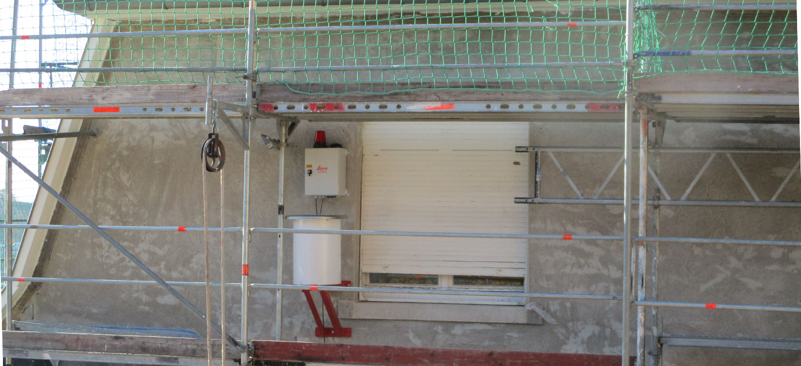
- One Leica Geosystems total station TCRP 1201
- GeoMoS Monitor
- GeoMoS Now!
- 13 Leica GPR112 prisms
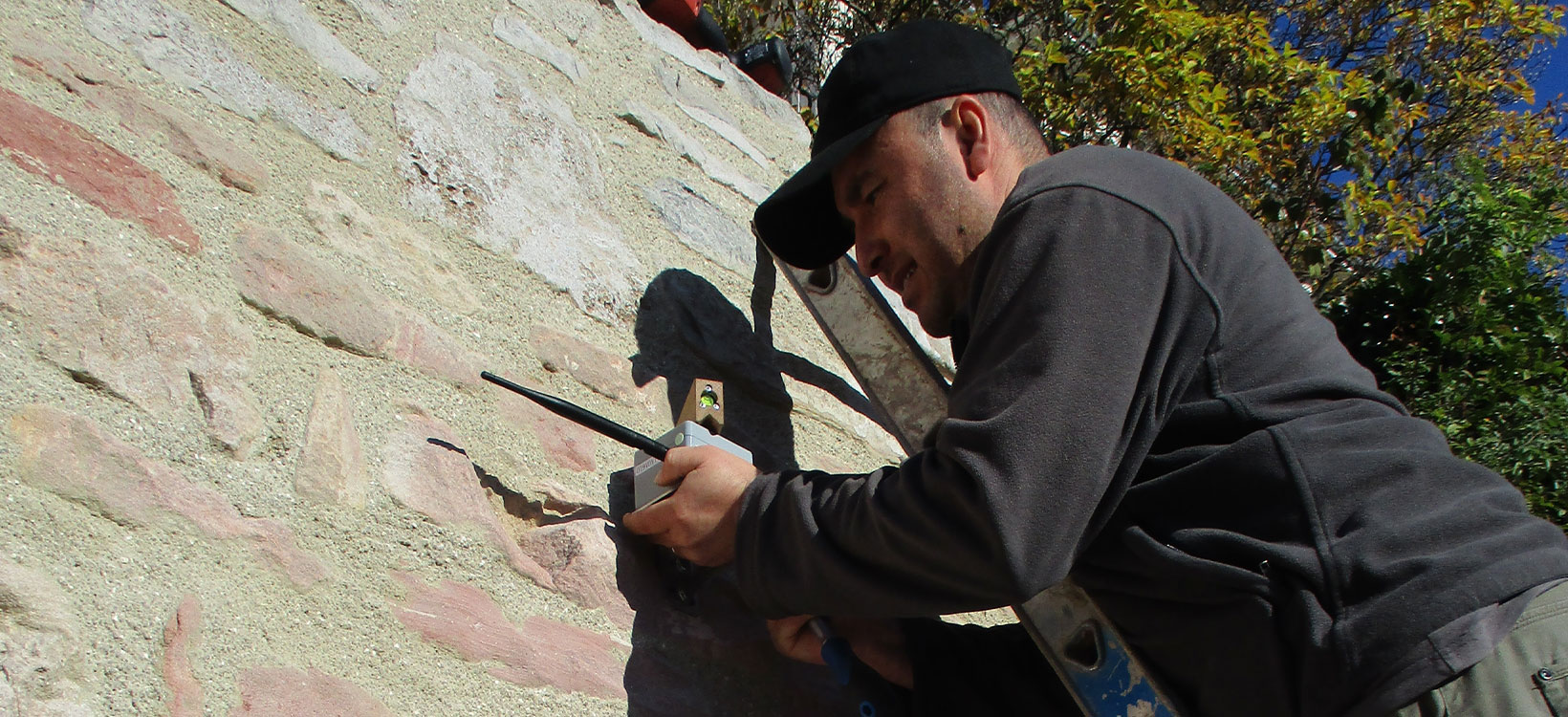
- Eight wireless inclinometers with two-axis
- One meteo sensor
The 3rd dimension

Two different monitoring methods were set to guarantee independent checks. With a geodetic focus, the prism monitoring captures 3D deformation allowing to detect any lateral movement or wall settlements. A total station is continuously measuring five reference and eight monitoring points. With a geotechnical focus, two-axis inclinometers are detecting wall tilts. Sensors are connected in a self-forming mesh network where each node can act as a data sender and receiver. This guarantees the measured data will reach the gateway in the fastest possible way, from where it will be uploaded to the cloud and automatically processed by GeoMoS monitoring solution.
All measured data, including data from the tilt sensors, angle and distance measurements to prisms and environmental data, such as temperature and air pressure, was automatically collected and analysed with GeoMoS. All acquired and processed data reported no tilt on the wall, hence, the reinforcements are good and stable enough and the team could proceed with the construction.
“GeoMoS Monitor and GeoMoS Now! are really sophisticated products that will certainly be further developed in specific areas. Thanks to the reliable support by our contact at Leica Geosystems, the setup of the system was straightforward. The user guide of the program was also very good. Even now after about five months, I still receive tips and support for individual program functions,” said Keiser at TPI.
TPI engineers and surveyors used in the past Leica Geosystems total station, GNSS, levels, laser scanner and laser tracker equipment. This time the tailor-made monitoring systems is giving specialists the confidence to dig and build underground. Rounded by competent support by Leica Geosystems staff, the secure could storage and web service enables TPI experts to:
- Permanently and automatically measure without manual intervention
- Automatically evaluate and trigger a message when the limit is exceeded
- Continuously monitor the results via the internet
- Enable designed stakeholders, such as their customer, access results.
Keeping everyone and everything safe

Excavations in urban areas pose risks to the people, structures and buildings on the surroundings. Fully-operating and reliable monitoring systems are essential to measure any deviations and make better-informed and timely decisions and mitigate any risks.
Supported by Leica Geosystems’ specialists, TPI set different monitoring methods with a solid reference frame that included additional reference points, to guarantee independent checks. With the confidence to detect any movement to the millimetre, experts can upgrade an urban area while preserving its cultural heritage.


