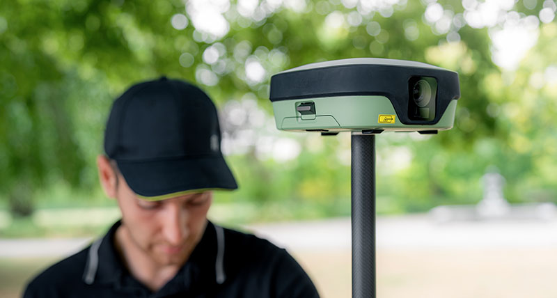
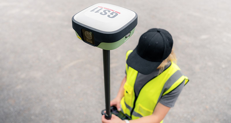
Leica GS11 GNSS smart antenna

Visual surveying meets trusted GNSS performance

Hero-placeholder_PIC_2480x750
The Leica GS11 is a GNSS smart antenna that combines trusted Leica Geosystems positioning with visual surveying. Together with Leica X-PAD field software, it brings focused performance to everyday surveying tasks with intuitive workflows, live visual navigation, and image-based measurements. The result is fast fieldwork, clear project understanding, and full confidence that the job is complete before leaving the site.


Leica X-PAD unterstützt die GS11-Workflows für visuelle Vermessung und fokussierte Performance.

Visueller Workflow bei der Vermessung 


RECEIVE AND PREPARE 


Import project data, coordinate systems, and CAD drawings into X-PAD. Pair the GS11 and prepare measurements, stakeout data, and maps so you're ready to start work in the field.

MEASURE AND STAKE OUT


Capture reliable GNSS measurements with image-based measurements, tilt compensation, and the integrated laser.

VERIY AND REPORT


Review measurements in real time with live AR visual validation for quality checks and create image-based reports. Confirm the job is complete before leaving the site and reduce costly rework.

PROCESS AND DELIVER


Sync field data with Hexagon GeoCloud and complete projects in X-PAD Fusion. Process GNSS measurements and deliver accurate drawings, reports, and more.


Warum Leica GS11? 
The Leica GS11 combines trusted Leica GNSS positioning with visual surveying, giving surveyors a more intuitive way to navigate, measure, and verify work in the field. Working with Leica X-PAD, its dual cameras provide real site context throughout the surveying workflow, making everyday tasks faster, clearer, and easier to complete.
 
Visual stakeout overlays navigation guidance onto live camera imagery so you can see exactly where to go, while visual survey with AR lets you view captured data on the live stream. Additionally, you can capture image groups and create points from the images, allowing you to measure where access is difficult or unsafe to reach with the pole.
 
Before leaving the site, live AR visual checks help you review and validate your work, reducing uncertainty and ensuring the job is completed right the first time.
 
field360
The Leica GS11 is built for the demands of everyday surveying. Reliable Leica GNSS technology, tilt compensation, an integrated laser, and dual hot-swappable batteries give you the flexibility to keep measuring across long days and when site conditions become challenging.
 
The GS11 combines trusted hardware with Leica X-PAD intuitive software, Hexagon SmartNet corrections, GeoCloud services, and global Leica Geosystems support in one connected surveying solution. The result is dependable performance that helps teams stay productive from the first point to the final deliverable.
 
Verwandte Produkte


Leica X-PAD

Die workflowbasierte Feldsoftware Leica X-PAD verbindet ausgewählte Leica GNSS-Empfänger und Totalstationen zu einer einzigen, intuitiven Vermessungslösung.

Hexagon SmartNet

Hexagon SmartNet bietet zuverlässige GNSS-Korrekturdienste in Echtzeit. So lässt sich mit Leica GS11 und Leica GS05 eine präzise und zuverlässige Positionierung vor Ort sicherstellen. GNSS-Sensoren und Positionierungsdienste aus einer Hand.
Hexagon SmartNet bietet zuverlässige GNSS-Korrekturdienste in Echtzeit. So lässt sich mit Leica GS11 und Leica GS05 eine präzise und zuverlässige Positionierung vor Ort...

Hexagon GeoCloud

Hexagon GeoCloud vernetzt Einsatzort und Büro mit Clouddiensten zum einfachen Austausch und Speichern von Daten, damit Teams effizienter zusammenarbeiten.

Leica GS05

Die leichte und kompakte GS05 bietet bewährte Neigungskompensation und zuverlässige Leistung.

Leica TS13

Leica TS13 ist eine aufrüstbare Robotic Totalstation für präzise Messungen und mit entsprechender Flexibilität, falls im Zeitverlauf Ihre Vermessungsanforderungen steigen.
Leica TS13 ist eine aufrüstbare Robotic Totalstation für präzise Messungen und mit entsprechender Flexibilität, falls im Zeitverlauf Ihre Vermessungsanforderungen steigen.

Leica CSX8

Das robuste Android-Feld-Tablet Leica CSX8 vereint Robustheit mit einem nutzerorientierten X-PAD-Erlebnis für die tägliche Vermessung.
Häufig gestellte Fragen


Noch nicht gefunden, was Sie suchen? Sprechen Sie mit unseren Experten.