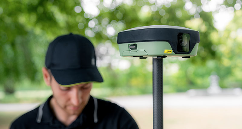
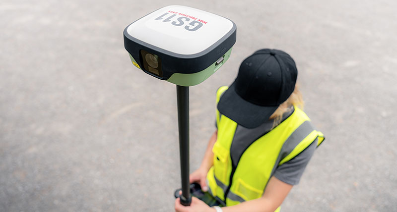
Leica GS11 GNSS smart antenna

Visual surveying meets trusted GNSS performance

Hero-placeholder_PIC_2480x750
The Leica GS11 is a GNSS smart antenna that combines trusted Leica Geosystems positioning with visual surveying. Together with Leica X-PAD field software, it brings focused performance to everyday surveying tasks with intuitive workflows, live visual navigation, and image-based measurements. The result is fast fieldwork, clear project understanding, and full confidence that the job is complete before leaving the site.


Learn how Leica X-PAD powers the GS11’s visual survey workflows for focused performance.

The visual surveying workflow 


RECEIVE AND PREPARE 


Import project data, coordinate systems, and CAD drawings into X-PAD. Pair the GS11 and prepare measurements, stakeout data, and maps so you're ready to start work in the field.

MEASURE AND STAKE OUT


Capture reliable GNSS measurements with image-based measurements, tilt compensation, and the integrated laser.

VERIY AND REPORT


Review measurements in real time with live AR visual validation for quality checks and create image-based reports. Confirm the job is complete before leaving the site and reduce costly rework.

PROCESS AND DELIVER


Sync field data with Hexagon GeoCloud and complete projects in X-PAD Fusion. Process GNSS measurements and deliver accurate drawings, reports, and more.


Why choose the Leica GS11? 
The Leica GS11 combines trusted Leica GNSS positioning with visual surveying, giving surveyors a more intuitive way to navigate, measure, and verify work in the field. Working with Leica X-PAD, its dual cameras provide real site context throughout the surveying workflow, making everyday tasks faster, clearer, and easier to complete.
 
Visual stakeout overlays navigation guidance onto live camera imagery so you can see exactly where to go, while visual survey with AR lets you view captured data on the live stream. Additionally, you can capture image groups and create points from the images, allowing you to measure where access is difficult or unsafe to reach with the pole.
 
Before leaving the site, live AR visual checks help you review and validate your work, reducing uncertainty and ensuring the job is completed right the first time.
 
field360
The Leica GS11 is built for the demands of everyday surveying. Reliable Leica GNSS technology, tilt compensation, an integrated laser, and dual hot-swappable batteries give you the flexibility to keep measuring across long days and when site conditions become challenging.
 
The GS11 combines trusted hardware with Leica X-PAD intuitive software, Hexagon SmartNet corrections, GeoCloud services, and global Leica Geosystems support in one connected surveying solution. The result is dependable performance that helps teams stay productive from the first point to the final deliverable.
 
Related Products


Leica X-PAD

Leica X-PAD workflow-led field software connects select Leica GNSS and total stations into a single intuitive surveying experience.

Hexagon SmartNet

Hexagon SmartNet delivers reliable real-time GNSS correction services that help Leica GS11 and Leica GS05 users achieve accurate, dependable positioning in the field. Rely on one source for your GNSS sensors and positioning services.
Hexagon SmartNet delivers reliable real-time GNSS correction services that help Leica GS11 and Leica GS05 users achieve accurate, dependable positioning in the field. Rely...

Hexagon GeoCloud

Hexagon GeoCloud connects the field and office with cloud services that make it easier to share and store data, helping teams work more efficiently together.

Leica GS05

The lightweight and compact GS05 offers proven tilt compensation and reliable performance.

Leica TS13

The Leica TS13 is an upgradeable robotic total station that combines precise measurements with the flexibility to grow as your surveying needs evolve.

Leica CSX8

The Leica CSX8 is a rugged Android field tablet that combines all-day durability with a responsive X-PAD experience for everyday surveying.
Frequently Asked Questions


Can't find what you're looking for here? Ask the experts your questions.