Writer: Mary Jo Wagner in collaboration with Yannick Stenger
Part one of an AI Classification series with Yannick Stenger, Cyclone 3DR Product Manager, where he discusses the development of AI Classification within our reality capture software portfolio, its functionalities, and how it benefits users. The second article focuses on application examples and workflow enhancements. You can read the second article here.
Answering the question, "Where is?" has long been one of the core strengths of geospatial technology. With the introduction and development of point cloud analysis software and more recently artificial intelligence (AI)-driven feature classification tool accelerated by NVIDIA CUDA, accurately answering the question “What is” has not only become easier but also an asset for better understanding our asset-heavy world.
Across many industries, professionals embrace AI in their daily work and replace time-consuming tasks and challenging processes with innovative tools. In the geospatial world, AI plays an essential role in point cloud classification, streamlining pre-processing steps and helping ensure success in downstream processing and analysis.
At Leica Geosystems, part of Hexagon, we are continuously we are continuously identifying and developing our AI portfolio to enhance point cloud classification and create efficiencies for our customers in automated point cloud processing. As part of this focus, we’ve recently improved our AI Classification for Leica Cyclone 3DR our powerful software solution that combines AI with the accuracy and efficiency of reality capture technology to help users deliver 3D results for many applications.
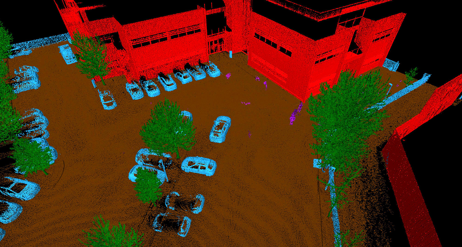
AI Classification works with different environment-specific models trained with machine-learning. Here is an example of outdoor classification, used for categorising outdoor features like trees, buildings, street furniture.
Understanding AI Classification and where it fits in Leica Geosystems' reality capture software portfolio
AI Classification is a reality capture technology developed by Hexagon’s Artificial Intelligence Hub and has been offered in our reality capture software portfolio since 2021. This technology provides intelligence to 3D data by ingesting point cloud data from laser scanner sensors and classifying the points––with limited human intervention––into accurate object categories.
AI Classification works with different environment-specific models trained with an intensive machine-learning process. For example, many point clouds from various outdoor environments have been used, processed and labelled, thus creating a classification model for categorising outdoor features such as trees, buildings, and street furniture.
Our core office software products, Leica Cyclone REGISTER 360 PLUS and Leica Pegasus OFFICE include the AI Classification feature which runs on NVIDIA RTX GPUs and are capable of processing point cloud data and classifying specific outdoor and indoor environments. These products can also export and import classified point clouds in LGSx format, Leica Geosystems universal data exchange format, offering our community a streamlined workflow for reality capture with the combination of AI Classification.
Leica Cyclone 3DR has built on these classified environments to provide a more comprehensive feature-classification offering, as seen in the chart below.
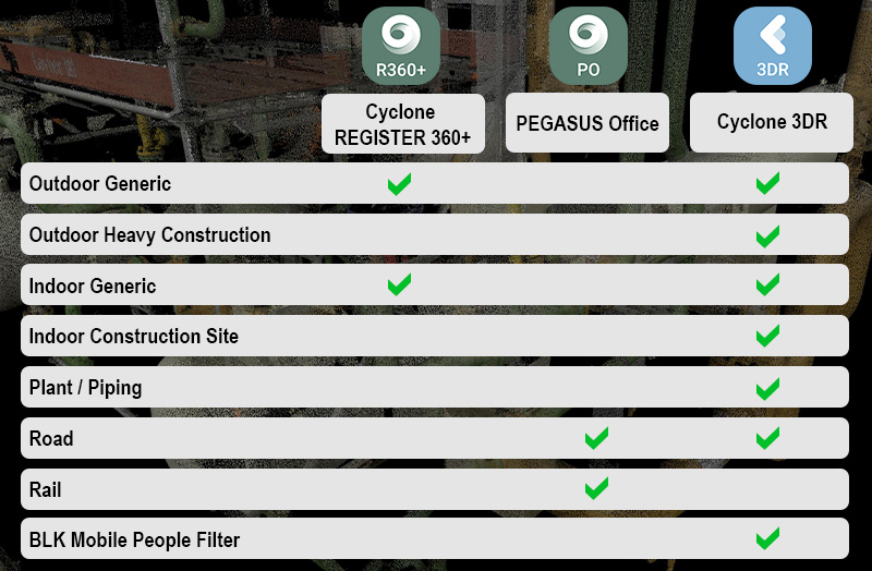
AI Classification offering in Leica Geosystems' core reality capture office software products.
Advancing intelligence and speed in Leica Cyclone 3DR's point cloud engine
We have regularly updated Cyclone 3DR’s point cloud engine since the first release of the technology in November 2021. With Cyclone 3DR 2024.1 we are thrilled to offer users an engine that is 20 percent faster in time computation compared to the previous version.
Any time-saving features or improvements driven by technology are obviously synonymous with end users’ success because they can benefit from accurate results and clear information. By providing more one-click functionality, users can address challenges and make informed decisions quickly and efficiently.
These enhancements benefit both small and heavy data users. For small data use cases, point cloud classification can automatically segment and clean data in minutes. For heavy data use cases, Cyclone 3DR can now address AI-driven automated point cloud cleaning, even for multiple-hour processes.
Streamlining workflows with continuous model improvement and new feature sets
Thanks to Cyclone 3DR’s agility, new models can now quickly populate the AI Classification feature, and users can expect more one-click cleaning capacity for new applications with each new product release.
Since the 2021.2 version, we have released the following models:
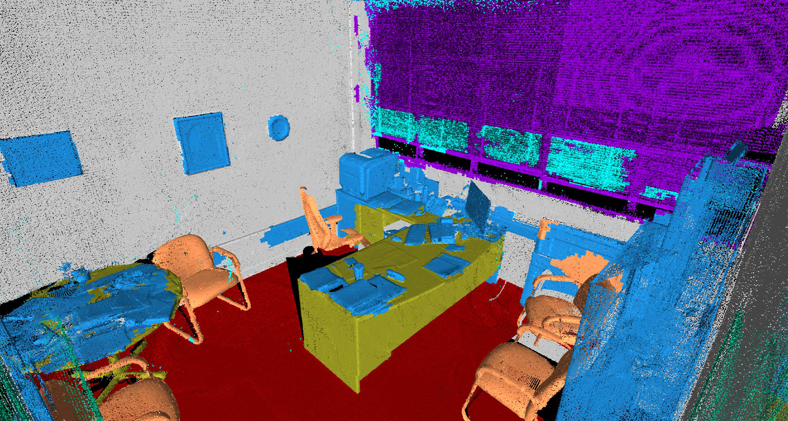
Indoor Generic: The latest Cyclone 3DR release provides a very detailed classification that can boost Scan-to-BIM processes.
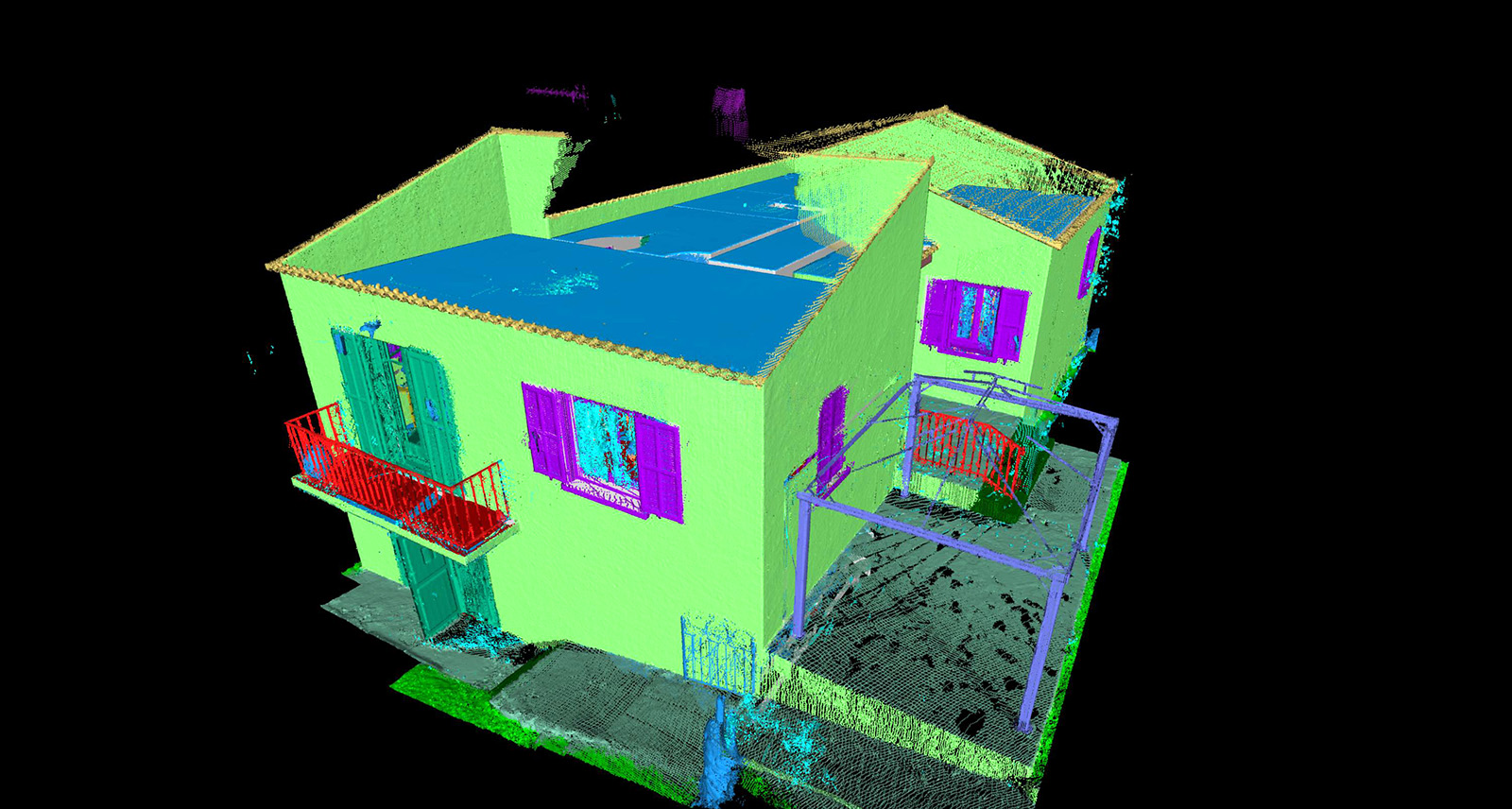
Outdoor Generic: This is the most generic model for quickly cleaning outdoor artefacts like buildings or vegetation.
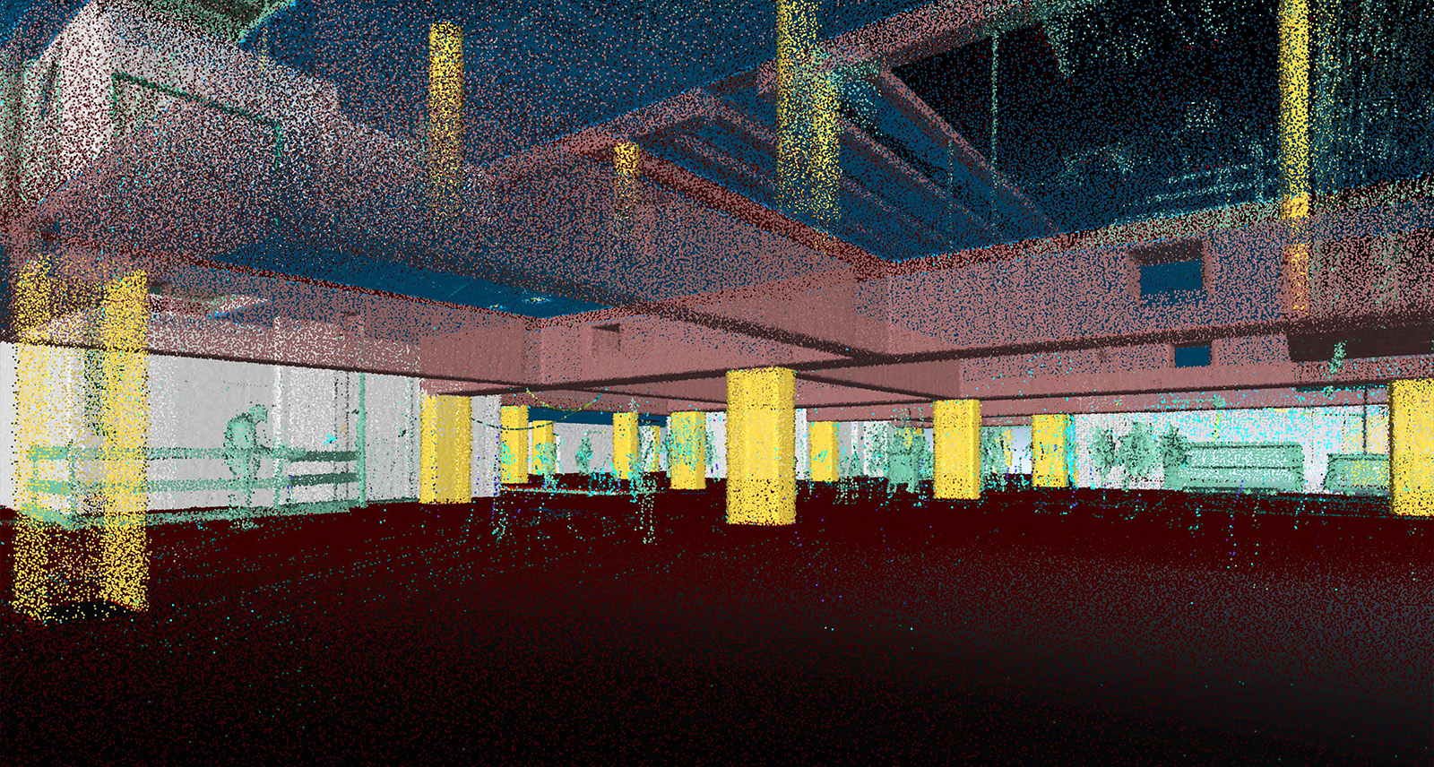
Indoor Construction Site: This specific model has been trained and designed to support analyses of work sites and is a great companion to Cyclone 3DR’s powerful analysis tools. For example, the Progress Monitoring feature allows users to optimise 3D comparisons based on class information.

Outdoor Heavy Construction Site: This outdoor-environment model supports various heavy construction products within Hexagon, such as AGTEK construction software. The model helps augment the segmentation of outdoor work sites, particularly for creating terrain models, monitoring operations, and rasterising or calculating volumes.
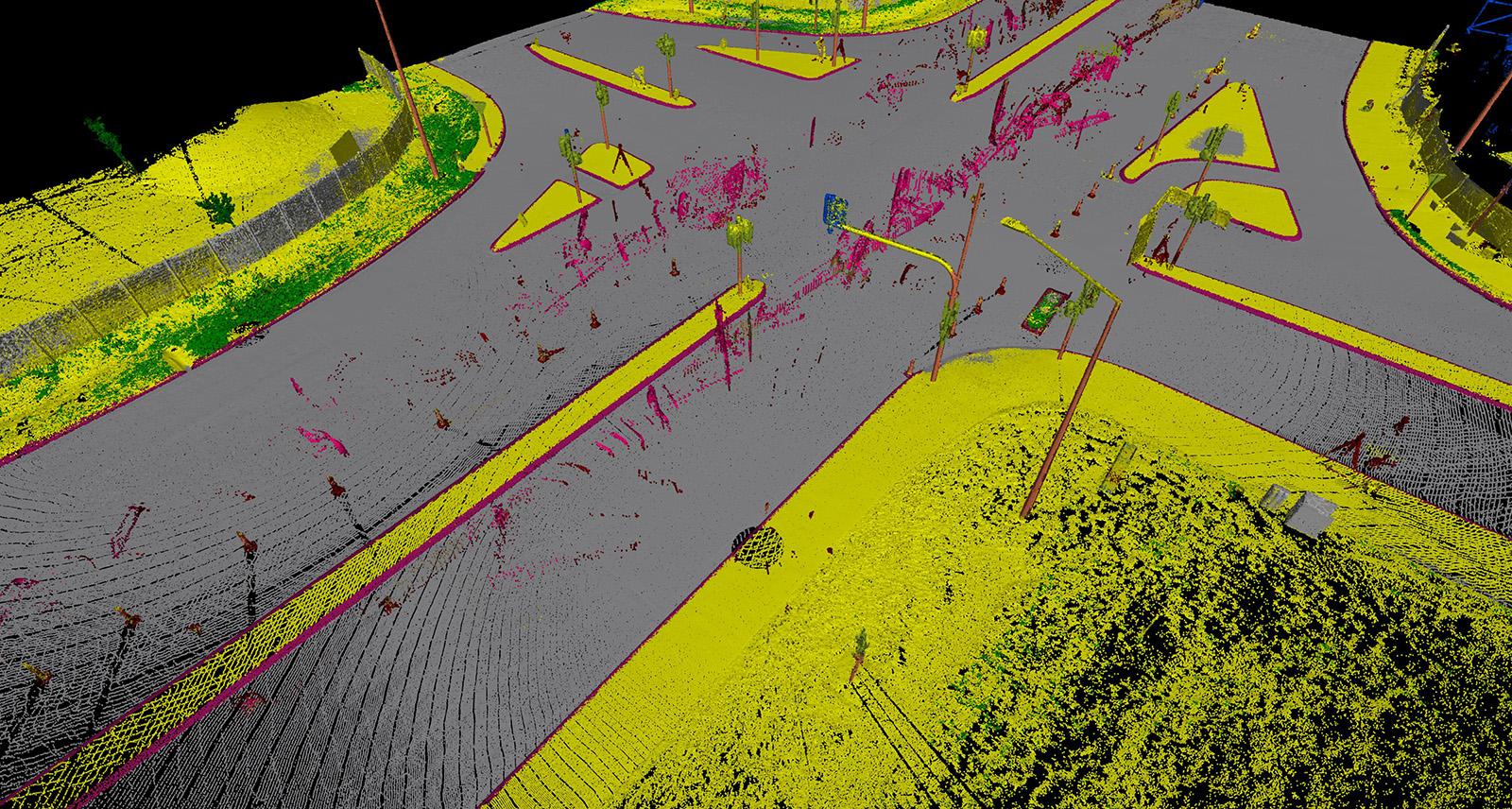
Road: Trained with Leica Geosystems MMS sensor datasets and embedded in mobile mapping products, this model is one of the oldest in our reality capture portfolio. Included in Cyclone 3DR, it can classify any point cloud, even from terrestrial laser scanners like the Leica RTC360, segment outdoor assets, or perform automatic extraction operations.
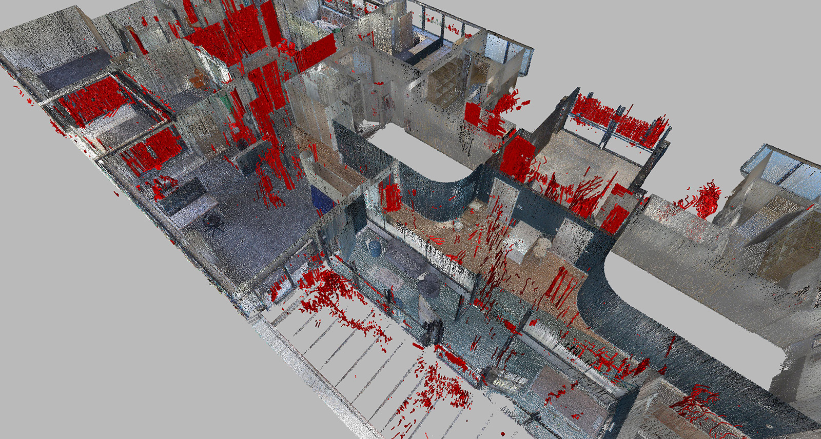
BLK Mobile People Filtering: We developed this model to support our BLK mobile and autonomous sensors, which quickly capture occupied environments with a lot of human activity, such as the Leica BLK2GO handheld laser imaging scanner and the Leica BLK ARC and Leica BLK2FLY autonomous laser scanning modules. It offers one-click functionality to remove noisy points corresponding to people and moving objects.
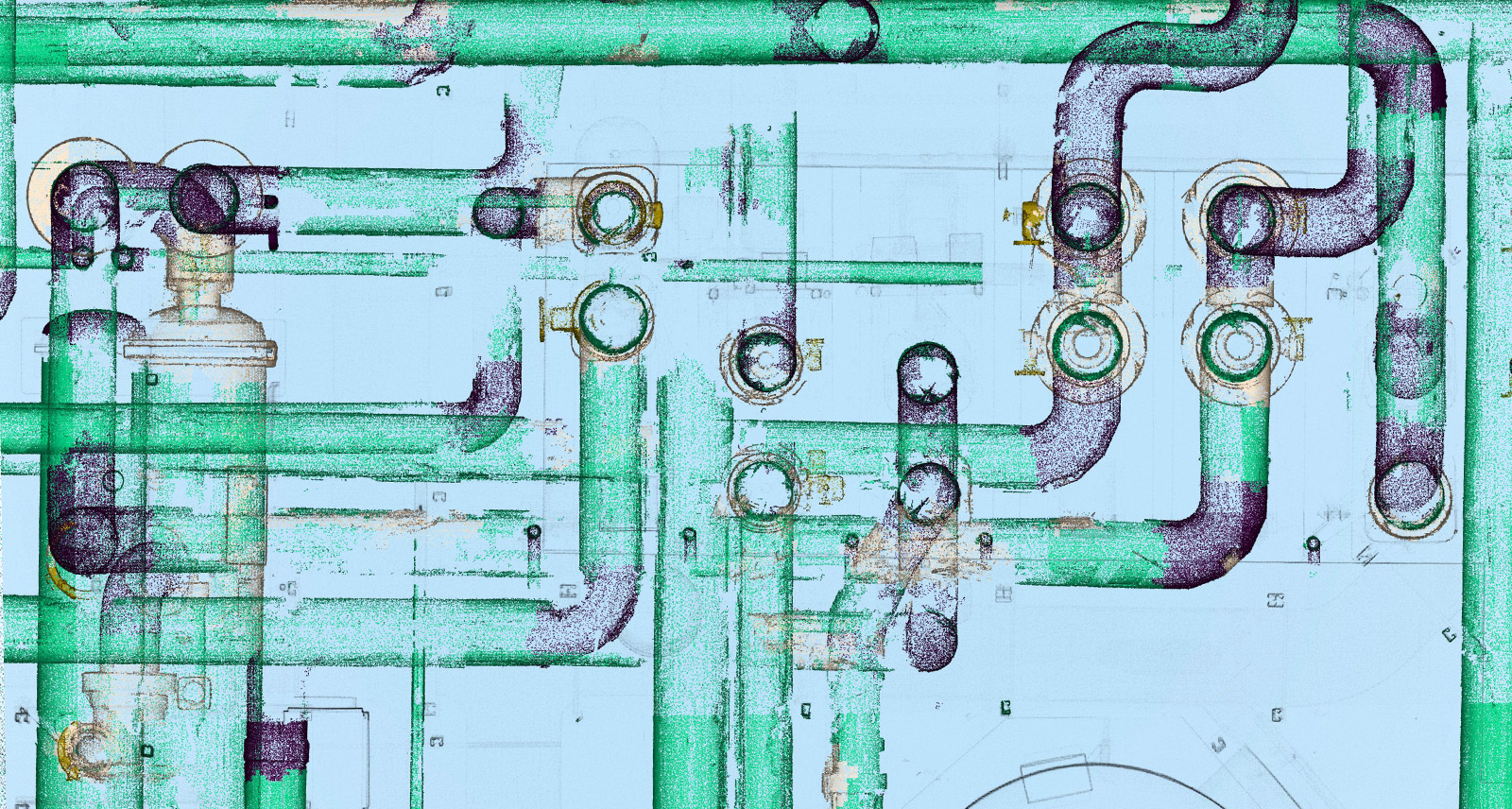
Scan-to-Facility: Our latest model, designed for our Plant Edition, confirms Leica Geosystems’ portfolio’s trend of consolidating its efficient positioning within the plant industry. The first version of the model directly serves the Scan-to-Pipe feature with a specialised six-class classification process. Updated models are expected in the future to address complete Scan-to-Facility operations.
Our emphasis on streamlining workflows with one-click functionality does not mean we are sacrificing accuracy in the classification process. We are constantly working to improve our AI classification models.
For example, the Generic Indoor Model, the first model in Cyclone 3DR and limited to less than ten classes, can now classify complex indoor environments with great detail for many use cases, such as Scan-to-BIM processes.
Our new plant model is another example. The first version of the model was designed to offer simplicity and efficiency to serve the Scan-to-Pipe feature in Cyclone 3DR. It can deliver six-class segmented point clouds: Pipe cylinder, Pipe bend, Pipe reducer, Valve, Pipe connection and Unclassified. Future and more advanced versions will target the Scan-to-Facility application, and we are confident that we’ll be able to deliver updated models for the plant industry that will include Steel columns, Steel beams, Railings, Walls, Pipe Flanges, and possibly more.
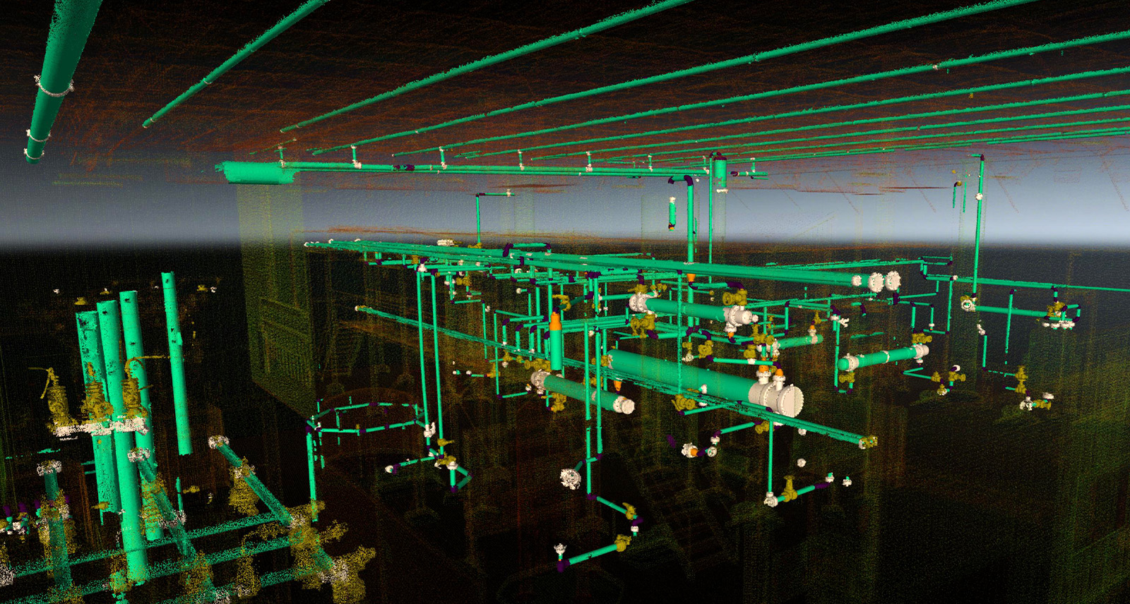
Using AI Classification features at the beginning of your workflow, offers immediate accuracy gain. For example, extracting assets to perform reverse engineering, like Scan-to-Pipe after processing a model.
The benefits of AI Classification, from accuracy to collaboration
AI Classification was designed to smarten 3D data, improve visualisation, streamline workflows and collaboration, and improve accuracy. As a whole, this brings many benefits to end users, including:
Upscaling 3D data with more intelligence. For any reality capture software product, the purpose of AI Classification is to offer an easy, one-click way to upgrade 3D data with more intelligence. This initial step of AI-driven reality capture workflows targets the ability to upscale digital reality contents with human-like information with limited user interaction. This enables an LGSx-classified 3D point cloud to be enriched and ready for processing within the reality capture software portfolio with more accuracy and efficiency.
A better visualisation experience. An immediate benefit of the classification intelligence is the visualisation. Point clouds remain a complex object for many stakeholders in various industries and offering class-colour point clouds readily facilitates the comprehension of the real world. The capacity to visualise different classes in various products like Leica TruView, Leica CloudWorx, and Leica Cyclone ENTERPRISE, in addition to other software solutions, enhances understanding, decision-making, and outcomes.
Efficient Collaboration. The LGSx file format or cloud-based solutions like Reality Cloud Studio, powered by HxDR and Cyclone ENTERPRISE, are key to allowing stakeholders to collaborate on projects that involve reality capture technologies. These products have the capacity to store the Classification and enable users to easily share digital reality information.
Deliver with accuracy. Applying AI Classification at the beginning of any workflow can offer an immediate accuracy gain in examples such as:
- Removing the vegetation in outdoor environments to create incredibly realistic textured meshes of any scanned environment.
- Optimising the computation of any 3D comparison by keeping only the classes of interests, such as specific components of a construction site, to execute an as-built verification.
- Extracting assets to perform reverse engineering, like Scan-to-Pipe after processing a plant model.
Holistically work across platforms. Our CloudWorx set of plugins for various CAD and BIM software applications is the most powerful plugin toolset in the market to process and visualise massive point cloud datasets in CAD and BIM environments. Extraction workflows realised through a CloudWorx plugin are facilitated when the LGSx file has been previously classified and exported with optimisation to LGSx format. With CloudWorx for Revit, an LGSx that stores only the elements of interest like walls, windows, doors, slabs, columns and beams, makes for an easier Scan-to-BIM process.
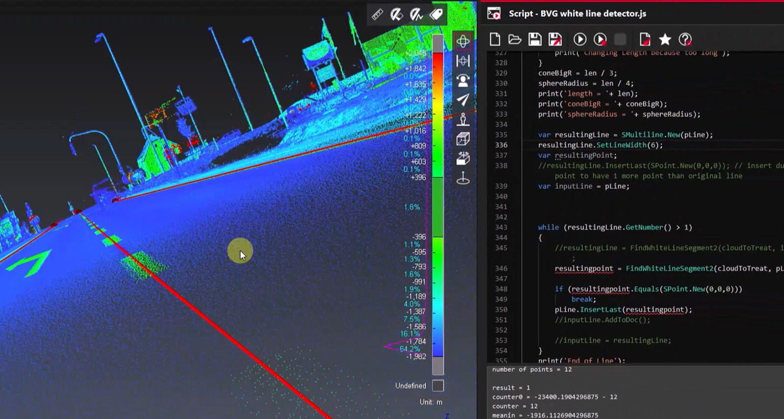
Create fully automated workflows when you combine the AI Classification and Scripting features in Cyclone 3DR.
Reaching full automation with Cyclone 3DR Scripting
Combining Cyclone 3DR's scripting and AI classification features is the best-in-class way to create fully automated deliverables. The association of these two powerful capacities unlocks many possibilities for extracting 3D information or performing massive and repetitive extraction from large datasets.
The Cyclone 3DR scripting module directly offers core aspects of the workflow like:
- LGSx Import and Convert.
- Classification with all embedded models in the product.
- Automatic splitting/merging capacity from the point cloud classes.
- Functions that enable final analysis, modelling or export steps.
The path to creating intelligent realities
Leica Geosystems’ reality capture portfolio offers a game-changing path to digitising, processing and delivering real-world environments. Creating meaningful analysis and models from that 3D data starts with the ability to efficiently and accurately clean and classify the millions of data points captured by terrestrial laser scanners, mobile scanners, mobile mapping systems, and aerial systems.
The advancements in Cyclone 3DR’s AI classification not only increase the efficiency and productivity of feature extraction but also enhance downstream applications and improve accuracy, enabling users to create higher-quality deliverables for clients.
Interested in learning more about AI Classification and other features and workflows in Cyclone 3DR? Browse our Cyclone 3DR YouTube Channel for tutorials, tips and tricks.
Yannick Stenger
Product Manager, Leica Cyclone 3DR


.jpg?sc_lang=en-gb&hash=C2BAAC69389A909D349812C9A92E3FCD)


