


The high life: Locating the floors of America’s tallest residential building
Case study

Author: T/F/D
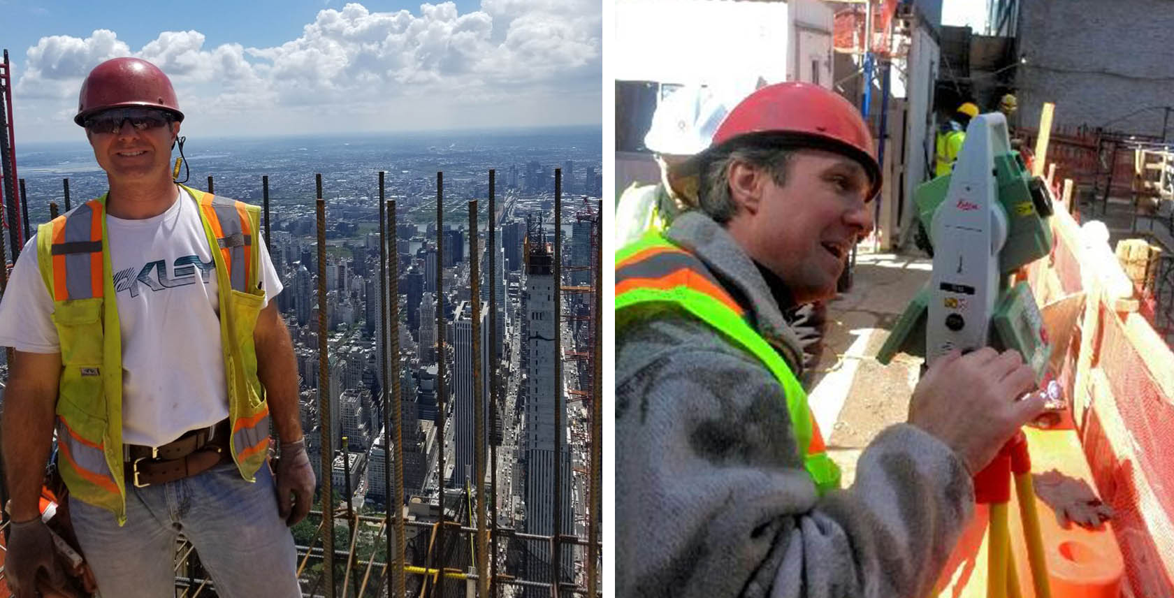
On Manhattan’s ‘Billionaire’s Row’, a new glistening New York skyscraper nears completion. The Central Park Tower rises to 1,550 feet (472 metres) tall, the tallest residential building in the world, and the second tallest building in the city, second only to One World Trade Center. Construction began in 2014 and Pinnacle Industries II, LLC installed the core super-climber forming system in 2016. Due to the height of the building, Robert Mandelbaum, Survey Engineer at Pinnacle Industries II, used a GPS solution − a Leica Geosystems GNSS system − to locate the layout of each new floor.
A new approach to monitoring
Central Park Tower will contain 179 homes with one of the most expensive views in the world. 300 feet (over 91 metres) above the street, the Tower cantilevers to the east, creating views of Central Park for all north-facing residents. The elegant exterior gives away nothing of the complexity of the construction or the challenges of keeping the building’s footprint consistent and accurate. Before each new floor could be built, Mandelbaum needed to provide the Pinnacle Industries II team with reliable coordinates to set out the structure. On a smaller building, surveyors would use optical instruments to do this from the ground, but above a certain height that becomes impossible. “Because it’s so high, we cannot use conventional transits [transit levels] to establish location,” explains Mandelbaum. “On a bad weather day, that’s just not happening. At 1500 feet (over 450 metres), you cannot see with a traditional instrument.” So, for the first time on a residential construction site, Mandelbaum used a GPS-based solution.
Establishing control lines for each floor
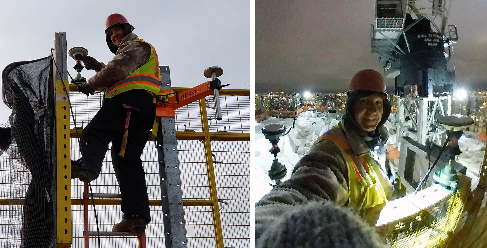
The Leica Geosystems GNSS-based monitoring system works by GNSS receivers being placed on the outside of the building − the hydraulically climbed protection screen enveloping the structure in this case − and acting as control points that move up as floors are completed. The system used on the Central Park Tower construction included four Leica AS10 SmartTrack antennas with co-located 360 prisms, a Leica GM30 GNSS monitoring receiver, Leica Viva TS15 Total Station (the predecessor of Leica TS16) and Leica Spider and Leica GeoMoS monitoring software. Mandelbaum explains, “The protection screen climbed up alongside the building, so I put all the equipment on it. I didn’t have to worry about me physically moving it up because it was fixed to the inside of the screen. The GNSS antennas, I would place on the perimeter, on each corner of the building as far as I could from each other. They would give me coordinates, and using that I was able to establish control lines.” The control lines mark out where the building slabs-edges, and column and walls will be positioned and located.
Proven accuracy in a high-pressure environment
The most significant benefit of the system to the Pinnacle II team, says Mandelbaum, was its accuracy, reassuring when working on any construction site, but especially a high rise. He used a traditional technique to check the GNSS measurements. “To verify that the access lines or the control lines stack from floor to floor, every 10 floors, I would use an old school piano wire. Literally a piano wire, and drop it through a corner. I would tie a good 80 lb weight to the bottom of it, and I would physically check with a rule to the access lines on the floor, to the control lines. And it was there, within a 16th of an inch (1/6 inches = 1.55mm accuracy). It just proved that it’s right.”
A Leica Viva TS15 Total Station was also used to establish the position of the control lines, acting as another independent check of the solution which could be referenced against the antenna readings. The total station positioned itself via prisms co-located under the GNSS antennas. Mandelbaum explains, “I would know where each antenna is according to the solution on the laptop. I would take the antenna that’s the farthest away from me, and I would look for the time solution as well. I would be at the same time slot and shoot (measure with the total station) the antenna. And if it’s the same number that I see on the laptop, within a few thousandths, then I will use it.”
Easy to use software displaying real-time data
Despite being new to the GNSS system, Mandelbaum and his partner found it easy to use. With support from Leica and by filming some of the processes on his phone for reference, he says “it was pretty simple.” A self-confessed mechanic rather than a ‘software guy’ Leica’s software programs − the Leica Spider Software Suite and Leica GeoMoS Now! − provided easy access to the real-time data essential for establishing control lines. “There were a few steps I needed to learn, and that was that. It was a piece of cake.”
Construction of Central Park Tower is due to complete in 2021. Now that Mandelbaum’s part in the build is finished, he plans to use the Leica Geosystems GNSS system again: “If I can, I will. It has a track record that it works.”
Interested in monitoring? Please feel free to read further case studies, showing how our customers use our solution to improve their monitoring workflow:

Contact us about Monitoring
Get in contact with us for more information about our monitoring solutions.
Get in contact with us for more information about our monitoring solutions.