How to choose the right Leica Pegasus TRK for your business
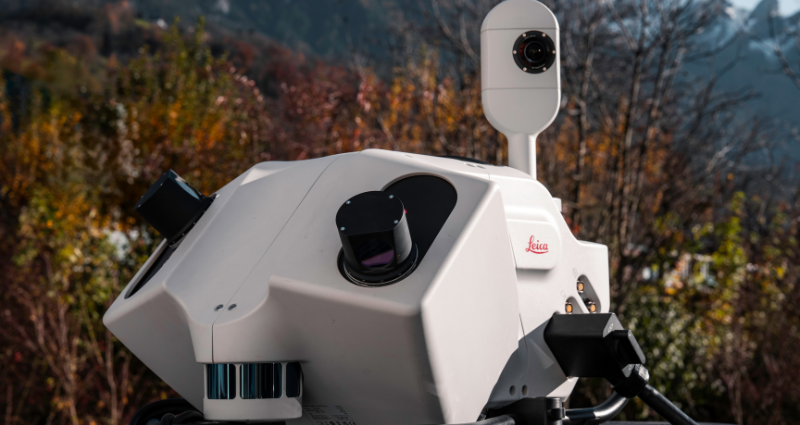
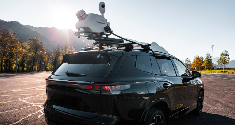
Mobile mapping with the Leica Pegasus TRK enables highway, railway, utilities, and general surveying teams to capture geospatial data across large areas quickly, accurately, and safely.
Compared with terrestrial laser scanning (TLS), mobile mapping with the Pegasus TRK can significantly improve data productivity when capturing large areas and corridors. In our own research, mobile mapping systems have been found to cut fieldwork’s share of total time from around 70% to 10% compared to TLS. Rather than stopping to scan individual locations, survey teams can capture data continuously while driving. This reduces time spent in the field, minimises disruption, improves safety, and allows surveyors to focus more time on analysing the data.
While all Pegasus TRK systems are efficient at capturing high detail, different mapping projects have different demands. That’s why the Pegasus TRK portfolio comes in several variants, each tailored to different applications, environments, and accuracy requirements.
Pegasus TRK portfolio overview
Below is a simple overview of how each system compares in terms of its architecture, features, and primary applications:
System
Scanner architecture
Common features
Unique features
Primary applications
Leica
Pegasus
TRK300
Dual-head, 32-beam scanner
Time-of-flight technology
MatchPoint technology
Up to 3.8 million points/sec at up to 300m range (multi return activated)
Safe data capture with minimal traffic disruption
Simple, single-person setup and deployment
Multi-sensor integration (GPR, bathymetry, and DMI)
Connected software workflow and simple integration with third-party tools
Versatile performance across a variety of applications
High detail across large or complex areas
GIS – Asset collection
Infrastructure measurement
Marine infrastructure
Mining site surveys
Topographic maps
Leica
Pegasus
TRK EVO
TRK 500 Evo: Single-head scanner
TRK 700 Evo: Dual-head scanner
Highest point cloud density, up to 4.4 million points/sec at up to 182m range
Delivers precise data for more demanding engineering and surveying projects
Industry-leading scanner precision
Road and tunnel infrastructure
Engineering applications
Rail infrastructure projects
Detailed structural analysis
High-definition (HD) mapping
Public safety
Leica
Pegasus
TRK NEO
TRK 500 Neo: Single-head scanner
TRK 700 Neo: Dual-head scanner
Up to 4 million points/sec at highest range of up to 730m
Urban digital twin creation
Smart city modelling
Marine infrastructure
Mining site surveys
High-definition (HD) mapping
Public safety
Note: the applications listed above for each system are not exhaustive. Customers consistently discover new use cases and continue to push the boundaries of innovation. That is the beauty of our versatile and flexible portfolio: imagination without limits.
Which Pegasus TRK is right for your project?
Pegasus TRK systems are designed for varying surveying requirements, depending on the level of detail users need, the environment being scanned, and the scale of the project.
Pegasus TRK300: Adaptable for a wide range of applications
For organisations that are looking for a cost-effective entry point into mobile mapping, the Pegasus TRK300 is a lightweight and adaptable system designed for measurement projects, like road asset inventories, street-level mapping, and GIS data collection. It captures detail needed for surveying large, complex areas, scanning up to 3.8 million points per second with a range up to 300 metres.
With both versatility and performance in mind, the Pegasus TRK300 delivers data quickly and reliably, helping teams make more informed decisions no matter the environment. To name just a few of its potential applications: road and urban infrastructure teams can map mid-scale networks to aid planning, upgrades, and maintenance, while mining teams can measure stockpiles and monitor site changes across quarry environments, and public safety teams can document a scene or verify a route.
Pegasus TRK Evo: Detailed, survey-grade data capture
Pegasus TRK Evo supports demanding engineering and surveying applications that require the highest precision and point cloud density.
Its industry-leading point cloud density enables teams to capture detailed 3D models of track layouts, bridges, tunnels, overhead lines and pavement conditions. Engineers can identify critical features, from structural shapes to surface changes and defects, supporting condition monitoring, safety assessments, and long-term planning across complex rail and road infrastructure.
Pegasus TRK Neo: Long-range performance for large-scale mapping
For organisations working across particularly vast or complex environments, Pegasus TRK Neo delivers the range, accuracy, and detail needed to capture geospatial data at scale. With a range of up to 730 metres and multi-return LiDAR, it can accurately survey wide road corridors, dense vegetation, and complex terrain.
Its long-range capabilities make it well-suited to surveying wide, open areas, including mines, marine environments, power line corridors, and other types of large, linear infrastructure.
For example, Brisa Group, a European mobility infrastructure company, needed a more complete understanding of conditions across its 1,500 km motorway network. However, they didn’t want to rely on multiple survey methods to capture the data. They chose the Pegasus TRK Neo because of its ability to capture complete road corridors. The extended range of the Pegasus TRK Neo enabled the team to collect detailed data beyond just the motorway surface itself, including slopes, embankments, and elevation changes, as well as more distant details like power lines.
Common features across all Pegasus TRK versions
The Pegasus TRK portfolio is designed to adapt to the user’s needs, built on a foundation of simplicity, intelligence, and autonomy. While each system is designed for different project requirements, the entire portfolio shares the following capabilities.
Capture safely with minimal disruption
All Pegasus TRK systems enable high-speed 3D data capture without the need for traffic management or road closures. By capturing data while moving, teams can reduce disruption to regular road users and limit exposure to dangerous environments such as live traffic.
Pegasus TRK systems can also be mounted easily by a single person onto a range of platforms, including vehicles, rail trolleys, boats, and ATVs. Its easy-to-use design also means minimal training is needed; it’s possible to train someone to start capturing within an hour.
Integrate multiple sensors for richer data
The portfolio works seamlessly with other sensors like ground-penetrating radar (GPR) to capture more complete datasets, where teams can simultaneously collect above- and below-ground information in a single workflow. Mounted to a boat, the Pegasus TRK can also be integrated with bathymetric systems to enable above- and below-water mapping of marine environments, like rivers, ports, and coasts.
When mapping GNSS-denied environments, such as tunnels, it is also simple to connect a Distance Measuring Instrument (DMI) to the Pegasus TRK, which helps to ensure measurements are accurately georeferenced.
Streamline capture and processing workflows
All Pegasus TRK systems are supported by the same connected software workflow. Leica Pegasus FIELD helps teams plan surveys, preview captured data in real time and verify positioning accuracy while out in the field. It takes users through a guided, step-by-step workflow, which makes data capture more straightforward. Also, real-time anonymisation features automatically protect sensitive information, by blurring vehicles and people. This ensures data capture stays compliant to privacy laws, like GDPR.
Once data is captured, Leica Pegasus OFFICE streamlines processing with AI-supported classification and automated workflows, helping teams efficiently transform raw data into accurate deliverables.
Ultimately, it’s important not to force users into one ecosystem, which is why Pegasus OFFICE supports export to a wide range of standard data formats, such as LAS or e57. LGSx, our proprietary reality capture file format, is also read natively by a growing number of third-party tools, including Mach9, N4CE, and SCC.
The right Pegasus TRK system for every application
Choosing the right Pegasus TRK system comes down to your project requirements. If you need a versatile solution for measurement collection or survey-grade accuracy for engineering projects, or long-range performance for large-scale mapping, the Pegasus TRK portfolio can provide a mobile mapping solution to match.
To discover more about the Pegasus TRK portfolio, contact your local sales representative, or read more here.


.jpg?sc_lang=es-cl&hash=0D19E91B8A1CF991E5BB17F6CFE08643)