1996: Uitvinging
Leica Geosystems introduceerde een revolutionair nieuw positioneringssysteem.


.jpg?sc_lang=nl-be&hash=3E8603D3743EEF0A68A45FC62CA7887B)
Wij introduceren een nieuwe dimensie op het gebied van reality capture en een nieuwe manier van werken voor 3D-laserscanning.
Safeguarding heritage with real-time monitoring and digital twin technology.

In the centre of Dublin, where historic architecture meets modern ambition, a major transformation was recently realised. The Royal College of Surgeons in Ireland (RCSI) completed Project Connect, a landmark development that expanded its campus and delivered state-of-the-art facilities for education and research.
Yet, as with many urban developments, progress came with complexity. The construction site sat immediately beside a 150-year-old protected Unitarian Church, as well as neighbouring buildings and the Luas light rail line, a vital Dublin’s transport link. Protecting these assets while enabling large-scale construction required a careful combination of precision and vigilance.
This is where advanced deformation monitoring and scanning technologies entered the picture, ensuring that progress, continuity, and historic preservation could safely coexist.
Project Connect’s 8-storey facility at 118 St Stephen’s Green opened its doors to students in 2025, marking a milestone in the RCSI’s plans to create a campus that fosters community as much as education and research.
Construction of the building involved demolition and deep basement excavation near sensitive structures. In these conditions, even slight movements pose serious consequences, ranging from structural damage to public transport disruptions.
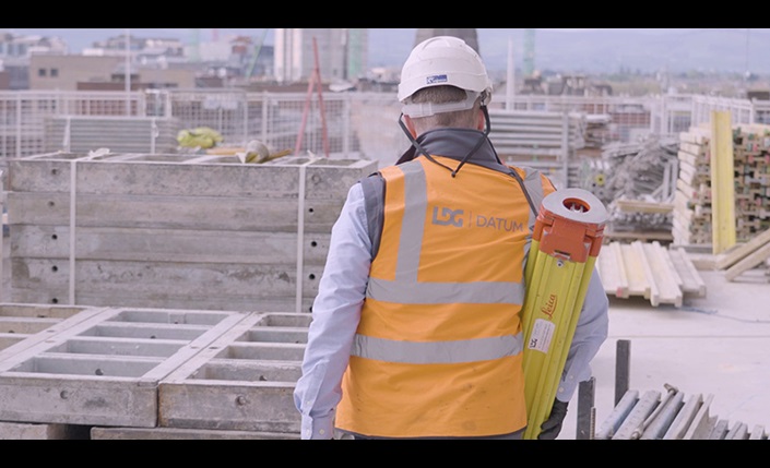
To mitigate those risks, main contractor Bennett Construction brought in LDG Datum, recently acquired by Socotec UK – specialists in geotechnical systems and automated monitoring.
Mark Hodgen, Director at LDG Datum, explains the project’s complexities:
“The unique challenges on Project Connect consisted of protection and preservation of a 150-year historic church and surrounding buildings whilst also protecting the Luas transport system which parallels this construction site.”
To preserve the historic church, ensure the safety of surrounding infrastructure, and protect the public, all while keeping construction on track, LDG Datum implemented a comprehensive monitoring strategy using Leica Geosystems technology.

Leica Geosystems introduceerde een revolutionair nieuw positioneringssysteem.

Wirtgen en Leica Geosystems ontwikkelden samen een 3D-oplossing voor nauwkeurig paving in tunnels en onder bovenleidingen, waar geleidedraden niet mogelijk zijn.

De eerste introductie van Leica machinebesturing voor paving-toepassingen.

Introductie van Pave Smart 3D als opvolger van LMGS. Ondersteuning voor koudfreesmachines werd toegevoegd.
The solution was based on high-precision instruments that provided continuous, near real-time information on how the structure was responding to construction activity. «We needed suitable instruments capable of providing continuous, high-frequency and high-quality measurements,» explains Mark Hodgen.
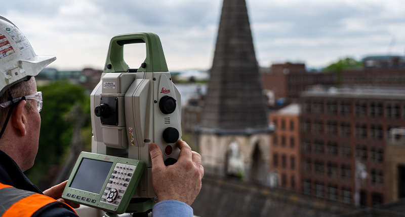
The Leica MS60 MultiStation played a key role, combining automated monitoring with scanning and reflectorless measurements. This allowed the team to track structural movement even in inaccessible areas, such as along the Luas tram line and on the church façade.
Supporting technologies ensured full data coverage, including periodic measurements and control with the Leica TS16 robotic total station, GNSS positioning with the Leica GS18 I and settlement monitoring with digital levels.
All data was processed automatically in Leica GeoMoS Monitor, where measurements are compared against predefined thresholds and alerts are triggered if movements exceed set limits.
“GeoMoS Monitor processes each individual measurement and alerts the presence of an event, while the Leica GeoMoS Now! platform allows us to visualise data, analyse trends and anticipate issues,” adds Hodgen.
To complete the picture, geodetic data was combined with environmental and geotechnical sensors, including vibration, noise and groundwater monitoring, ensuring a comprehensive understanding of site stability and environmental impact.
The result was not simply a set of measurements, but a validated flow of information that transformed raw data into actionable insight and safe decision-making throughout the project.
While site monitoring protected the structure during construction, the project also considered its future preservation. Recognising the cultural importance of the Unitarian Church, the team expanded its approach to include digital documentation through laser scanning.
Using the Leica RTC360 laser scanner, the church was captured in high-resolution imagery and point data, generating a dense and accurate 3D point cloud dataset that forms the basis of a digital twin. This virtual representation preserves the building in its current state, providing a permanent record that can be accessed, analysed and shared.
The value of this technology goes far beyond construction. The digital twin supports long-term conservation efforts, enables detailed inspection without physical intervention, and offers a tool for virtual exploration. Through interactive visualisation, stakeholders and the general public can experience the structure in a unique way.
In this way, the project does more than protect heritage; it actively contributes to its preservation through digitisation.
In an environment where precision and uptime are critical, the choice of technology was decisive. For LDG Datum, Leica Geosystems’ reputation for reliability and performance played a fundamental role.
“Leica Geosystems is at the forefront of innovation in monitoring, and their technical support service is exceptionally good, which gives us great peace of mind. Using Geosystems products within our service solution portfolio allows our company to thrive and stay ahead in our industry.”
– Mark Hodgen, Director, LDG Datum
The seamless integration of hardware and software, combined with effective technical support, ensured that the monitoring system could operate continuously and deliver reliable results throughout the entire project lifecycle.
As construction progressed, the monitoring solution ensured the protection of both historic and modern infrastructure. The ability to detect even the smallest changes enabled the team to minimise risk and maintain safety.
At the same time, the digital twin forms a lasting legacy: an accurate and detailed record of a historic structure, safeguarded not only physically but also digitally.
The Connect project illustrates what is possible when advanced technology is applied with purpose. By combining continuous monitoring with reality capture, the project team demonstrated how cities can evolve without losing sight of their heritage.
In Dublin, past and future are not in conflict. They are carefully managed, measured and preserved, coexisting side by side.
Leica GeoMoS monitoring software combines data from a range of sensors to enable autonomous, comprehensive structural monitoring during construction.
Leica GeoMoS monitoring software combines data from a range of sensors to enable autonomous, comprehensive structural monitoring during construction.