Buildings and Structures

Gegarandeerde nauwkeurigheid wanneer dit het meest nodig is


Leica Geosystems geeft eenvoudig toegang tot flexibele monitoringoplossingen die zijn toegespitst op uw behoeften.

Of het nu gaat om het monitoren van de invloed op gebouwen, van de constructie van nieuwe ondergrondse infrastructuur zoals metrolijnen of tunnels onder dichtbebouwde stadscentra, van verouderende infrastructuur, van grondinstabiliteit, of van de verticaliteit van hoogbouwprojecten, wij hebben de juiste oplossing voor u. Wij leveren software met de mogelijkheid om volledige oplossingen te bieden vanuit één betrouwbare aanbieder. De software is ontwikkeld om naadloos samen te werken met in-house, hoogwaardige sensoren, zoals total stations en GNSS, en andere geotechnische en milieutechnische sensoren van derden, in combinatie met deskundige support en advies. Monitor met realtime informatie en vertrouw op automatisch gegenereerde rapporten op basis van een aanpasbaar tijdschema.

„Leica heeft voor een grote wereldwijde fabrikant enorme flexibiliteit laten zien, bijvoorbeeld in het vlug reageren op onze ideeën over het aanpassen van softwareroutines en het oplossen van nieuwe lokale uitdagingen op locatie. Dit soort support is essentieel voor het leveren van de best passende oplossing, en het geeft de klant het gemak om slechts met één servicepartner te werken voor al zijn behoeften met betrekking tot metingen, BIM en monitoring.”

Andrew Masters,
Technical Manager bij Murphy Surveys

Sub-segments

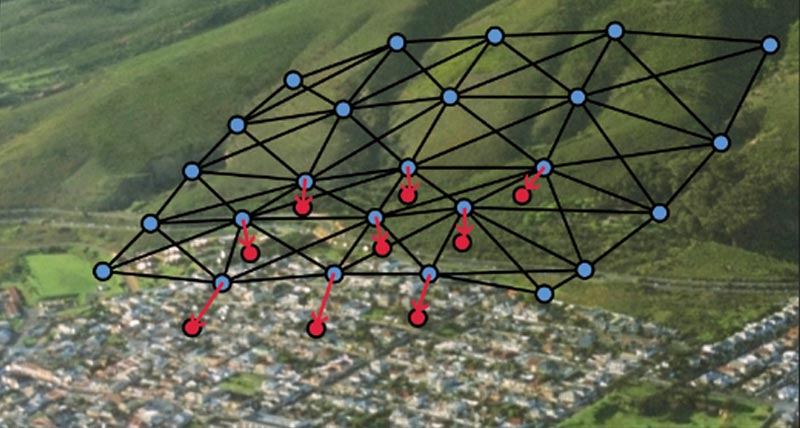
Monitoring in urban areas

Cities have grown and evolved for thousands of years, but today, more than ever, the velocity of urban development requires greater consideration for safety.

Monitoring for construction sites

The construction industry continues to evolve, with a focus on sustainability, efficiency, and lean construction methods. Increasing regulatory demands create continued pressure to manage safety, production and cost requirements.

Monitoring for preservation of heritage structures

Our historic buildings, heritage structures and ancient landmarks are treasured both culturally and architecturally. Their preservation is important. Read more about the complete solution for monitoring of historic buildings, structures and landmarks.
Casestudies

Precise Positioning in London’s Sky

Leica Geosystems developed a procedure, using GNSS observations combined with tiltmeters

Locating the floors of America’s tallest residential building

Deploying a GPS solution to locate the layout of Central Park Tower‘s floors

Monitoring the structural health of hangars

Monitoring the Royal Canadian Air Force Warren Truss Hangars’ wooden structure

Combining Geotechnical & Geodetic Data

Cities are evolving entities that need to adapt
Cities are evolving entities...
Softwareproducten

Leica GeoMoS

Flexibele softwareoplossing voor het automatisch monitoren van deformaties.

Leica GeoMoS Edge

Monitoringsoftware voor autonome sensoraansturing en ononderbroken dataopslag in het veld.

Leica GeMoS Now!

Analyseer en visualiseer monitoringgegevens vanaf waar dan ook.

Leica GNSS Spider

De kern van het continu werkende netwerk van referentiestations

Leica GeoMoS Adjustment

Automatische justering en deformatieanalyse voor monitoring

Leica CrossCheck

Een multifunctionele GNSS-analysetool voor QC en monitoring.
Hardwareproducten

Leica Nova TM60: Monitoring Total Station

Ontwikkeld voor deformatiemonitoring

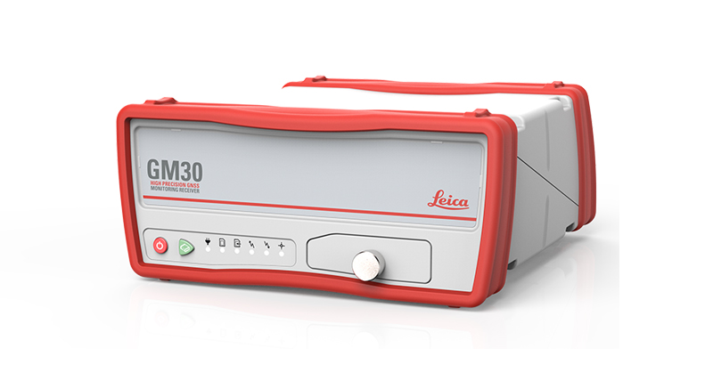
Leica GM30

Alles-in-één GNSS monitoring-ontvanger

Geotechnical Sensors

Automated geotechnical sensors for measurement and data acquisition, integrated into monitoring systems.

Leica ScanStation P50

De snelste en veiligste 3D-laserscanner met groot bereik.

Leica Nova MS60

De ultieme allrounder, een scannende, zelflerende total station met GNSS-connectiviteit en digitale camera

Leica M-Com

Plug en play communicatieoplossingen voor monitoring.

HYDRA-G

High-resolution radar system for early warning and real-time monitoring of buildings, dams, tunnels, mining infrastructures, and cut-slopes

IBIS-FS

Remote static and dynamic monitoring
Downloads


Heeft u nog vragen? Wij hebben de antwoorden!

Laat ons u ondersteunen