Energie-infrastructuur

Betrouwbare oplossingen voor maximale efficiëntie

Leica Geosystems geeft eenvoudig toegang tot flexibele monitoringoplossingen die zijn toegespitst op uw behoeften.

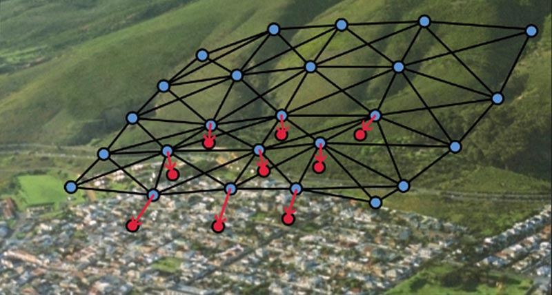
Of het nu gaat om het monitoren van infrastructuur (zoals dammen, pijpleidingen of olieplatforms) voor het reduceren van gevaren als gevolg van structurele belasting door verouderingseffecten of schade door natuurlijke gevaren, omringende bouwwerkzaamheden, verzakkingen of nutsnetwerken, wij hebben de juiste oplossing voor u. Wij leveren software met de mogelijkheid om een volledige oplossing te bieden vanuit één betrouwbare aanbieder. De software is ontwikkeld om naadloos samen te werken met in-house, hoogwaardige sensoren, zoals total stations en GNSS, en andere geotechnische en milieutechnische sensoren van derden, in combinatie met deskundige support en advies. Monitor met realtime informatie en vertrouw op automatisch gegenereerde rapporten op basis van een aanpasbaar tijdschema.

„Wij hebben Leica GeoMos en total stations aanbevolen omdat we ze met uitstekende resultaten in vele andere projecten door het hele land hebben gebruikt.”

Richard Ingham,
C.R., State Manager bij Kennedy Survey Division New South Wales, Australië

Sub-segments

Monitoring for dams and reservoirs

Dams and reservoirs are vital for water supply, flood control, waste deposits & hydropower. Real-time deformation monitoring enables swift, informed decisions to ensure safety, protecting people, property and environment.
Casestudies

Designing a Dam Monitoring System

East Bay Municipal Utility District (EBMUD) had the technology in place to monitor crest elevations at these dams and dikes remotely with improved temporal resolution.

Safety on the High Seas

Lukoil’s directors initiate geodynamic monitoring systems on a maritime, ice-resistant platform to ensure safe operation and to protect workers from unexpected occurrences on the high seas.
Lukoil’s directors initiate geodynamic monitoring systems on a maritime, ice-resistant platform to ensure safe operation and to protect workers from unexpected occurrences...

Chemical Plant Monitoring

the stability of the pipes related to their absolute as-built positions in the plant are monitored in real-time with very close human supervision of the gathered results.

Concrete Dam Monitoring in Montereale Valcellina

Automatic and continuous monitoring of the Ravedis mass gravity concrete dam.
Softwareproducten

Leica GeoMoS

Flexibele softwareoplossing voor het automatisch monitoren van deformaties.

Leica GeoMoS Edge

Monitoringsoftware voor autonome sensoraansturing en ononderbroken dataopslag in het veld.

Leica GeMoS Now!

Analyseer en visualiseer monitoringgegevens vanaf waar dan ook.

Leica GNSS Spider

De kern van het continu werkende netwerk van referentiestations

Leica GeoMoS Adjustment

Automatische justering en deformatieanalyse voor monitoring

Leica CrossCheck

Een multifunctionele GNSS-analysetool voor QC en monitoring.
Hardwareproducten

Leica Nova TM60: Monitoring Total Station

Ontwikkeld voor deformatiemonitoring

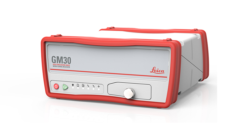
Leica GM30

Alles-in-één GNSS monitoring-ontvanger

Geotechnical Sensors

Automated geotechnical sensors for measurement and data acquisition, integrated into monitoring systems.

Leica ScanStation P50

De snelste en veiligste 3D-laserscanner met groot bereik.

Leica Nova MS60

De ultieme allrounder, een scannende, zelflerende total station met GNSS-connectiviteit en digitale camera

Leica M-Com

Plug en play communicatieoplossingen voor monitoring.

MyMo

Making Structural Monitoring faster to deploy and easier to scale.

IBIS-FM EVO

The Evolution of the groundbreaking radar that introduced ground-based monitoring radars as performant, reliable and versatile. 
Downloads


Heeft u nog vragen? Wij hebben de antwoorden!

Laat ons u ondersteunen