Transportinfrastructuur

Levert grenzeloze flexibiliteit en hoge nauwkeurigheid

Leica Geosystems geeft eenvoudig toegang tot flexibele monitoringoplossingen die zijn toegespitst op uw behoeften.

Of het nu gaat om het monitoren van bruggen, tunnels of de geometrie van de spoorwegen, van de invloed van omringende bouwwerkzaamheden of grondinstabiliteit, van verouderende infrastructuur of om het maximaliseren van de levensduur van infrastructuur, wij hebben de juiste oplossing voor u. Wij leveren software met de mogelijkheid om een volledige oplossing te bieden vanuit één betrouwbare aanbieder. De software is ontwikkeld om naadloos samen te werken met in-house, hoogwaardige sensoren, zoals total stations en GNSS, en andere geotechnische en milieutechnische sensoren van derden, in combinatie met deskundige support en advies. Monitor met realtime informatie en vertrouw op automatisch gegenereerde rapporten op basis van een aanpasbaar tijdschema.

„We waren zeer onder de indruk van de geautomatiseerde monitoringoplossing van Leica Geosystems. Niet alleen gaf het kant-en-klaarpakket ons de mate van precisie, gedetailleerdheid en nauwkeurigheid die het project vereiste, maar daarnaast hoefde niemand op ongewone tijden te werken, behalve op momenten dat het alarm afging. De oplossing gaf ons 100% vertrouwen in het project en maakt het mogelijk voor ons om waardevolle informatie te verzamelen en analyseren die we konden doorgeven aan Network Rail zodat zij het bewijs hadden dat hun infrastructuur onaangetast bleef en waardoor ze het vertrouwen hadden in onze aanhoudende werkzaamheden.”

Jamie Beech,
Agent voor BAM Nuttall

Sub-segments

Monitoring for railway

The demand for capacity and efficiency on railways is ever-increasing, continually driving the need for maintenance

Monitoring for tunnels

Deformation monitoring provides real-time information about ground movements and tunnel distortions, allowing rapid and critical decisions.

Monitoring of large-scale infrastructure

Infrastructure objects are intricate systems composed of various structures that are susceptible to performance changes caused by external factors. Monitoring systems are crucial in maintaining their safety, efficiency, and functionality.

Monitoring for highways

Keeping our busy highways operating efficiently and safely is essential for the economy, but this can only be achieved by regularly maintaining, upgrading and expanding the infrastructure.
Casestudies

Bridge rehabilitation

Learn all about the connection between Leica Geosystems’ monitoring package and the rehabilitation of the Edgar Cardoso bridge in Figueira da Foz, Portugal.

Moving a Capital City Forward

Saudi Arabia’s first rail metro will have six lines with 85 stations covering 176 kilometres with about 40 per cent of the lines underground.

Railway and platform monitoring during construction

Leica Geosystems technology puts itself at the service of rail

Bridging the continental divide

Learn all about how Leica Geosystems’ monitoring package has been used to monitor the 1915Çanakkale Bridge, connecting Turkey and the rest of the European continent.
Softwareproducten

Leica GeoMoS

Flexibele softwareoplossing voor het automatisch monitoren van deformaties.

Leica GeoMoS Edge

Monitoringsoftware voor autonome sensoraansturing en ononderbroken dataopslag in het veld.

Leica GeMoS Now!

Analyseer en visualiseer monitoringgegevens vanaf waar dan ook.

Leica GNSS Spider

De kern van het continu werkende netwerk van referentiestations

Leica GeoMoS Adjustment

Automatische justering en deformatieanalyse voor monitoring

Leica CrossCheck

Een multifunctionele GNSS-analysetool voor QC en monitoring.
Hardwareproducten

Leica Nova TM60: Monitoring Total Station

Ontwikkeld voor deformatiemonitoring

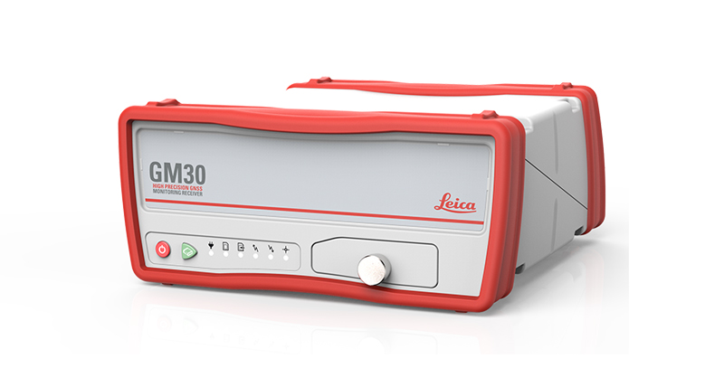
Leica GM30

Alles-in-één GNSS monitoring-ontvanger

Geotechnical Sensors

Automated geotechnical sensors for measurement and data acquisition, integrated into monitoring systems.

Leica ScanStation P50

De snelste en veiligste 3D-laserscanner met groot bereik.

Leica Nova MS60

De ultieme allrounder, een scannende, zelflerende total station met GNSS-connectiviteit en digitale camera

Leica M-Com

Plug en play communicatieoplossingen voor monitoring.

HYDRA-G

High-resolution radar system for early warning and real-time monitoring of buildings, dams, tunnels, mining infrastructures, and cut-slopes

MyMo

Making Structural Monitoring faster to deploy and easier to scale.
Downloads


Heeft u nog vragen? Wij hebben de antwoorden!

Laat ons u ondersteunen