


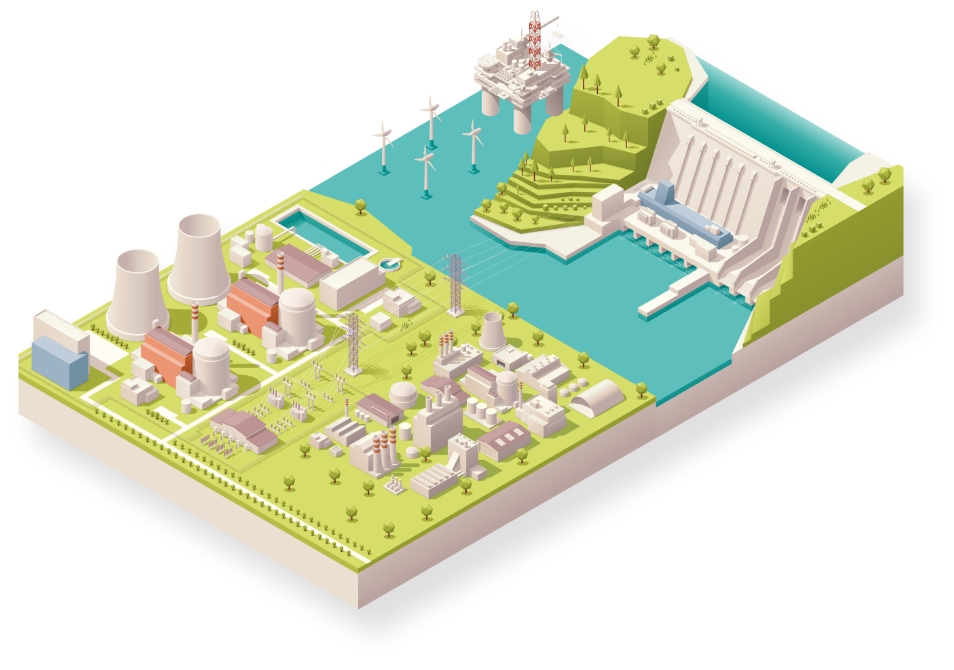
Energy Infrastructure
Reliable solutions for maximum efficiency

Customise monitoring projects with innovative and versatile solutions

Customise monitoring projects with innovative and versatile solutions

Customise monitoring projects with innovative and versatile solutions

Customise monitoring projects with innovative and versatile solutions

Customise monitoring projects with innovative and versatile solutions
Leica Geosystems provides easy access to adaptable monitoring solutions that are tailored to your requirements.
Be it for monitoring of infrastructure (e.g. dams, pipelines, oil platforms) to reduce risk caused by structural stress related to aging effects or damage from natural hazards, nearby construction, subsidence or utility networks, we have the right solution for you. With the ability to provide a full solution, all from one reliable vendor, we provide software that is developed to work seamlessly with in-house, high-end sensors, like total stations and GNSS, as well as other 3rd party geotechnical and environmental sensors, along with expert support and consultation. Monitor with real-time information and rely on reports generated automatically based on a customisable schedule.
“We recommended Leica GeoMoS and total stations because we’ve used them in many other projects around the country with excellent results.”
Richard Ingham,
C.R., State Manager at Kennedy Survey Division New South Wales, Australia
Sub-segments

Monitoring for dams and reservoirs
Dams and reservoirs are vital for water supply, flood control, waste deposits & hydropower. Real-time deformation monitoring enables swift, informed decisions to ensure safety, protecting people, property and environment.
Dams and reservoirs are vital for water supply, flood control, waste deposits & hydropower. Real-time deformation monitoring enables swift, informed decisions to ensure...
Case Studies

Designing a Dam Monitoring System
East Bay Municipal Utility District (EBMUD) had the technology in place to monitor crest elevations at these dams and dikes remotely with improved temporal resolution.
East Bay Municipal Utility District (EBMUD) had the technology in place to monitor crest elevations at these dams and dikes remotely with improved temporal resolution.

Safety on the High Seas
Lukoil’s directors initiate geodynamic monitoring systems on a maritime, ice-resistant platform to ensure safe operation and to protect workers from unexpected occurrences on the high seas.
Lukoil’s directors initiate geodynamic monitoring systems on a maritime, ice-resistant platform to ensure safe operation and to protect workers from unexpected occurrences...

Slope movement monitoring at Hinkley Point C
Under construction in Somerset, England, the new Hinkley Point C (HPC) nuclear power
Under construction in Somerset, England, the new Hinkley Point C (HPC) nuclear power

Monitoring Kristanstad's Central Sewage Treatment Plant
Automated monitoring ensures full control of sensitive ground when Kristianstad’s central sewage treatment plant undergoes expansion.
Automated monitoring ensures full control of sensitive ground when Kristianstad’s central sewage treatment...
Software Products

Leica GeoMoS
Flexible automatic deformation monitoring software solution.
Flexible automatic deformation monitoring software solution.

Leica GeoMoS Edge
Monitoring software for autonomous sensor control and uninterrupted data logging in the field.
Monitoring software for autonomous sensor control and uninterrupted data logging in the field.

Leica GeoMoS Now!
Analyse & visualise monitoring data from everywhere.
Analyse & visualise monitoring data from everywhere.

Leica GNSS Spider
The core of the continuously operating reference station network
The core of the continuously operating reference station network

Leica GeoMoS Adjustment
Automatic adjustment and deformation analysis for monitoring.
Automatic adjustment and deformation analysis for monitoring.

Leica CrossCheck
A multi-purpose GNSS analysis tool for QC and monitoring.
A multi-purpose GNSS analysis tool for QC and monitoring.
Hardware Products

Leica Nova TM60: Monitoring Total Station
Engineered for deformation monitoring
Engineered for deformation monitoring


Geotechnical Sensors
Automated geotechnical sensor measurement & data acquisition
Automated geotechnical sensor measurement & data acquisition

Leica ScanStation P50
The fastest and safest, long-range 3D laser scanner.
The fastest and safest, long-range 3D laser scanner.

Leica Nova MS60
The ultimate all-rounder, a scanning, self-learning total station with GNSS connectivity and digital imaging
The ultimate all-rounder, a scanning, self-learning total station with GNSS connectivity and digital imaging

Leica M-Com
Plug and play communication solutions for monitoring.
Plug and play communication solutions for monitoring.


IBIS-FM
Safely ahead of slope instability by reliably measuring mine movements
Safely ahead of slope instability by reliably measuring mine movements
Downloads