Leica ConX – Cloud Solution & Web Interface to Share and Visualise Data
Open, simplified and user friendly cloud based collaboration platform for managing and transferring of data.

Leica ConX is a cloud-based collaboration tool that allows you to efficiently manage all your connected construction projects and to share job-related data with all stakeholders. Leica ConX enables you to visualise and validate localised reference models, survey data and constructed data with powerful analysis tools for monitoring and reporting site productivity.

Transparency and real time connectivity
This cloud-based collaboration tool allows you to efficiently manage all your connected construction projects, including third party platforms, and share job-related data with all stakeholders. With Leica ConX, even non-experienced users will be able to visualise and validate localised reference models, survey data and constructed data. Leica ConX provides you the fast and easy-to-use web based suite of tools you need to get the job done quicker, more efficiently and to specification.
Cut/Fill analyses and volumetric progress tracking
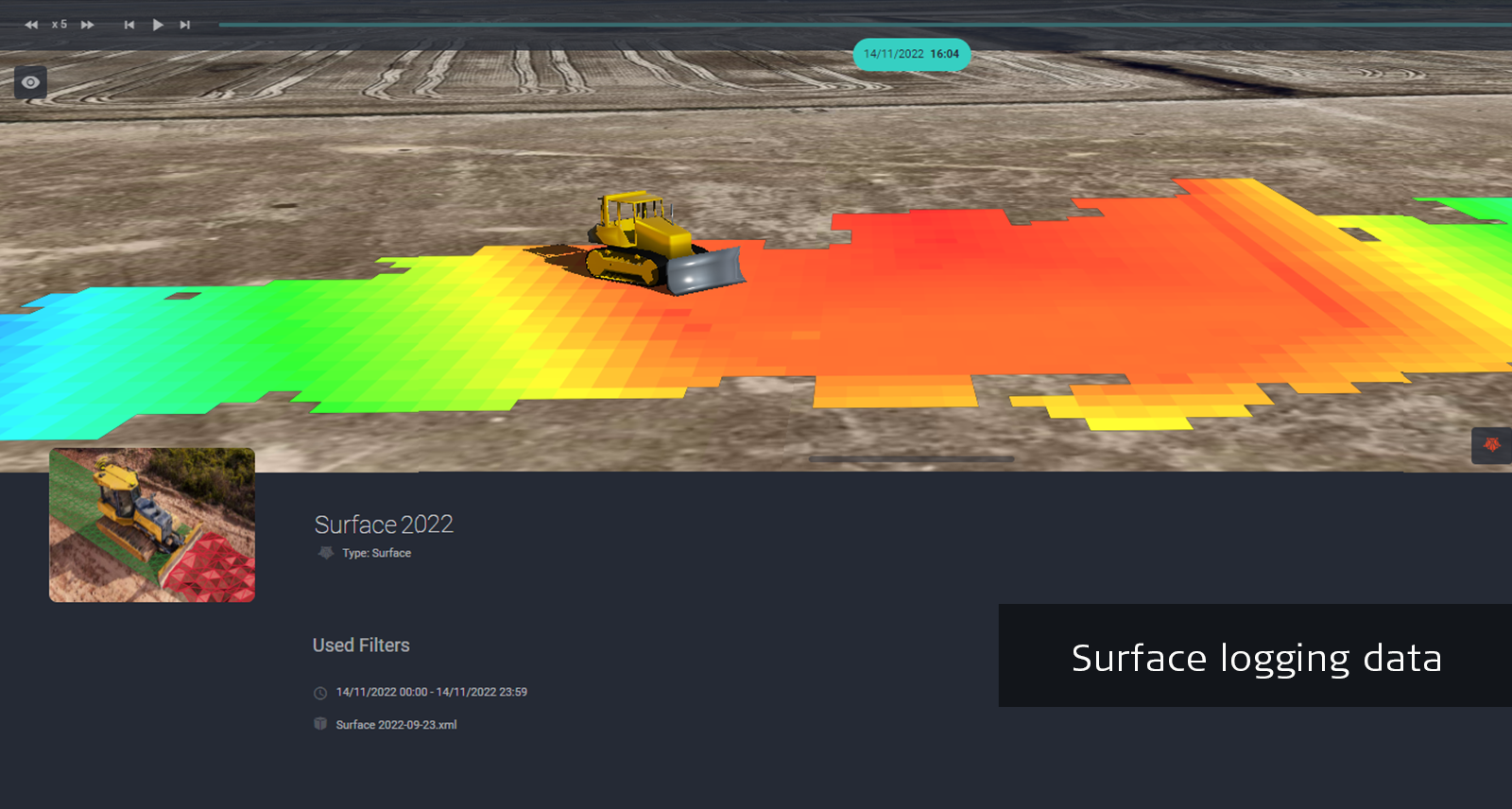
The initial surface can be sourced from terrestrial or aerial surveys or simply as files from desktop or third party applications. All measured points from machines or field surveyors can be used to create surfaces that allow for surface comparisons for grade checking and cut fill analysis. As-built information sent back to ConX are used to create 3D cut/fill maps that allow you to visualise project progress in real time. Volumetric changes are presented in an easy-to-read dashboard for reporting project productivity.
Digital 3D project environment
Get a quick overview of the project progress with easy access to all critical project information on the ConX 3D page. Visualise in real-time reference models, unit location’s history and as-built data information. Take advantage of the as-built data measured with the surface logging functionality of MC1 for progress tracking, reporting and model creation.
ConX Safety Awareness Module
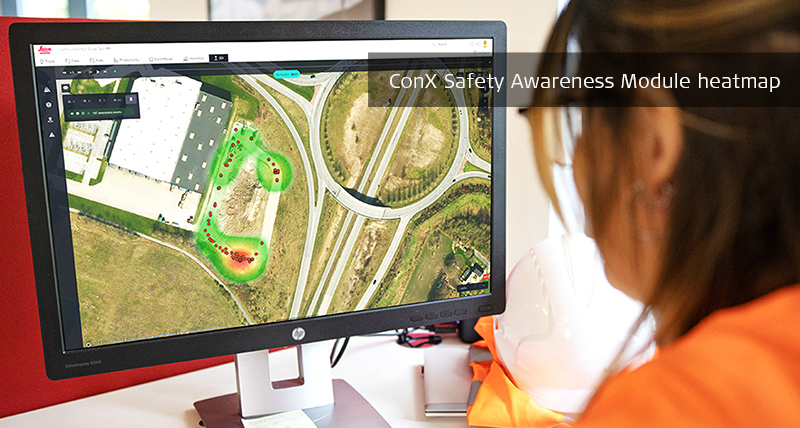
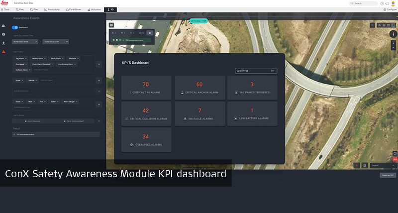
All incident data from the Leica iCON PA10, iCON PA80 and iCON CAS solutions are collected in Leica ConX Safety Awareness Module, providing new possibilities for proactive safety measures. Now safety managers can analyse incident data from reports and a built-in KPI dashboard, which are supported by a heatmap of the incident location indicating the highest-risk areas on the construction site. By tracking and measuring incidents, they will be able to make data-driven decisions to improve the on-site safety of construction workers and other assets.
Remote support and trouble shooting
Minimise operator downtime with remote real-time communication between office and machine for troubleshooting, on-the-fly training and setup without travel costs and delays.
EarthMover
The EarthMover is an add-on solution to the Leica ConX platform to support material hauling management for contractors. Dump truck operators can log all haul data (load & unload position, time & date, material type, and volume) on their smart device and sync the information to ConX. Based on this information, project managers can monitor the earthmoving activities on site and create progress reports for key stakeholders or their customers. The EarthMover app enhances digital reporting, is easy to use, and is available for Android and iOS operating systems.
Leica iCON excavate iXE2 2D excavator machine control solution
Leica iCON grade iGG2 2D grading solution
Leica iCON grade iGG3 3D grading solution
Leica iCON iGW3 - 3D wheel loader
Leica iCON pave
Leica iCON compaction
Leica ConX Safety Awareness Module
Leica iCON gps 120 Machine Smart Antenna
Leica iCON gps 80 Machine Receiver
Leica iCON iCR80 Robotic Total Station
Leica iCON gps 70 Series
Leica MC1
Leica iCON site
Leica iCON office


