


Protecting the Past: How 3D Laser Scanning Enables Essential Maintenance of Historic Buildings
Case study

Author: Michelle Byrne, Principal Marketing Manager Reality Capture
The maintenance of historic buildings is vital, but it is not easy. Many existing systems (such as pipework and utilities) may be completely inaccessible or hard to reach, expensive to replace, and potentially hazardous to access. But keeping these systems in place is often an essential part of retaining the character of the property or building in question - this is made possible with 3D laser scanning.
The University of Toronto is the leading university in Canada and supports over 90,000 students annually. Although a modern university, its’ St. George campus is steeped in history, dating back to the early 1800s. The University’s Central Steam Plant is over 100 years old and sends heat to most buildings on the campus via an underground maze of steam pipes.
In the past, maintaining a facility such as this would have been challenging. However, using 3D laser scanning technology, accurate 3D models of the critical areas both above and underground can be created without causing damage, disruption, or the need to excavate unnecessarily.
Managing historically significant sites with 3D laser scanning
This is the approach 3DS Technologies Inc applied when they were tasked with scanning the steam pipes at the University of Toronto, creating a high-accuracy model to enable a contractor to plan the route for new and replacement steam lines.
As part of the work, the contractor needed to plan excavations that would cause the least disturbance and disruption. A non-contact 3D data capture approach was preferred as although some locations are above ground, it can be hazardous in the underground tunnels as they contain hot pipes carrying steam. There are often small, confined spaces that are hard, if not impossible, to access.
3DS Technologies Inc is a specialist high-resolution 3D laser scanning consultancy that prides itself on using the most up-to-date LiDAR equipment and technology to ensure its clients receive accurate and reliable data, which why they choose Leica Geosystems, part of Hexagon.
To provide a comprehensive service, 3DS Technologies Inc uses a combination of interoperable Leica Geosystems solutions including the RTC360 and Leica Scanstation P30 and P50 3D laser scanners, Leica BLK2GO handheld imaging laser scanner, Leica Cyclone, Cyclone 3DR and Cyclone REGISTER 360 3D point cloud software, and the Leica FlexLine TS07 manual total station. This gives the company flexibility to determine the best product for each project and ensures reliable, consistent data is collected and processed every time.
The perfect laser scanner for the project? The RTC360…
Given the campus’ historical significance and the project aims, 3DS Technologies Inc opted to use a non-contact reality capture approach. Aside from protecting the site, it also protected users from potential hazards and meant the team could see unforeseen obstructions and obstacles before they became a problem.
They used the FlexLine TS07 to align scans because of its ease of use and intuitive features, including AutoHeight, which reduces the likelihood of errors during setup. Targets were used throughout the scan area to verify the registration.
The RTC360 was selected as the primary 3D laser scanner for this project because of its portability, weight and size, which made it perfect for confined areas. In addition, it offers user-friendly features such as being easy to set up and start, and easy to reposition. As the RTC360 scans at 2 million points per second, it accurately captures any environment in 3D improving efficiency and increasing productivity in the field.
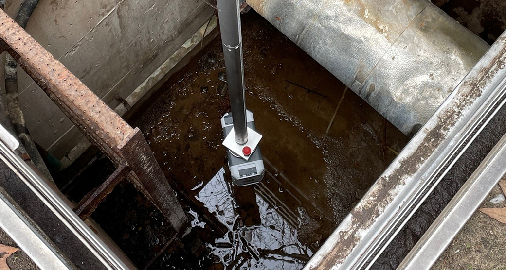
That’s why it only took one day to complete the scanning, including above ground around the tunnel, along the laneway and into the basement where the steam pipes enter the building. In addition, the tunnel corridor of the steam pipe location was scanned. The Leica CET103 elevator tripod was used for inverted scanning with support from regular tripods. All Leica Geosystems’ tripods are engineered with stability in mind for increased accuracy.
Data point cloud and High Dynamic Range (HDR) imagery were processed in Cyclone REGISTER 360 and exported LGS, RCS and e57 for modelling software. What sets Cyclone REGISTER 360 apart from comparable solutions is its usability – users of all skill levels can visualise their data in detail. This makes it the ideal solution for collaborative projects, whether it is used by itself or as part of an integrated solution.
The final delivery was LGS files, viewed in Leica TruView digital reality viewer and used for 3D CAD modelling. TruView transforms point cloud data into practical information while making collaboration easy.
The result?
This combination of reality capture technology and office processing software ensured a comprehensive data set was efficiently collected and processed, all while keeping the team protected from potentially hazardous conditions.
The result is successful scanning and modelling that will enable the contractor to plan excavation sites with minimal disruption and damage to a historically significant building. The data will be used to design new steam pipes and routes to support growing demand while ensuring the existing system is well maintained.
Travis Sachs, Chief Operating Officer of 3DS Technologies Inc, said: “The data quality of the ScanStation P-Series and RTC360 laser scanners is among the best. One advantage of 3D laser scanning and reality capture technology that cannot be overlooked is the planning for the physical work can now be done from the comfort of the office, and confidence is increased knowing the accuracy of the process and scanning equipment.”

Laser scanning: A tool for the past, present and future
This project has set the benchmark for the requirement for 3D laser scanning as a safety tool, not only for 3DS Technologies Inc, but for their client and other clients or property owners in a similar situation who need to deal with potentially hazardous steam pipes.
The challenges faced at the University of Toronto could apply to any industry or building that uses steam for heating. For example, manufacturing facilities that use steam in their processes or have boilers or contractors dealing with hot water lines and underground utilities.
But that’s not all. This project also highlights the fact that proactive maintenance and necessary works can be sensitively completed on historic buildings with 3D laser scanning and reality capture technologies. The stress, hassle, and unpredictability caused by works and excavations are no longer an issue when laser scanning buildings.
The number of projects embracing reality capture and 3D laser scanning is growing year-on-year. This trend will continue as the technology becomes even more sophisticated and integral to companies such as 3DS Technologies Inc, but what’s next? Travis Sachs, Chief Operating Officer of 3DS Technologies Inc, says: “We will continue to try new [Leica Geosystems] products as they are released … because of the data quality.”

Contact for Laser Scanning
Get in contact with us for more information about our laser scanning portfolio.
Get in contact with us for more information about our laser scanning portfolio.

Reality Capture Newsletter
Click here to subscribe to our regular newsletter and stay up-to-date on all the latest reality capture news.
Click here to subscribe to our regular newsletter and stay up-to-date on all the latest reality capture news.

Laser Scanning Industry Applications
With the introduction of laser scanning, measuring and documenting is simplified and improved across all industries.
With the introduction of laser scanning, measuring and documenting is simplified and improved across all industries.