


Improving county access to high-resolution imagery
Case study

Author: Linda Duffy
As a subscriber to the HxGN Content Program through the State of Washington, rural Jefferson County in the United States benefits from access to the most current high-resolution aerial imagery available. Highly useful decision-support tools are created by overlaying the imagery with detailed county-wide GIS data. The insights obtained from combining information lead to more-informed analysis, faster approval processes and better services to internal and external customers.
Unique county characteristics
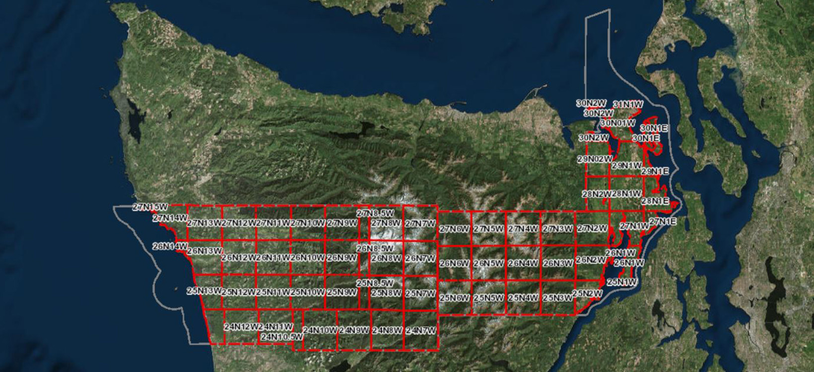
Jefferson County encompasses a diverse geographic area, which presents special challenges for government administrators. Located on the Olympic Peninsula, the coastline along the Pacific Ocean forms the western border of the county, while the eastern section includes four small towns, a shipping port, several islands, farmland and an active naval facility. In between West Jefferson County and East Jefferson County lies Olympic National Park and Olympic National Forest, managed by the federal government. In total, about 31,000 residents are dispersed over 5,654 square kilometres.
Due to the varied terrain and long distance from the county seat of Port Townsend in the east to the Pacific coast in the west, onsite inspections can be time consuming and expensive, causing delays in building permit approvals, infrastructure planning and environmental protection efforts. Government and private users both benefit from up-to-date aerial imagery because it provides detailed information in and around the area of interest and reduces the need for in-person field visits.
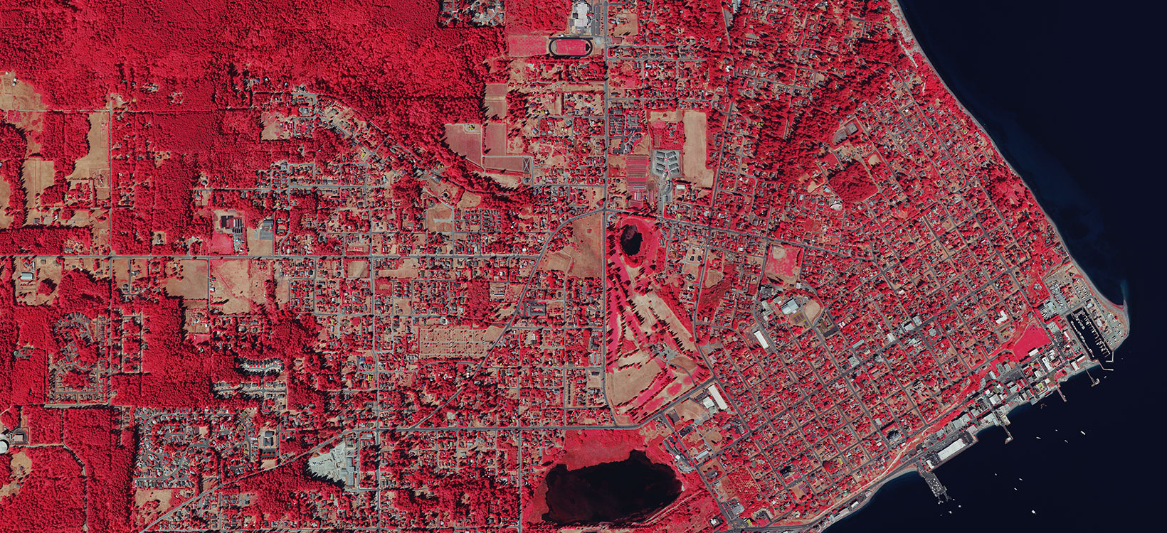
“With aerial imagery, we can see structures, outbuildings, and natural features, and when combined with contours, we can make a lot of determinations from the office,” says Kevin Hitchcock, GIS analyst/cartographer, Jefferson County Central Services. “In a rural community like ours, online maps are used for a variety of activities, such as planning new developments and evaluating impacts on streams and wetlands. The Public Lands Records database also includes sales history and other information for every property in the county, making it easy to do research without leaving the office.”
Improved basemap
In 2015, counties and municipalities throughout the State of Washington were approached to assess their interest in cost-sharing to obtain high-resolution aerial imagery of the entire state. A certain level of participation from local jurisdictions was necessary to make it cost effective. In Jefferson County, department managers and administrative staff agreed that signing up would be beneficial. Ultimately the county entered into a three-year contract to receive imagery through the HxGN Content Program.
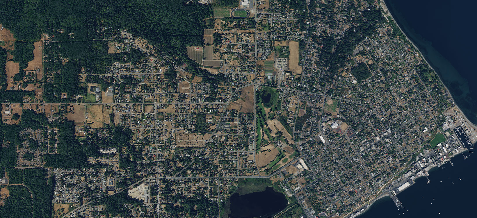
The HxGN Content Program collects speculative off-the-shelf orthorectified imagery of the US, parts of Europe, and populated areas of Canada to create a database available to customers. The goal is to acquire cloud-free 30-centimetre resolution, 4-band imagery over less populated areas, and 15-cm resolution over metro areas with a population greater than 50,000. In 2017, Jefferson County received 30-cm resolution aerial imagery, a welcome update to its 1-metre basemap obtained in 2011 through the National Agriculture Imagery Program (NAIP).
The goal of Jefferson County Central Services GIS team is to develop and maintain an effective countywide resource that serves the needs of government agencies and the public. Historical and current imagery and GIS data layers are available for viewing and printing through an Esri ArcGIS web application. An imagery map service hosted by Valtus, part of Hexagon, allows users to add the content as a layer to any GIS webmap. The public can download the existing shapefiles, such as tax parcels, but not the actual imagery. Government employees are authorised to download the imagery to create derivative products and to perform analysis.
Benefits to the community
Jefferson County has created a user-friendly GIS that contains a broad range of information. The online map archive includes rich data layers such as zoning, fire districts, school districts, roads, emergency services, and channel migration zones overlaid on the high-resolution imagery.
Within the county, frequent users of spatial and map information include the departments of Environmental Health, Public Works, Community Development and the Assessor. Emergency responders, such as police and firefighters, are aided by the address point layer to pinpoint the fastest way to reach someone in need, while engineers in the private sector can more easily design septic systems by analysing online data. For shoreline properties, developers check for extra regulatory restrictions to ensure compliance with proximity to shoreline and erosion concerns.
“Access to high-resolution aerial imagery through the HxGN Content program makes it easier to visualise an area of interest, in detail and in the broader context of the surrounding terrain,” says Hitchcock. “We save time and money by completing our work with online tools. As we continue to explore the applications, there will probably be a desire for even higher resolution to support better decision making.”

Contatta Leica Geosystems
Cerca il tuo referente Leica Geosystems per le vendite, il supporto e l'assistenza tecnica.
Cerca il tuo referente Leica Geosystems per le vendite, il supporto e l'assistenza tecnica.