Infrastructures de transports

Offrir une polyvalence illimitée et une haute précision

Leica Geosystems provides easy access to adaptable monitoring solutions that are tailored to your requirements.

Be it monitoring bridges, tunnels or the geometry of railway tracks, for surrounding construction impact or ground instability, aging infrastructure or maximising the lifetime of infrastructure, we have the right solution for you. With the ability to provide a full solution, all from one reliable vendor, we provide software that is developed to work seamlessly with in-house, high-end sensors, like total stations and GNSS, as well as other 3rd party geotechnical and environmental sensors, along with expert support and consultation. Monitor with real-time information and rely on reports generated automatically based on a customisable schedule.

"We were thoroughly impressed with the automated monitoring solution from Leica Geosystems. The off-the-shelf package not only provided us with the level of precision, detail and accuracy that was demanded of the project, but it also required no one to work unsociable hours, unless movement is detected and the alarm raised. The solution gave us 100% confidence in the project and allowed us to collect valuable information to analyse and submit to Network Rail, giving them the evidence their infrastructure remained unaffected, and the confidence in our continuing works."

Jamie Beech,
Agent for BAM Nuttall

Sub-segments

Le monitoring ferroviaire

La demande de capacité et d'efficacité sur les chemins de fer ne cesse d'augmenter, ce qui entraîne continuellement des besoins de maintenance.

Monitoring for tunnels

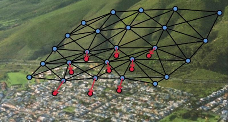
Deformation monitoring provides real-time information about ground movements and tunnel distortions, allowing rapid and critical decisions.
Case Studies

Bridge rehabilitation

Learn all about the connection between Leica Geosystems’ monitoring package and the rehabilitation of the Edgar Cardoso bridge in Figueira da Foz, Portugal.

Moving a Capital City Forward

Saudi Arabia’s first rail metro will have six lines with 85 stations covering 176 kilometres with about 40 per cent of the lines underground.

Railway and platform monitoring during construction

Leica Geosystems technology puts itself at the service of rail

Bridging the continental divide

Learn all about how Leica Geosystems’ monitoring package has been used to monitor the 1915Çanakkale Bridge, connecting Turkey and the rest of the European continent.
Software Products

Leica GeoMoS

Solution flexible et automatique pour la surveillance de déformations.

Leica GeoMoS Edge

Logiciel d'auscultation pour le pilotage autonome des capteurs et l'enregistrement en continu des données sur le terrain.

Leica GeoMoS Now!

Analyse & visualise monitoring data from everywhere.

Leica GNSS Spider

The core of the continuously operating reference station network

Leica GeoMoS Adjustment

Automatic adjustment and deformation analysis for monitoring.

Leica CrossCheck

A multi-purpose GNSS analysis tool for QC and monitoring.
Hardware Products

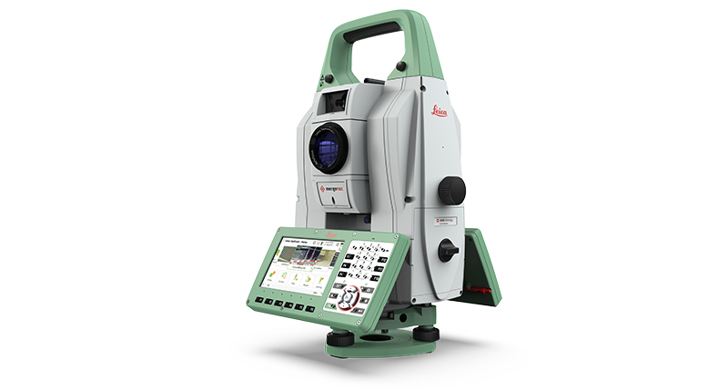
Leica Nova TM60

La station totale automatique Leica Nova TM60 est robuste, précise et attrayante pour vos projets de surveillance.

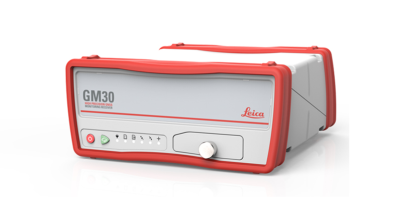
Leica GM30

Capteur GNSS d'auscultation tout-en-un

Capteurs géotechniques

Mesure automatisée par capteurs géotechniques connectés et acquisition de données

Leica ScanStation P50

Laser scanner 3D longue portée, le plus rapide et le plus sûr

Leica Nova MS60

Un instrument unique adapté à toutes vos tâches de levé, combinant une fusion des capteurs à un niveau jamais égalé.

Leica M-Com

Solutions de communication pour les systèmes d'auscultations permanentes

HYDRA-G

High-resolution radar system for early warning and real-time monitoring of buildings, dams, tunnels, mining infrastructures, and cut-slopes

MyMo

Making Structural Monitoring faster to deploy and easier to scale.
Downloads


Got questions? We've got the answers!

Let us support you