


Leica Infinity: How to share data with Leica ConX

The direct connectivity to Leica ConX available. Share data any time across the project to the ConX cloud services or directly to machine control in the field.
- Easily login to ConX directly in the project
- Access all ConX projects and create projects
- Visualise, analyse and extract the required information from the design, like alignment or road elements
- Collect and combine the design data with the measurement data in one project. Process, analyse and check measurement data, including total stations, GNSS data, level data, and Imagery (UAVs & Leica GS18 I)
- Full 3D surface and volume computations, surface-to-surface height comparisons, creating and editing Infrastructure objects like road alignment, cross section or material surface
- Direct data download or upload to the ConX cloud service
- Manage and transfer data between the office and the field crews
Learn more about the workflow from this article or watch the tutorial video linked at the end of this page.
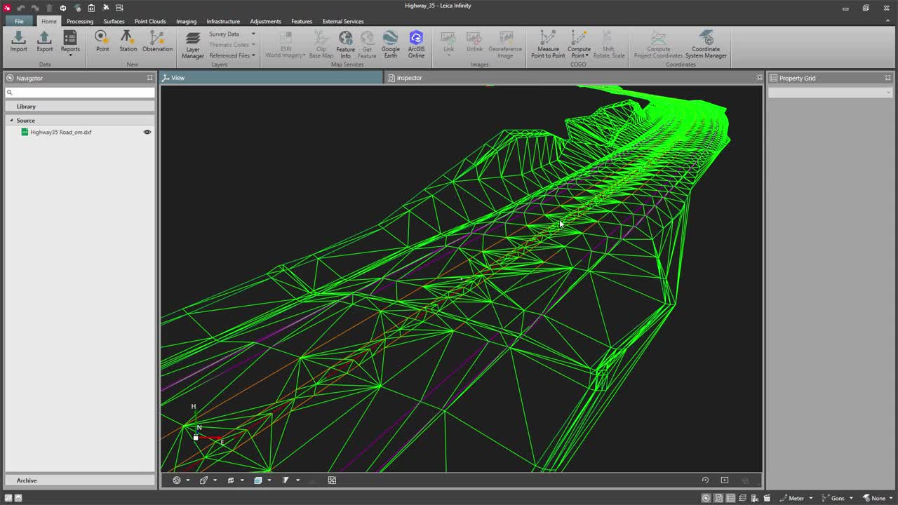
Import and visualise the design in 3D
First, import the design in any of the numerous supported data formats. Visualise the data in the 3D view. For location awareness, use Base Maps to view road data and store as georeferenced images.

Image 1: Imported road design and base maps
Extract data from the design, edit and create new objects
Use the Copy from CAD functionality to extract the data you need from the DXF/DWG file and simply import the infrastructure elements like a road or an alignment. Update the design if needed and combine the design data with the measurement data. Use any data from total stations, GNSS, level and imagery (UAVs & GS18 I). Create a new object, including all road elements or material surfaces.

Image 2: Material Surface created from a road design
Connect to ConX
Users can connect from Infinity to field sensors and machines via the internet using ConX integration.
Navigate to the External Services tab in the ribbon bar, select login and add credentials. Once you have successfully connected, the ConX icon will be enabled in the Import/Export dialogue. You can now create a new project or select any of the existing projects in the cloud service. Easily download or upload the data in only a few clicks.

Image 3: Direct login to Leica ConX in the project
Transfer data to ConX cloud service or machine control systems in the field
Easily transfer data to the ConX cloud service or on-site units only with few clicks. Share the construction design drawings updated with the measurement data, digital terrain models (DTM), material surfaces or quality check reports.
Select the desired ConX project and press Export in the ribbon bar. Define a filename and export.

Image 4: Data transfer to machine control systems
Benefit from comprehensive cloud-based data exchange. Keep your field and office teams and stakeholders on track with up-to-date data.
Watch the video to learn how to share data with ConX:
Leica Infinity and Leica ConX connectivity. Share data any time across the project to guarantee transparency and quick reaction to design updates. Manage all your construction projects efficiently.
To watch other Infinity videos, go to the playlist.
Author
Monika Bodziak
Product Engineer, Leica Infinity
Monika Bodziak
Product Engineer, Leica Infinity

Neem contact met ons op over Leica Infinity
Neem contact met ons op over Leica Infinity-software.
Neem contact met ons op over Leica Infinity-software.

Online leren
Leica Geosystems heeft een online leerplatform ontwikkeld om klanten de kennis te geven om het meeste uit de functionaliteit van hun materieel te halen.
Leica Geosystems heeft een online leerplatform ontwikkeld om klanten de kennis te geven om het meeste uit de functionaliteit van hun materieel te halen.