UAV-based mapping of the Porgera mine
Leica UAV brings efficiency to environmental monitoring

Papua New Guinea, one of the most rural and unexplored places on the planet, challenges surveyors with its dense rainforest, swamps, steep valleys and mountains up to 4,500 meters to find new ways to create accurate measurements. To defy these difficulties, the experts are forced to search for new innovative solutions to obtain precise results and found their perfect match in the use of an Unmanned Aerial Vehicle (UAV).
When Benchmark Survey & Design, experts specialised in topographic site surveying from North Queensland, Australia, were contracted by the Porgera Mine Survey Team to map spill grounds around the secluded mine located at the head of the Porgera Valley in highlands at an altitude of 2,200 to 2,700 m, they needed to find a new method of surveying. As the captured data would be used for environmental monitoring of the dump sites generated by the mine, accuracy was of the utmost importance.
Mapping dangerous terrain with an UAV
In an area where landslides and earthquakes are common and with only five days available to map, Benchmark Survey & Design determined a survey by air would be the safest and most efficient way to collect the needed data. As the firm needed more experience in using Leica Geosystems UAV, it turned to Spatial Technologies, an Australian firm with more than 20 years in geographic information systems (GIS), to provide an UAV pilot. Flying Leica Geosystems UAV and collecting data in various environments for the past two years, Spatial Technologies was up for the challenge.
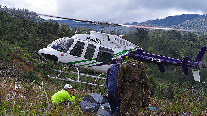
With two sites to capture around the mine, Anjolek at 380 Hectares and Anawe at 250 ha, the pilot, Anton van Wyk, had to carefully plan his route in the flight planning software. Facing several challenges, like steep and unattainable terrain only accessible by helicopter, use of the helicopter only available one out of the five days to map, and extreme weather with heavy fog in the mornings and continuous rainfalls in the afternoon, reduced the time bucket to only a few hours each day to survey. Anton’s precise plan rested upon the durability and dependability of Leica Geosystems UAV solution.
“Leica Geosystems UAV provided better results than what Porgera Mine Survey Team expected, even in such rough terrain,” said Wayne Storey from Benchmark Survey & Design. “Though the mine survey team had someone prior fly this mission, the team didn’t receive the expert mapping and processing of the data the UAV delivered with its more advanced sensors.”
With 32 total flights at about 10 minutes each, Spatial Technologies collected 9,100 orthophotos at a 5 cm ground sampling distance. While Benchmark Survey & Design only need sub-metre accuracy for the project, Spatial Technologies was actually able to supply 10-20 cm accuracy with strategically placed controls in conjunction with the RTK on the UAV. The entire project was processed in about 96 hours to provide visual documentation of volume changes in the spill grounds.
More than just volumes
Combining the orthophotos from Leica Geosystems UAV with older data and point clouds of the site created by laser scanning technology, engineers and environmentalists on the project were enabled to go beyond just volume calculations. Together with the many forms of data collected, they can now see visible proof of vegetation changes and conduct slope analyses.
As the dangerous terrain evokes dangerous conditions for surveyors, measurements were previously being taken few and far in between. With the safer and quicker UAV survey, the mine survey team can now monitor on a more regular basis to manage issues sooner and rectify problems before they become major concerns.
“Aerial surveys with an UAV can not only be done quicker than with traditional methods, but with the advanced sensors it can carry, we can gain the same if not better accuracy, as well, “said van Wyk. “Since surveyors don’t have to enter risky areas, too, to set up instruments, the UAV also makes our jobs safer.”
When terrain creates obstacles on the ground, UAVs are able to overcome from above. Opening access to more and more areas, Leica Geosystems UAV solution is creating new opportunities across the globe.


