Leica GeoMoS - Now Survey Edition streamlines deformation monitoring for surveyors

New function: Visualisation of the thresholds for campaign monitoring
Surveyors can use GeoMoS Now! Survey Edition to easily upload coordinates, process and visualise deformations for project responsibles to immediately access results from any smart device. This Cloud enabled solution offers users one convenient platform for all their existing and previous survey field campaign data.
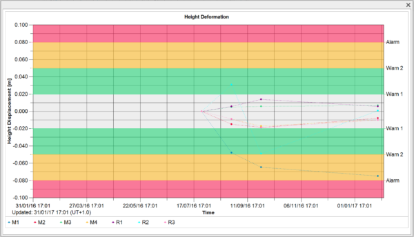
We are pleased to announce the release of a new function for the solution that enables surveyors to create limit classes and represent them on the graphs in GeoMoS Now! Survey Edition. For each graph an individual limit class can be defined to visualise the critical level of deformation.

Height displacements with warning levels
During the campaign monitoring project surveyors only need to examine the time line diagrams with integrated limit level. The visualisation of the warning levels is the important information surveyors should focus on.
By using GeoMoS Now! Survey Edition, engineering companies gain the benefits of a complete monitoring system for all their surveying projects without the complexity or expense of a traditional system.
The best way to experience GeoMoS Now! Survey Edition is with a hands-on free trial. Contact us to try it out and see how easy it is to manage deformation measurements on standard surveying projects. Find below the product pages to learn more about the solution.
Leica GeoMoS Now! Monitoring Service


