


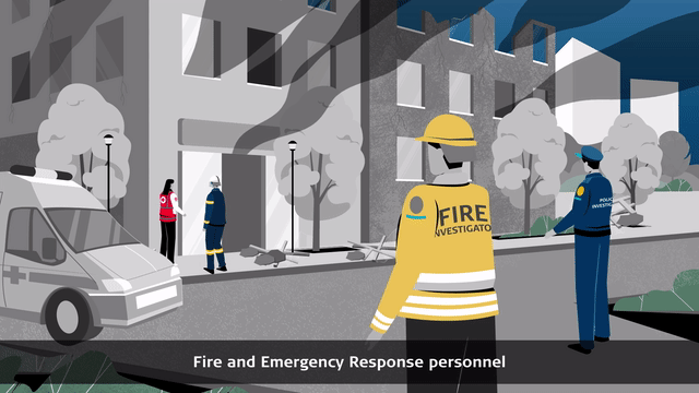
Advanced Fire and Explosion Investigation

When everything is covered in soot and blackened from fire and smoke, how can you accurately document a fire or explosion scene?
With our technology, you can quickly and safely gather crucial interpretive information to investigate and clarify the circumstances. Our solutions help maintain the safety of the response teams on scene, and completely document the steps taken at the outset of a fire investigation. Implementing standardised procedures with reliable solutions help you to gather invaluable insights into the course of events and reconstruct what has happened, even if the type and scope of your investigation may vary from case to case.
Secure the fire scene and monitor the safety of the response teams
Rescue operations carried out after a fire are the most complicated and complex tasks performed by fire rescue units. Safety is paramount when a structure may have already collapsed or is close to collapse. When the rescue unit arrives on the scene, their first important task is a comprehensive reconnaissance.
The stability of the structure needs to be analysed, and where necessary, structural monitoring through all the operation (for example, with our Leica Geosystems total stations and GeoMoS solution) increases the safety of the response teams.

Document the fire or explosion scene in challenging conditions
The initial concern with regards to a fire incident scene is safety. A fire or explosion scene has an increased risk factor with possible hazards, including heated materials, structural collapse, damaged electricity and gas mains, debris, asbestos, dangerous combustion products and other toxic substances.
Using the BLK360 imaging laser scanner with its thermal imaging function showing heat maps on the fire site helps to reduce risks for units entering the building, rescuing the victims and documenting the scene. The extent of the structure or building and environmental factors can play a significant role.
Large or complex structures are best captured with the RTC360 laser scanner. The versatile and robust (IP54) scanner is an ideal tool for outdoor data capture in adverse weather conditions.

Preserve the fire scene, visualise the details in Virtual Reality (VR) and train your staff anytime and anywhere
Create photo-realistic virtual reality environments from UAV data, or 3D point clouds to enable re-visitable fire or explosion scenes in digital reality. Include evidence pictures, PDF reports, 2D data, or annotations, and develop truly immersive training environments with flexible virtual scenarios according to your needs. The immersion in the digital world and the interaction of the users, enhanced by haptic or audio stimuli, the ego-perspective and the feeling of “presence” complete the benefits of virtual training.
Provide your units, teams, and response personnel with a fit-for-purpose VR-learning environment for instructor-led training or remote, self-paced learning paths
Discover our recommended solutions for advanced fire and explosion investigation
Fast, agile, and precise fire scene documentation and forensic mapping for court-ready deliverables

Document the scene with the Leica RTC360
With the RTC360 3D laser scanner, fire or explosion scenes can be captured at up to 2 million points per second in less than two minutes directly at the scene.
The RTC360 can easily record fine details and spatial relationships with speed, comprehensiveness and millimetre accuracy, regardless of environmental conditions and site range.

Manage data with Leica Cyclone FIELD 360 and Leica Cyclone REGISTER 360
Captured scan data is visualised and pre-registered directly in the field in real-time with the Cyclone FIELD 360 app, allowing users to perform quality control and assurance of the data.
Quickly post-process 3D environments in the office with Cyclone REGISTER 360 software.

Deliver a wide array of reports with Leica Map360
Our forensic mapping software, Map360 can integrate collected scan data directly with, for example, CCTV footage, images, and other relevant documents into models for analysis and hypothesis. Results of the data analysis can be easily accessed from computers in the crime/fire laboratory or anywhere else, providing an easy and accessible way to revert to the details when needed, even weeks or months after the fire happened.
Map360 helps you to easily transform your 3D fire and explosion data into an accurate and compelling Forensic Digital Twin.
One-button indoor fire scene reality capture in 360° with thermal imaging

Capture the scene with the Leica BLK360
The BLK360 captures the environment in 3D with full-colour panoramic images superimposed over a highly accurate point cloud. Weighing only 1 kg, the BLK360 is the smallest and lightest instrument of its kind and is easy to use thanks to its one-button operation. Anyone who can handle a tablet computer can now capture the environment with high-resolution 3D panoramic images.
The BLK360 is capable of thermal imaging thanks to its built-in thermal imaging sensor. Every scan includes a thermal image panorama, allowing you to view temperatures within the scan with a colour scale and capturing energy units for a fire or explosion scene.

Manage and deliver the data with Leica Cyclone FIELD 360 and Leica Cyclone REGISTER 360 (BLK Edition)
Using Cyclone FIELD 360 mobile-device app, the BLK360 streams image and point cloud data to an iPad or final project data to Cyclone REGISTER 360 or Cyclone REGISTER 360 (BLK Edition) via Wi-Fi. With on-the-fly image and point cloud processing in the field and auto-registration office workflows in both software offerings, the BLK360 plus the software solution of your choice dramatically streamlines the reality capture process – thereby opening this technology to everyone.
Structural monitoring for automated safety and rescue operations on a fire scene

Monitor movements with Leica Geosystems total stations and a dedicated app
With a Leica Geosystems total station and an on-board App, movements of structures can be automatically and precisely monitored day or night to ensure the safety of incident response teams and the victims.

Continuously monitor movements with Leica GeoMoS software and Leica Geosystems total stations
For structures that need to be monitored for a longer period of time, an automated monitoring system can be established. Comprising of a Leica total station and Leica GeoMoS controlling software at the scene, any movement in the structure will be detected 24/7. Notifications of movement are automatically sent to inform stakeholders to ensure safety.
Structural monitoring for automated safety and rescue operations on a fire scene

Capture the scene with the Leica BLK2GO
The Leica BLK2GO is a handheld imaging laser scanner that captures colorized 3D point clouds while you walk. For quick documentation of fire investigation scenes, you can dramatically reduce the time spent scanning onsite with award-winning mobile mapping and GrandSLAM technology. Rapidly move through any scene with the BLK2GO and it will capture all dimensions, and you can capture geotagged detail images during your scan.

Manage data with Leica Cyclone FIELD 360 and REGISTER 360
Captured scan data is visualised and pre-registered directly in the field in real-time with the Cyclone FIELD 360 app, allowing users to perform quality control and assurance of the data. Quickly post-process 3D environments in the office with Cyclone REGISTER 360 software. You can also use the BLK2GO Live App for real-time monitoring of scans and scanner settings.

Deliver a wide array of reports with Leica Map360
Our forensic mapping software, Map360 can integrate collected scan data directly with, for example, CCTV footage, images, and other relevant documents into models for analysis and hypothesis. Results of the data analysis can be easily accessed from computers in the crime/fire laboratory or anywhere else, providing an easy and accessible way to revert to the details when needed, even weeks or months after the fire happened.
Map360 helps you to easily transform your 3D fire and explosion data into an accurate and compelling Forensic Digital Twin.
Structural monitoring for automated safety and rescue operations on a fire scene

Capture the scene with the Leica BLK2FLY
The Leica BLK2FLY is an autonomous flying laser scanner that captures digital twins from the sky. At any fire investigation scene, you can easily scan with the BLK2FLY from above, especially for hard to reach or hazardous areas, including unstable structures. With GrandSLAM technology that incorporates advanced obstacle avoidance, the BLK2FLY requires minimal training and can simply be set to fly its course over the scene to capture all data needed.

Manage data with Leica Cyclone FIELD 360 and Leica Cyclone REGISTER 360
Captured scan data is visualised and pre-registered directly in the field in real-time with the Cyclone FIELD 360 app, allowing users to perform quality control and assurance of the data. Quickly post-process 3D environments in the office with Cyclone REGISTER 360 software. You can also use the BLK2FLY Live app to control scan settings and take manual flight control.
Deliver a wide array of reports with Leica Map360
Our forensic mapping software, Map360 can integrate collected scan data directly with, for example, CCTV footage, images, and other relevant documents into models for analysis and hypothesis. Results of the data analysis can be easily accessed from computers in the crime/fire laboratory or anywhere else, providing an easy and accessible way to revert to the details when needed, even weeks or months after the fire happened.
Map360 helps you to easily transform your 3D fire and explosion data into an accurate and compelling Forensic Digital Twin.
Autonomous Laser Scanning Module BLKARC mounted on robotic carriers scans and navigates robots in dangerous or hazardous areas like fire scenes

Capture the scene with the Leica BLK ARC
The Leica BLK ARC is an autonomous laser scanning module for robots and robotic carriers—and our first integration is with the Boston Dynamics Spot robot. Capture unstable structures with minimal or no human intervention, keeping personnel in a safe area. With GrandSLAM technology, the BLK ARC scans autonomously while the robot carries it and can stop to take individual static scans. Plan a scan route remotely and set the BLK ARC off on its own to capture the data you need.
Manage data with Leica Cyclone FIELD 360 and Leica Cyclone REGISTER 360
Captured scan data is visualised and pre-registered directly in the field in real-time with the Cyclone FIELD 360 app, allowing users to perform quality control and assurance of the data. Quickly post-process 3D environments in the office with Cyclone REGISTER 360 software. With BLK ARC UI, an easy-to-use browser-based user interface, users can plan scan paths remotely using existing drawings or BIM models of your building, including large and complex spaces.

Deliver a wide array of reports with Leica Map360
Our forensic mapping software, Map360 can integrate collected scan data directly with, for example, CCTV footage, images, and other relevant documents into models for analysis and hypothesis. Results of the data analysis can be easily accessed from computers in the crime/fire laboratory or anywhere else, providing an easy and accessible way to revert to the details when needed, even weeks or months after the fire happened.
Map360 helps you to easily transform your 3D fire and explosion data into an accurate and compelling Forensic Digital Twin.
Contact our Public Safety, Security and Forensics experts

Freeze it while its hot! Insights from a fire and explosions visualisation expert
Forensic photographer, and crime and fire scene visualisation expert shares his passion for the unique technical and procedural challenges of fire scene investigation.
Forensic photographer, and crime and fire scene visualisation expert shares his passion for the unique technical and procedural challenges of fire scene investigation.

The making of a Swedish fire investigator
Fire investigators play a critical role in helping public safety authorities, insurance companies, architects, and safety planners to understand and prevent fires. Independent fire investigator Richard Jacobsson talks about his approach and the importance of having robust methodologies and efficient tech tools.
Fire investigators play a critical role in helping public safety authorities, insurance companies, architects, and safety planners to understand and prevent fires. Independent fire investigator Richard Jacobsson talks about his...

Polish Fire Service uses total stations for post-fire deformation monitoring
Rescue operations on fire-, arson- or explosion scenes are the most complicated, complex, and dangerous tasks. Polish firefighters ensure safety on site using total stations.
Rescue operations on fire-, arson- or explosion scenes are the most complicated, complex, and dangerous tasks. Polish firefighters ensure safety on site using total stations.

Why choose us
Peer-to-peer advice, consultancy and practical assistance. We are a partner trusted by public and private sector organisations, offering the broadest portfolio of geospatial tools, reliable service, and expertise.
Peer-to-peer advice, consultancy and practical assistance. We are a partner trusted by public and private sector organisations, offering the broadest portfolio of geospatial tools, reliable service, and expertise.

Applications
Our know-how serves Public Safety professionals worldwide and redefines the way law enforcement personnel manage incident and scene investigation, evidence gathering, and forensic mapping.
Our know-how serves Public Safety professionals worldwide and redefines the way law enforcement personnel manage incident and scene investigation, evidence gathering, and forensic mapping.

Solutions
Our solutions for reality capture, scene investigation or reconstruction, precise positioning and location intelligence give you the edge in creating your Forensic Digital Twin.
Our solutions for reality capture, scene investigation or reconstruction, precise positioning and location intelligence give you the edge in creating your Forensic Digital Twin.

Learning centre
Whether looking to move beyond traditional documentation methods or master your technology, our training resources support you in every step of your day-to-day job.
Whether looking to move beyond traditional documentation methods or master your technology, our training resources support you in every step of your day-to-day job.