For many cities, "business as usual" is not an option. Urban development must take climate change into account to continue to provide liveable spaces for citizens. The way toward a smart and sustainable future is through data — data that accurately maps the present and enables simulating and visualising the future. Solutions from Leica Geosystems, part of Hexagon, provide a valuable data foundation for holistic urban development studies.
The need to act is obvious: overstretched infrastructure, declining biodiversity and declining quality of life. The world's urban centres are looking for solutions to reorganise urban space and make it more liveable. Many “smart cities” already focus on innovative ideas and explore opportunities for digital transformation. But how do cities find solutions that can gain majority support? How can politics, business and society join forces to make strides toward a smarter and more sustainable future? The answer: Data and digital models that accurately reflect the current state and software that processes the data in a way that ideas and visions become easy to understand. The city of St. Gallen is on exactly this path — supported by Leica Geosystems, part of Hexagon.
More green spaces equals more quality of life
Climate change is becoming increasingly apparent in St. Gallen as well, with temperatures rising two to three degrees in the last 35 years. Hot days and tropical nights have more than doubled during that time. These developments put a strain on people and nature. Therefore, WWF St. Gallen together with the architecture and urban development company GSI Architekten took the initiative and launched the St. Gallen Green Study. "Around 80% of the world's population will live in cities in the coming decades. This makes green spaces that are alive, counteract overheating and particulate pollution all the more important," explains Lukas Indermaur, Managing Director of WWF St. Gallen. "Human health and also biodiversity as a basis for life can be massively enhanced with attractive green structures everywhere: on roofs, on facades, along roads. And even in gardens and public spaces, closer proximity to nature is possible and necessary. We must seize this opportunity. Today, as a society, we must determine the environment in which our children and grandchildren should grow up."
The fundamental goal of the study was to uncover potential for greening the urban space with structures that regulate the climate and promote biodiversity. "With the green study, we are providing politicians, administrators and the public with a rich construction toolkit to tackle the necessary transformation process," says Lukas Indermaur. St. Gallen is to become a national model for green urban development that reconciles densification and growth with the needs of people and biodiversity.
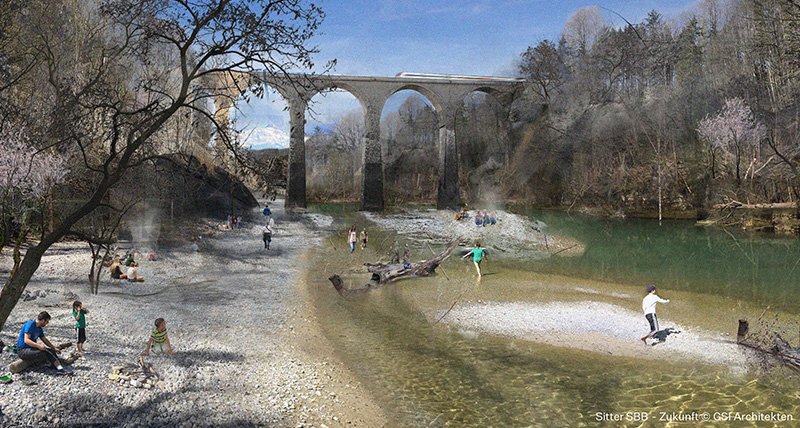 In response to rising temperatures and increased tropical nights, the St. Gallen Green Study visualises a greening of the city of St. Gallen.
City model with 100 billion points
The "Green Gallus Valley" project looks at the city of St. Gallen from a new perspective — in the truest sense of the word. Leica Geosystems was called in to analyse the current state, determine potential for green spaces and visualise concrete measures. The company not only has the necessary technical solutions for data acquisition, but also the software for data processing. Leica specialists equipped an aircraft with the Leica CityMapper-2 with hybrid sensor and used it to collect image and LiDAR data during a flight over the city that lasted several hours. "The CityMapper-2 was specifically designed to efficiently capture highly accurate aerial imagery and laser data in cities," explains Benjamin Müller, electronics developer at Leica Geosystems. "The combination of cameras and a laser scanner in a flight-based system is unique." The result: a digitised city of St. Gallen consisting of several 100 billion individual data points.
Digital twin as a hybrid model
The data was then used to create a digital twin of the city on the computer — a detailed image of its actual state. Using the workflow software Leica Cyclone 3DR, Müller simulated the city's transformation with new green spaces in the 3D model. With this powerful all-in-one solution, Müller created a hybrid model of the city: "The buildings are represented as two-dimensional 3D mesh variants. The streets, existing green spaces, and the new green spaces that I visualised consist of point clouds. This makes the trees appear airy and transparent." Müller created videos in which the viewer flies through the city and treetops. The video conveys the possible urban development to the viewer in an accessible way. The current state of selected street sections and squares transforms into green oases before the viewer's eyes.
“For sustainable urban development, you need the public on board. Cities cannot bear the burden alone.” explains Regula Geisser, architect at GSI Architekten, St. Gallen (Switzerland). “GSI Architekten AG is keen to send a clear signal that the private sector is taking responsibility alongside the environmental associations and setting developments in motion. We have found a great partner in Leica Geosystems, part of Hexagon, which allowed us to set much more ambitious goals. The generous contributions of another 18 companies and 19 experts prove that there is broad support for the topic of urban greening in public and private spaces. The level of collaboration is currently unique in Switzerland, but it represents the opportunity for other cities to unite with partners to address this important and pressing challenge."
Basis for better decisions
Based on the data and visualisations, urban planners and city administrations can simulate possible future scenarios and present them in a comprehensible and attractive way. Since our imagination is limited, such models are helpful, Müller explains: "Digital twins based on hybrid data are detailed and consistent. They make it easier to understand what could be. The possible change becomes vivid and very real." Thus, such simulations provide the basis for better decisions. They help to prevent mistakes, avoid unnecessary costs and get other stakeholders on board, including the public. Especially for cities that use taxpayers' money for their development, this is a crucial aspect. By working together with Leica Geosystems, cities like St. Gallen receive valuable data and visualisations to shape the path toward a smart and sustainable future.
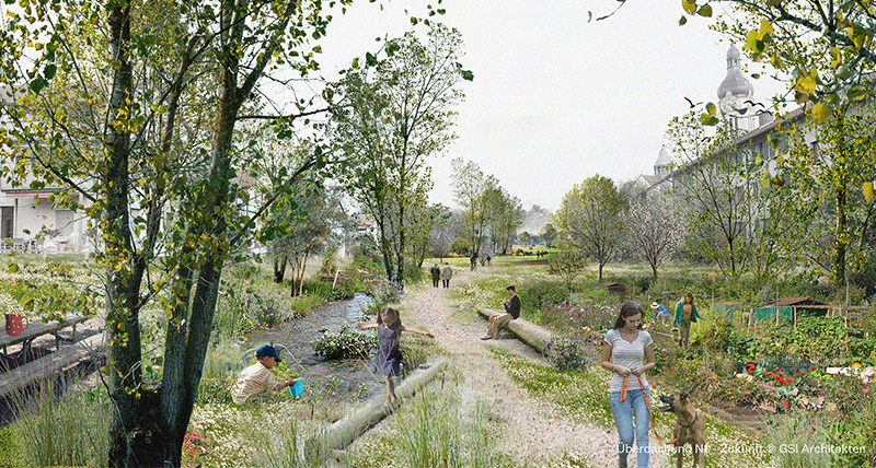 The study proposed urban development changes that enhance climate regulation and biodiversity preservation.
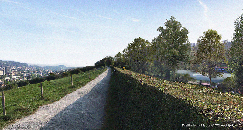 Initiated by WWF St. Gallen, driven by GSI Architekten and supported by Leica Geosystems, the St. Gallen Green Study uses digital simulations to reveal how urban spaces can evolve to meet sustainability goals.


.jpg?sc_lang=fi-fi&hash=F21D7B20FB6B194EA8939B013A6725D8)


