An Antarctic Expedition: Monitoring Essential Climate Variables with GNSS

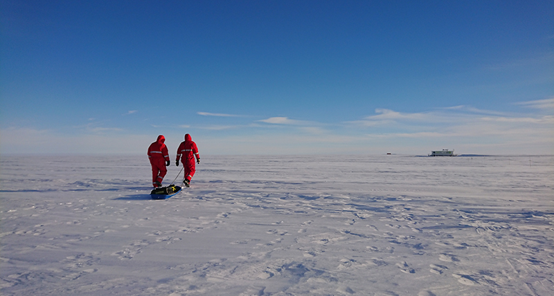
In November 2021, Dr. Ladina Steiner looked out across the icy expanse of Antarctica’s Ekström ice shelf, situated at the intersection of a childhood dream to join an Antarctic expedition and her current geodetic-based glaciological research.
In the preceding months, she had not only arranged the setup of an experiment intended to run remotely and endure a year in one of the world’s harshest environments, but also navigated challenges and looming logistical uncertainties by leading a project during the pandemic.
Ultimately, her perseverance and preparation paid off: between heavy storms and occasional seal and penguin sightings, Steiner set up her experiment to test a new method for estimating in-situ surface mass balances by developing a combined GNSS refractometry and reflectometry method.
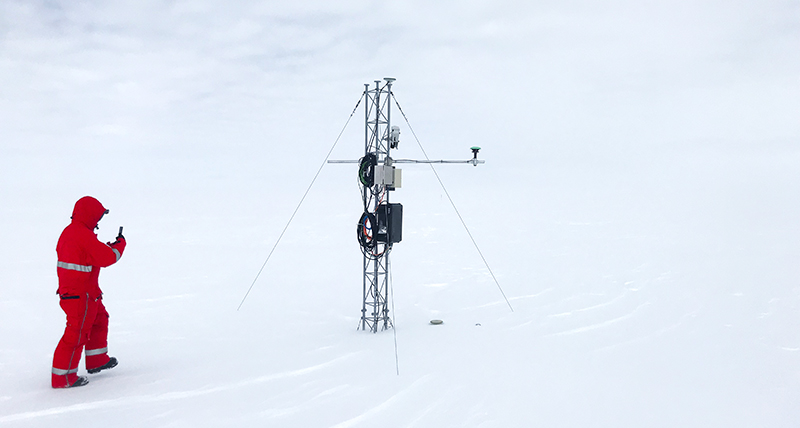
Equipped with Leica Geosystems AS10 GNSS antennas and Leica GR10 receivers, Steiner was able to continuously collect data over a year, opening a promising path for using GNSS to help researchers understand the impact of climate change on ice sheet mass loss and sea level rise.
A Journey to Antarctica

Steiner’s journey to Antarctica began long before she earned her doctorate in geomatics engineering or became a postdoctoral researcher at Germany’s Alfred-Wegener Institute in glaciology:
“After seeing a documentary, it was my kindergarten dream to travel to Antarctica as a researcher and see the penguins in their real environment. So, in a way I’ve been working towards this my whole life,” she reflects.
“I was always very interested in research topics related to environmental monitoring. The Earth is our fundament for living and understanding its processes enables us to develop realistic models and predict future scenarios, such as climate change consequences,” Steiner explains.
Studying surface mass balance to understand climate change
Specifically, Steiner focused on observing Antarctic mass balance changes, which can significantly contribute to rising global sea levels.
“Following climate warming, rising global temperatures are projected to lead to an increased solid ice discharge, surface melt, and surface mass balance (SMB) in future decades,” says Steiner.
However, retrieving accurate on-site, real-time data in polar environments to monitor these changes is difficult and rare, creating uncertainty in computations and projections:
“While snow accumulation can be obtained in various ways, conversion to mass requires knowledge of the snow density, which is more difficult to obtain,” Steiner explains.
“Manual techniques such as snow pits are laborious and destructive and have low temporal and spatial resolution. They also suffer from high costs and irregular revisiting times in logistically inaccessible regions, like the Antarctic or Greenland ice sheets.”
Innovative Data Acquisition with GNSS
Steiner’s solution to this data acquisition problem involves combining GNSS refractometry and reflectometry (RR) to measure SMB automatically and continuously on fast moving ice sheets and shelves, enabling accurate and simultaneous estimations of snow density, mass, and accumulation.
“This combined technique would be highly advantageous for a continuous and correct quantification of ice sheet SMB. The approach could supplement or replace manual on-site data collection, leading to reduced expenses and enhanced results,” says Steiner.
GNSS reflectometry gathers data from GNSS signals reflected off the snow’s surface to the antenna, providing valuable information about height changes and surface texture that can be used to track snow accumulation.
Adding her recently developed refractometry method, in which GNSS signals are refracted as they travel through snow to reach a buried antenna, provides data needed to estimate the snow mass on top of the sensor.
“By combining these two methods,” says Steiner, “we can derive the bulk snow density of the layer buried above the GNSS. This information can be used to calibrate remote sensing products or validate regional climate models.”
“The research approach is very unique,” she explains. “It is the first development and application of a combined GNSS-RR snow monitoring system and the first application of GNSS refractometry in a polar environment and on a fast-moving ground surface.”
High accuracy GNSS sensors for extreme conditions
Integral to testing this approach, Steiner required high accuracy, robust, and reliable GNSS antennas to continuously collect GNSS signals during the experiment.
“I needed GNSS sensors which are easily accessible remotely and capable of tracking multi-GNSS and multi-frequency GNSS signals with a high reliability and accuracy. Due to the remote field application site, changing sensors when something is not working is not an option. Therefore, high-end GNSS equipment is the best solution.”

In partnership with and provided by Leica Geosystems, she selected two Leica AS10 GNSS antennas, along with two configurable Leica GR10 GNSS receivers, capable of transferring daily data packages to Germany. Having used this equipment for prior testing in Alpine glacier environments during her doctoral studies at the ETH Zurich, Steiner was familiar with and trusted the instruments to perform as required.
“The Leica equipment is water and dust proof for the Antarctic’s extreme weather conditions. Additionally, features like the data storage and flow, remote access, configurable data tracking and logging, and other built-in functions all made this system the right choice for my research,” continues Steiner.
“I was very happy to get the equipment from Leica Geosystems as my research funding could not cover high-end equipment. Thanks to them, I could focus on answering the research questions, because instrument problems were reduced to the minimum.”
Preparing for the expedition
However, equipment selection was only one aspect of Steiner’s complex preparations:
“Planning the field experiment and all logistics involved a high level of uncertainty, including weather and infrastructure, which was heightened by the COVID-19 circumstances,” Steiner reflects.
“To build the experiment in advance from Europe, I needed to know every detail about the existing remote infrastructure at the German Neumayer III research station and the site.”
Additionally, Steiner prepared for the Antarctic environment by taking a glacier safety course in the Austrian Alps where she learned to set up a rescue anchor in the snow, self-rescue from a crevasse, and repel down an ice shelf.
After flying from Frankfurt, Germany to Cape Town, South Africa, a two-week quarantine, and an overnight stay in a tent on Antarctica due to a delayed connecting flight, she finally reached the Ekström ice shelf and the Neuymayer III.
Under the midnight sun: Sensor and receiver installation
“Field work at the site was highly influenced by the weather situation,” recalls Steiner. “The actual installation was postponed many days due to a heavy storm (70 knots) where it was impossible to leave the research station.”
While the storm raged outside, Steiner calibrated and checked the antennas and receivers, ensuring that everything was ready when the next change in the weather allowed installation.
“We had a short window to set up the experiment between the snow fall and the next storm to be able to measure the snow and test the equipment. This would ensure the system could run independently at very cold temperatures,” she continues.
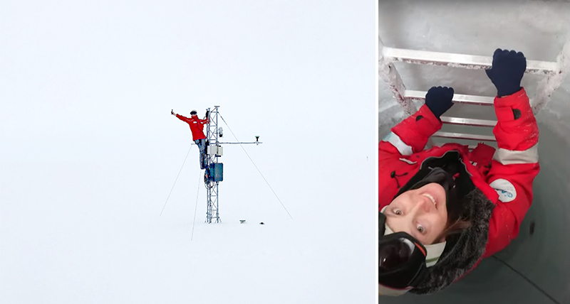
The first AS10 GNSS antenna was installed atop an existing snow height sensor mast for reference and reflectometry, while the second was attached to a horizontal pole measuring the snow which accumulated on top over the year.
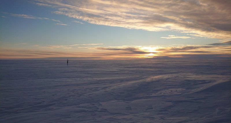
As another storm approached, the final component of setup had to wait. When a good weather window emerged, Steiner and her team installed the GR10 GNSS receivers, their work illuminated by the Antarctic’s midnight sun.
For more insights into the expedition and journey, including the technical setup of the antennas and receivers, watch Steiner’s vlog, Fieldwork in Antarctica.
One-Year Later: Results
The robust and high accuracy sensors and remote access capabilities enabled Steiner to monitor and post-process signals from the test area, providing a consistent data set over the year with promising results for using the GNSS RR method to estimate snow mass.
“While planning Antarctic field work was very challenging due to the difficult accessibility and remote location, I was convinced that the Leica GNSS equipment would reliably work in this harsh environment. Throughout the experiment, it collected and transmitted valuable data without any problems,” says Steiner.
Below, she explains one of her results:

“The above plot shows one result from the project. The snow accumulation since the beginning of the experiment is detected by both independent GNSS-RR techniques with a high level of agreement. The general trend fits well with the reference measured by a laser distance sensor (blue). The offset between the GNSS refractometry derived SWE, converted to snow accumulation by using a mean density observation, and the laser is caused by a high variation in snow deposition in the small scale due to strong storm events. The GNSS reflectometry derived snow accumulation (light blue) contains all variations (light blue background) as a bigger area is observed by this technique.”
For more information, visit her multi-media online poster session for the 2022 American Geophysical Union’s conference, which details the objectives, methods, and results of her Antarctic work.
Women in engineering sciences: pursuing goals despite challenges
This case, however, not only represents the promise of new GNSS remote sensing method, but also the potential for researchers like Steiner to overcome a range of situational challenges, including gender equality disparities:
“Due to limited research positions and short contract durations, discrimination in research is quite common,” Steiner describes. “This is especially emphasised for women in engineering sciences.”
“Having a clear goal, working towards fulfilling our dreams, strongly believing in our strengths and collaborating with independent experts helps overcome such challenges,” she advises.
“I knew the chances were low to become part of an Antarctic expedition, but as I pursued my studies in an environmental and technical topic, I always kept the Antarctic dream in my mind as a career goal. With every job opportunity, I tried to get closer to it, while staying open to other interesting paths.”
Ultimately, this was a successful approach for Steiner:
“It was amazing to fulfil my childhood dream and experience this exciting expedition. I was amazed by everything, the station, the research, technics, the environment, and, of course, seeing the penguins and seals.”
“And now that I’ve fulfilled my biggest goal, I am open for new challenges.”


