Around the world
Customers across the globe solving complex daily challenges using Leica Geosystems equipment

Whether it is surveying a 78-storey tower in Kazakhstan or working on an airport runway in Greenland, our users are working diligently to further not only the industry but global society.
At Hexagon’s Geosystems division, we are honoured to be a part of this, supporting them with precise and accurate instruments, sophisticated software, and trusted services. We deliver value every day to those shaping the future of our world, and we thank them for all that they do continuously, tirelessly, decisively. Here, we feature a few of our users in the field doing what they do best - ensuring a scalable, sustainable future.
Share with us how you are solving complex daily challenges using Geosystems solutions. Send us your photos at reporter@leica-geosystems.com to be featured in Reporter.
Heritage conservation project in Costa Rica

Dayhiana Dalvise creating the as-built plan of a 100-year-old heritage building using the Leica BLK360 3D imaging laser in Cartago, Costa Rica.
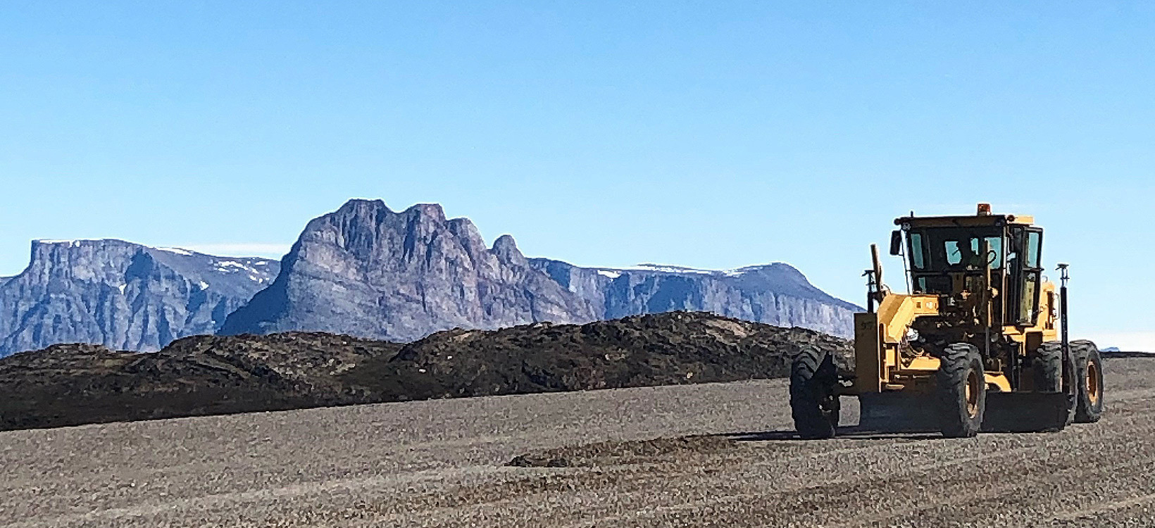
Runway maintenance with machine control in Greenland

Per Eriksen witnessed the maintainance of the runway at Qaarsut airport in Greenland with a grader equipped with the Leica iCON iGG3 dual GNSS machine control solution.
Ground survey of water race in New Zealand

Scott Cookson and his assistant undertook a full-aerial and ground survey of a 7-km-long piped section along the Beaumont Water Race with three Leica Viva GS14 GNSS smart antennae in Otago high country, New Zealand.
Monitoring the Abu Dhabi Plaza tower in Kazakhstan

Damir Issilbayev working on the Abu Dhabi Plaza project, a 78-floor multi-storey complex using Leica TS09 and TS15 total stations for plumbing vertically control points and monitoring the tower in Astana, Kazakhstan.
Road construction in Australia

Damien Cooke from CENEX working on a road construction using ICR52 total station and MCP80 3D machine control panel with a posi-track loader in Sydney, Australia.
Training of future mining engineers in Burundi

Maxim Bukin works as a chief mine surveyor at Tanganyika Gold S.A. and trains local mining engineers to use the Leica TS06, TS02 total stations, Leica Viva GS14 GNSS smart antenna and Leica Infinity surveying software in Burundi, Central Africa.
Surveying a hydroelectric plant in the Andes

Bruno Vásquez Ceballos, surveyor and geomatics engineer, working on the project Underground Hydroelectric Plant Cóndores Enel Chile uses Leica Viva GPS15 smart antenna, TS11, TS15 and TS50 total stations in the Andean Mountains between Chile and Argentina.
Stockpile inventory survey in the USA

Farrah Etcheverry working for Southwest Geographic Services uses Leica GPS1200+ GNSS system for stockpile inventory in Camp Verde Arizona, USA.
Setting out a railway track in Nigeria

Ajeigbe Joseph Olusola setting out a railway track using Leica TCR303 prismless surveying total station in Lagos, Nigeria.
Expanding tunnel infrastructure in Indonesia

Denny Maynardi Dyatmoko from Redpath expanding the tunnel infrastructure of Deep Mill Level Zone (DMLZ) Underground Mine using Leica Viva TS15 robotic total station in Papua, Indonesia.
Boundary survey in Canada

Veronica Meister doing a boundary survey with her dog, Bonnie, using Leica TCR805 prismless robotic total station in Williams Lake, British Columbia, Canada.
Measuring pile tips in Russia

Alexey Mansurov measuring with Leica DISTO S910 to do tedious work much faster, more convenient and easier when it comes to understanding the slopes and positions of pile tips in Yekaterinburg, Russia.
Building water pipes in Finland

Petri Junttila taking advantage of Leica MC1 3D machine control software with automatic tilt and tool identification while building new water pipes and sewer lines in Jyväskylä, Finland.
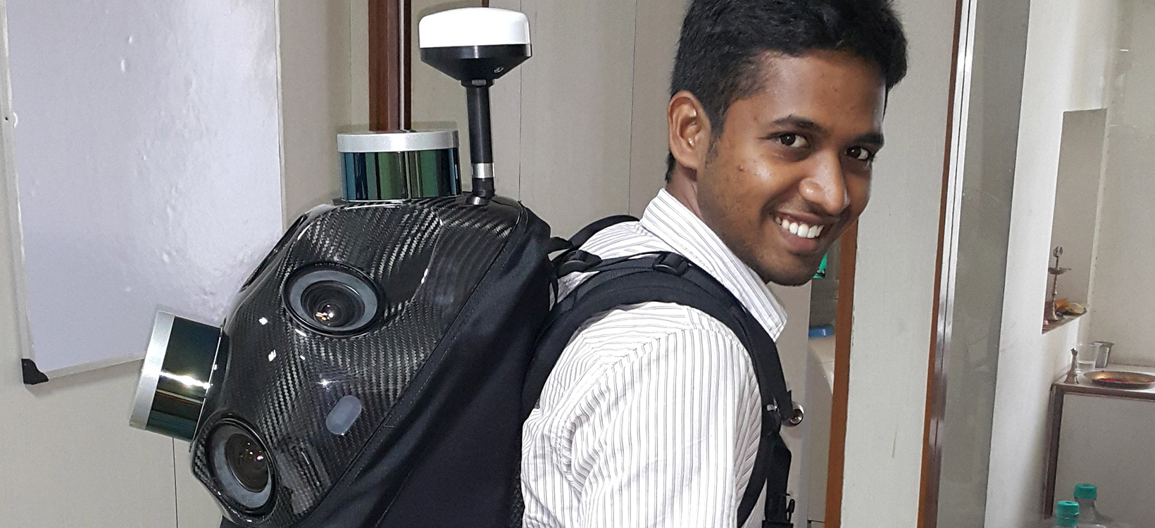
Mobile mapping in India

Vasanth Palani demonstrates the Leica Pegasus:Backpack for customers interested in building and interior road documentations in Chennai, India.


