Author: Reka Vasszi
In the Netherlands, water is never simply there. It is moved, held back, let through, and measured every day, across a network of ditches, canals, and watercourses. Waterschap Drents Overijsselse Delta looks after one of those networks, and its job is deceptively simple to state: get the water away when there is too much of it, and get it there when there isn't.
Doing that well depends on knowing the shape of every watercourse: how deep, how wide, how much it can carry. That data used to arrive roughly once every eight years. Today, 19 of the water authority's maintenance excavators collect it while they mow, and the water system is refreshed two to three times a year.
The challenge: managing a water system on eight-year-old data
Almost everything the organisation plans, calculates, and executes rests on the flow profiles of its watercourses. Yet keeping those profiles current meant sending people out to measure by hand: slow, expensive, and easy to get wrong.
"The water board has an interest in up-to-date and reliable data on the flow profiles of the watercourses. Based on this data, much of the work within the organisation is calculated, but also planned and executed. Getting and keeping this data up to date turns out to be very labour-intensive and error-prone."
— Sander van 't Klooster, Project Manager, Water Authority Drents Overijsselse Delta
Meanwhile the weather stopped cooperating. Rainfall in the region is arriving in shorter, heavier bursts, and a system you only measure once every eight years is a system whose risks you can only estimate.
"As a water board, we see that there are more and more intensive showers. That means you also have more risk in the system. You want to know what your system looks like. With these kinds of data systems, you will manage the risks much better and you can also intervene much better when you have to."
— Sander van 't Klooster, Project Manager, Water Authority Drents Overijsselse Delta
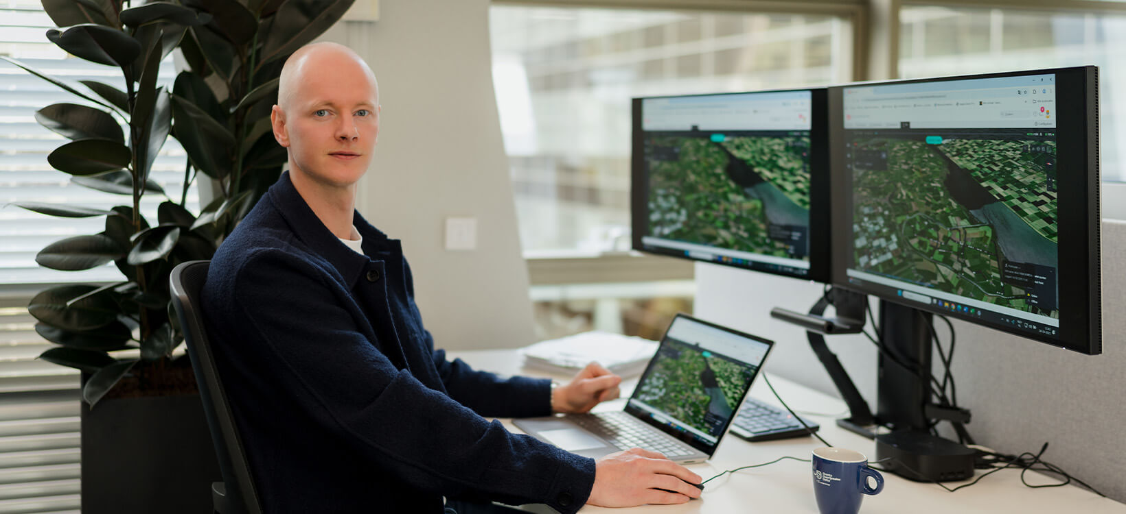
The solution: the machine that maintains the ditch also measures it
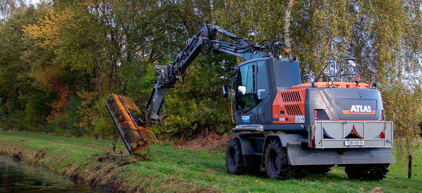
Rather than adding a survey task to an already full maintenance programme, the water authority made the maintenance itself the survey. Each excavator was fitted with the Leica MC1 machine control system, sensors and GNSS positioning, so that the same pass that clears the watercourse also records its profile.
Here is how it works at Drents Overijsselse Delta:
- Nineteen maintenance excavators are equipped with Leica MC1, sensors and GNSS positioning, all fully operational
- The operator presses one button to engage the mowing bucket; the same button starts the measuring system
- As the bucket follows the bed of the ditch, depth and width are recorded automatically, pass by pass
- Measurement data flows straight to the connected cloud, where it is immediately visible
- A data engineering partner pulls that data out via API and turns it into information products for end users inside the water authority
- Aquatic plants and silt are removed in the same operation; the maintenance job is unchanged
"What you see behind me is an excavator equipped with the Leica MC1 system for excavators. What actually happens is that they press a button while mowing to activate the mowing bucket, and with that same button you also activate the measuring system, so that all outputs that the excavator does are automatically recorded."
— Jan Van Groesen, Sales Engineer at Leica Geosystems
The result, in the project manager's words, is that the field comes indoors.
"It is a solution that enables the water board to carry out one of the core tasks they have more effectively and efficiently. This saves a lot of time in manual work and provides direct insight into the current situation of the water system."
— Sander van 't Klooster, Project Manager, Water Authority Drents Overijsselse Delta
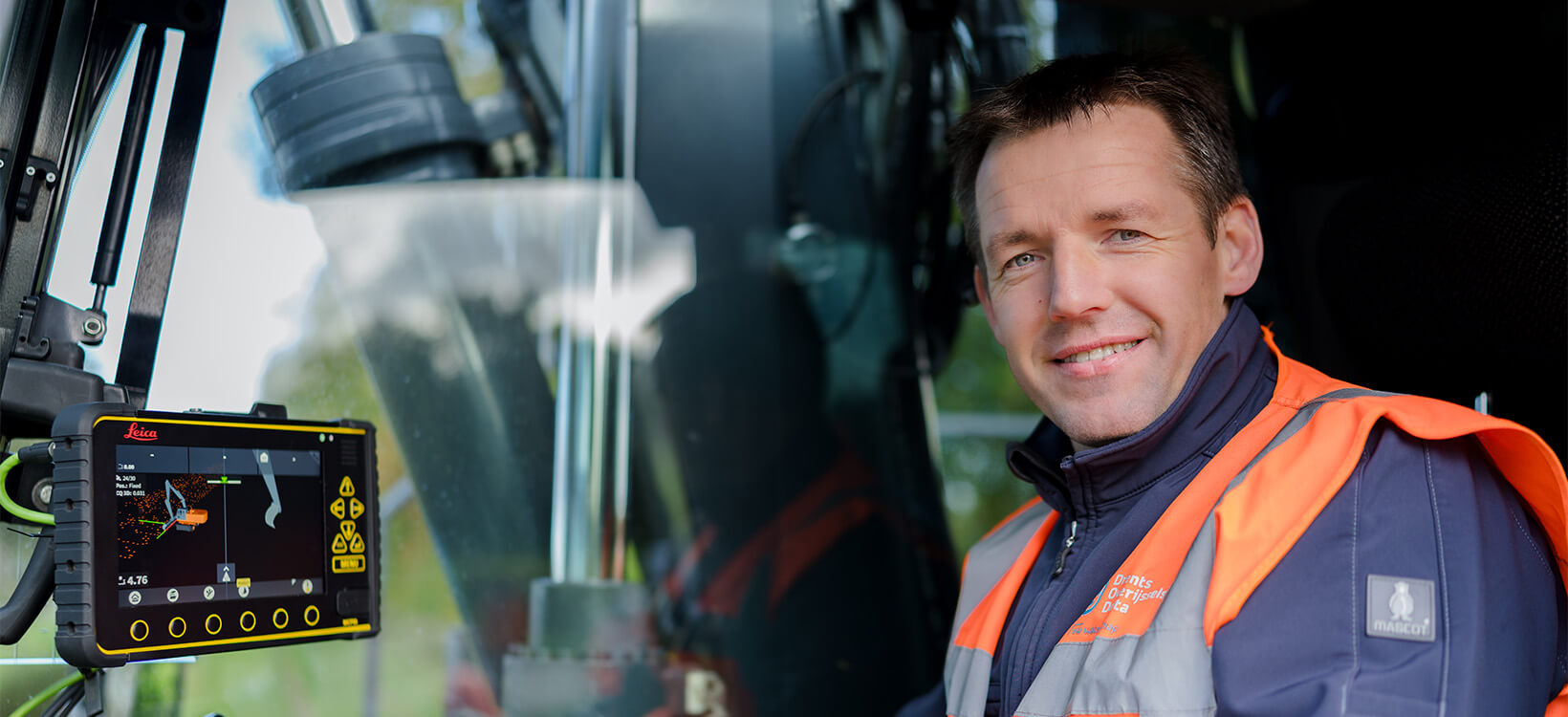
A new colleague in the cab
For the operators, the day did not get harder; it got more interesting. The machine handles the data capture; they keep doing the work they already know how to do, and the measuring comes along for the ride.
"I start up the machine in the morning and all the data is automatically loaded and are also automatically sent. They can work with it directly in real time. It's a very user friendly system. And yes, it is logical. You learn it quickly."
— Hans Vrieling, Machine operator, Water Authority Drents Overijsselse Delta
Training took two days. Operators were involved in installing the system from start to finish, with a dedicated support channel for questions, and the system now runs as part of the normal routine rather than alongside it.
"It makes the work more exciting for the operators. They are not only busy mowing the waterways, but they are also generating data. And I see the new system as a new colleague in the cab."
— Bertwin Post, Water Authority Drents Overijsselse Delta
No extra hours, and fewer hands in the water
The economics of the project rest on a single point: the measurement is free, because it happens inside work that was already scheduled. There is no separate survey crew, no second visit, no extra shift.
"The advantage of this system is that it does not cost extra labour. The normal regular maintenance and measuring — that is included in the same operation. It doesn't cost us anything extra in time and energy."
— Robert Pannenborg, Water Authority Drents Overijsselse Delta
Safety improved for the same reason. Manual profile measurement puts people on soft banks and in the water with a survey rod; automated capture takes them out of it.
"Safety has improved as the machine collects all data in one operation and we no longer have to do manual measurements that are quite labour-intensive."
— Bertwin Post, Water Authority Drents Overijsselse Delta
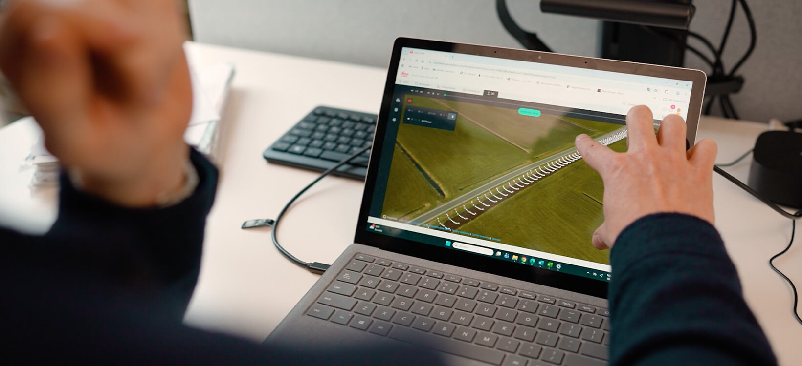
From the theoretical water system to the real one
The change the organisation notices most is not the technology. It is that the map on the screen and the ditch in the field are finally the same thing.
"Previously, we had data that was measured once every few years, so in terms of eight years. Now we have data that is up to date. We now measure two or three times in a year a canal or a watercourse. This gives us a direct picture of our practical water system outside."
— Sander van 't Klooster, Project Manager, Water Authority Drents Overijsselse Delta
With current profiles across the network, questions that used to require fieldwork and estimation can be answered from the desk:
- How much water can this watercourse take in, and how much can it discharge?
- What happens here when it rains hard, and where does that put us at risk of flooding?
- Where in our area are we exposed to water shortage in a dry spell?
- What is the actual depth and width out there, as opposed to the design?
- Where should dredging go next winter, based on what we measured this summer?
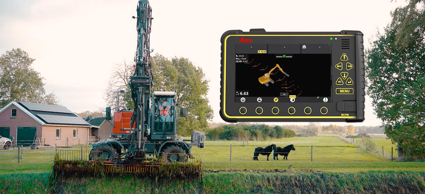
Dual stick: supporting the attachments Dutch waterways actually need
Waterway maintenance in the Netherlands is not a single-bucket job. Mowing buckets, dredging buckets, and additional stick configurations are all part of normal operation, and a machine control system that only supports a standard setup is of limited use. The Leica MC1 dual stick solution was developed to cover exactly this.
"For the maintenance of the waterways in the Netherlands, you need more attachments than might normally be standard. But in the new version of MC1 we can support those extra attachments, so that you can simply use the entire MC1 system, including all those attachments."
— Jan Van Groesen, Sales Engineer at Leica Geosystems
Speaking on site, the Leica Geosystems team put the capability more bluntly:
"We are currently the only supplier of machine control systems that support so many moving attachments."
— Jan Van Groesen, Sales Engineer at Leica Geosystems
The bottom line: a starting point, not an end point
For the water authority, the 19 smart excavators are infrastructure for everything that comes next, and the project is already being treated as a template rather than a one-off.
"With this project, we are laying the foundation for a new way of working in which smart solutions and data processing directly contribute to better insight and decision-making. The smart excavator is not the end point as far as I'm concerned, but rather a starting point. A platform on which we can build further towards applications such as insights into mowing locations, water quality monitoring and invasive species detection. In this way, this project will become the catalyst for future innovations."
— Sander van 't Klooster, Project Manager, Water Authority Drents Overijsselse Delta
For any asset owner managing a large, dispersed network on infrequent survey data, the lesson from Drents Overijsselse Delta is straightforward. Putting the measurement inside the maintenance bought them:
- Current data on the whole network, refreshed two to three times a year instead of once every eight
- No additional labour, machine time or survey visits to pay for
- Safer crews, with manual measurement in and around the water largely removed
- A data platform the organisation can extend to water quality, invasive species, and beyond
"The collaboration within the project shows how innovation is created when technology, expertise and practical experience come together."
— Sander van 't Klooster, Project Manager, Water Authority Drents Overijsselse Delta
Discover Leica Geosystems' 3D machine control solution here: https://leica-geosystems.com/products/machine-control-systems/excavator/leica-icon-ixe3---3d-system


